PART TWO. The Roman Presence
I. Ratiaria and the north-west 111
(Ratiaria; Bononia; Castra Martis; Montana)
II. Oescus and its vicinity 116
III. Nikopol 126
IV. Novae 128
V. Iatrus 133
VI. Transmarisca 135
VII. Durostorum 135
I. Nicopolis-ad-Istrum and the central slopes 143
(Nicopolis-ad-Istrum; Hotnitsa; Butovo; Discoduratera; Prisovo)
III. Abritus 156
IV. Voivoda 165
V. Madara 167
I. Serdica and its territory 169
II. Pautalia and its territory 178
(Pautalia; The territory of Pautalia)
III. Sandanski 183
IV. The upper Mesta valley 185
I. Philippopolis and its vicinity 187
(Philippopolis; Peroushtitsa and Kurtovo Konare; Burdapa and Batkoun)
II. Hissar 197
III. Beroe-Augusta Trajana and its vicinity 199
(Beroe-Augusta Trajana; Starazagorski Mineralni Bani; Arzus and Pizus; Trite Mogili, Mogilovo, and Krun)
IV. Chatalka 209
(Haskovo Mineralni Bani; Sveti Duh; Kasnakovo; Armira)
5. The Danube
I. RATIARIA AND THE NORTH-WEST
The establishment of permanent Roman camps along the Danube, extending from Pannonia into, first, what is now north-west Bulgaria and gradually reaching to the Black Sea coast, arose from the need to set up a viable line of defence against the Daco-Getic threat to Macedonia. While a measure of control had been attained over the Thracian tribes south of the Danube, those north of it - in present-day Romania - remained aggressively independent under the military leadership and influence of the Dacians based in the mountainous regions of southern Transylvania. Thus, instead of to the partially Hellenised interior, it was to the lesser-known north-west and south banks of the Danube that Roman organisation was first introduced and followed by a policy of Romanisation to replace the existing Thracian structure.
Ratiaria
Ratiaria (Archar), one of the oldest and to become one of the wealthiest Roman cities on the lower Danube (Pl. 1), was described by Dio Cassius as strongly fortified when Crassus campaigned against the Triballi and other Moesian tribes in 29 b.c. It grew rapidly in the first century a.d. and received the title of Colonia Ulpia Trajana following the conquest of Dacia. Predominantly although by no means exclusively settled by Romans and others of Italic descent - civilians as well as soldiers - the city was the focal point for the Romanisation of the surrounding territory. The name is generally considered of Latin origin and survives to some degree in that of the modern village of Archar.
Ratiaria’s commercial potentialities, as inscriptions show, also drew traders from Asia Minor. Besides serving as a port and point of transhipment enabling Danubian traffic to avoid the dangerous ‘Iron Gates’, it was the northern terminus of the shortest land route from Lissus (Lesh) on the Adriatic, and hence from Italy, to the lower Danube. In addition to its garrison, Ratiaria was a headquarters of the Danube fleet, at least from the time of Aurelian, who made it the chief city of the new province of Dacia Ripensis after the evacuation of trans-Danubian Dacia. Among its industries was one of the five imperial munition factories in the Balkan peninsula.
Today the site, on either side of the little Archar river, is covered by fields and vineyards, the village of the same name, and, on a low hill, the hamlet of Turska Mahala, where the citadel probably stood. Excavations undertaken within the last 20 years or so are reported to have located a necropolis, an aqueduct, and the beginning of the road to Bononia (Vidin), and to have shown that the city expanded westward after becoming a provincial capital, but the work has not yet reached publication stage. Surface finds have yielded many inscriptions and other objects. Essentially Roman and typical of many found along the Danube in its shape and carefully carved formal decoration of ivy and vine is a mid-second-century stele erected by a lady of probable Greek origin in memory of her Roman husband and her ‘dulcissima’ and ‘pientissima’ 18-year-old daughter [1] (Pl. 68).
111
![]()
![]()
112
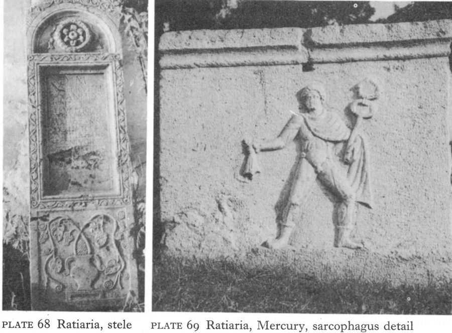
Plate 68 Ratiaria, stele
Plate 69 Ratiaria, Mercury, sarcophagus detail
Other funerary intrusions into this land of tumulus burials are the locally carved sarcophagi. One - also of the Antonine period - has on one short side a relief of Hermes-Mercury, here no doubt intended as the herald of the dead but also suggestive of the commercial acumen and statecraft of Ratiaria (Pl. 69). Yet on two other approximately contemporary sarcophagi, both very alike, a small framed uninscribed relief of the Thracian Horseman appears as the centrepiece of otherwise elaborate conventional ornamentation, an illustration of the headway made even here by this Thracian cult in the second century.
A dedication to Porobonus, a god of Celtic origin, has also been discovered, one of only three known in east Europe, the others at Abritus (Razgrad) and Olbia in south Russia. Worship of the Roman pantheon is naturally well represented, notably of Jupiter and Juno - portrayed together in a chariot on one relief - Pluto, Proserpina, Ceres, and Hercules. Mithras is a prominent secondthird-century addition. An unusual marble statuette of Hercules was found recently by an Archar farmer when building a pigsty. The muscular but pensive hero is seated, his chin resting against his right hand, his club dangling against his left knee (Pl. 70), a fascinating, coincidental mid-second-century intermediary between the ‘Thinker’ statuette of the Neolithic Hamangia culture of the Dobroudja and Rodin’s Penseur.
Bononia
About 10 kilometres upstream from Ratiaria and within its territory was Bononia (Vidin), a station of secondary importance during the Roman period.
![]()
113
The name is equivalent to Bologna and Boulogne and the site may have been a Celtic settlement before the Roman arrival, when a cavalry detachment was stationed here. Bononia’s remains now lie below a busy modern town and the medieval and Turkish fortress of Baba Vida on the bank of the Danube. In the latter area soundings have uncovered fortifications of the second half of the third century, when the evacuation of Dacia must have increased its military importance. The best-preserved part was a polygonal north-east angle tower, a powerful structure enclosing an area 13 metres across, of which walls up to 2 metres high and nearly 3 1/2 metres thick were found. A public bath with its heating system and a drainage network carrying waste into the Danube, dating from about the same period, have also been identified.
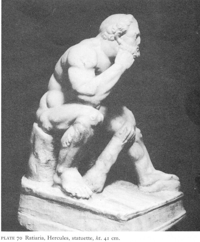
Plate 70 Ratiaria, Hercules, statuette, ht. 41 cm.
![]()
114
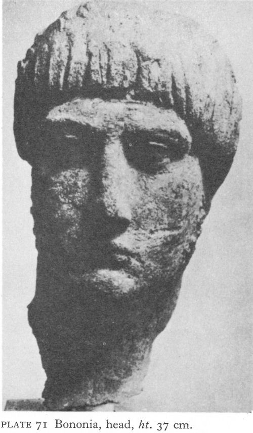
Plate 71 Bononia, head, ht. 37 cm.
A recent chance find near the fortress was the fine bronze head of a young man, stylistically associated with the reign of Trajan (Pl. 71). Such work is likely to have come from or through Ratiaria.
Castra Martis
A station on the road leading west from Ratiaria to Naissus (Niš) and the Adriatic has been identified some 24 kilometres south-west of Vidin. This is Castra Martis (Kula), where a short sector of wall has been uncovered. In the main square of the little town are substantial remains of a small square fort - its sides 34 metres long - built to protect the north-east angle of Castra Martis. One of the four round angle towers - still, with later repairs, 16 metres high - has given the town its Bulgarian name, ’kula’ meaning ‘tower’. The three other towers, walls and inner buildings including the garrison commander’s quarters, barracks, and a craft workshop have been excavated (Pl. 72), and the structure dated to the late third or early fourth century. Unlike the walls which, so far as one can tell, were of stone only, the towers were of roughly dressed stone,
![]()
115
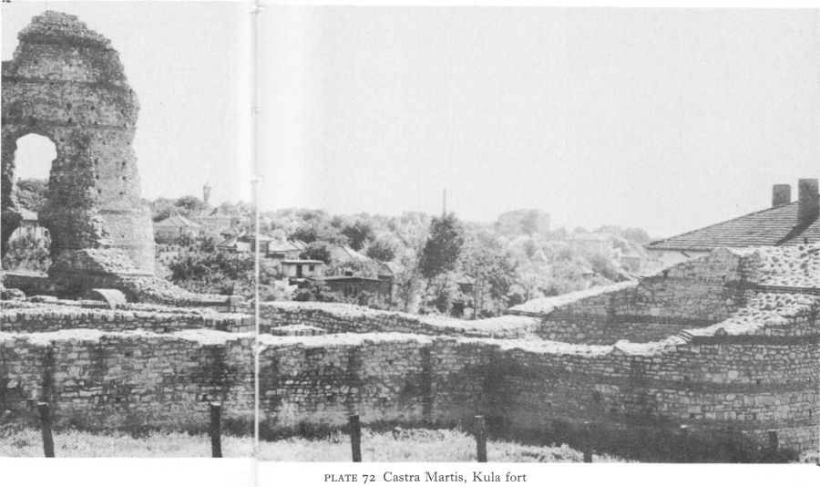
Plate 72 Castra Martis, Kula fort
bonded with irregularly spaced layers of three brick courses. The single entrance, flanked by guardrooms, was in the south wall.
Montana
Excavation - halted by the First World War and only resumed in 1968 - is now uncovering the most renowned Roman sanctuary in this corner of Bulgaria, the temple of Diana and Apollo at Montana (Mihailovgrad, formerly Ferdinand). By 161-63, if not before, Montana, situated where the Marcianopolis (Reka Devnya)-Nicopolis-ad-Istrum (near Nikyup)-Melta (Lovech) road bridged the Ogosta on its way to join the Ratiaria-Naissus highway, had achieved the status of Municipium Montanensis. Fortifications, including a great U-shaped angle tower measuring 24 by 18 metres, were, it seems, constructed about the middle of the third century and lasted until the late fifth or early sixth.
The temple of Diana and Apollo, on the evidence of many Latin inscriptions, was already in existence in the second century and occupied the site of an earlier Thracian sanctuary - a great spring at the foot of the rocky hill on which the fortress stood. It is believed to have survived destruction until the fifth century.
![]()
116
The 1915 excavations uncovered a niche hollowed out of the cliff by the spring, intended for a statue of Diana. An altar dedicated to her stood in front of it; nearby was another to Silvanus. Three statuettes of the goddess were found among the ruins as well as broken pieces of others of Silvanus, Apollo, Hygieia, and a Thracian Horseman relief with part of a Greek inscription - a rarity in Montana where Latin was commonly used. Many fragments of altars and votive tablets to Greco-Roman deities, mostly Diana and Apollo, were used as building material in the town. Worship of the huntress goddess seems to have been especially widespread in this region; another sanctuary is known to have existed at Almus (Lom). In view of the Thracian origins of the sanctuary, the find of a Thracian Horseman relief almost certainly reflects syncretism with Apollo, just as Bendis with Diana-Artemis. With such continuity in the ancient world, it is hardly surprising that an altar consecrated to Diana and Apollo was discovered beneath the altar table of a Mihailovgrad church.
Other cult objects from Montana include a find of 11 small clay plaques depicting religious motifs or gods, usually framed in aediculae, or pillared niches [2]. The superficial resemblance to the Abritus collection of bronze plaques (pp. 164 ff) is very striking, but the Montana group are much cruder and entirely devoid of oriental influences. Exceptions to the normal pantheon here are Epona standing between two foals - a Celtic influence possibly connected with the Cohors II Gallorum stationed in the province under Trajan - and a Thracian Horseman.
II. OESCUS AND ITS VICINITY
Oescus
Oescus (near Gigen) shared with Novae (near Svishtov) the main burden of defending the central region of the lower Danube. Established in the early years of the first century a.d. as the headquarters of Legio V Macedonica, it replaced an earlier Triballi settlement; Ptolemaeus refers to it as Oescus Triballorum. The site was a low plateau with steep slopes on the north and north-west, some 5 kilometres from the Danube and its confluence with the Iskur, the ancient Oescus. Like Ratiaria, it was an important centre of Romanisation and attracted a considerable civil population. Identified by Count Marsigli in the eighteenth century, Oescus was first excavated in 1905-6, the main purposes being apparently a search for works of art and the location of the forum. A large area was uncovered to little scientific purpose, no results being published and no records left. The ruins were then abandoned until 1941-43, when an Italian team excavated a large building outside the city walls. Excavations by Bulgarian archaeologists in 1947-52 and again more recently have thrown much new light on the antique city and it is encouraging to know that work is being continued.
The oldest stone fortifications probably belonged either to the end of the first century, after the Dacian invasions of 85-86, or to the beginning of the second, before the departure of Legio V Macedonica (of which the future emperor Hadrian was a tribune) in 106 as a result of the conquest of Dacia. Massive walls, some 3 metres thick but, except by the gate, apparently without bastions or towers, enclosed a roughly pentagonal area of about 18 hectares. A ditch about 15 metres wide gave added protection. The city expanded rapidly in spite of the loss of its military importance, but with the legion’s return on the evacuation of Dacia in 271-75, Oescus again became a major fortress of the limes.
![]()
117
The city had suffered severely at the hands of the Goths in the middle of the third century. The original wall was repaired and a new one built to enclose a further 10 hectares on the long east side. Faced on the outer side with well-cut stones, it was strengthened at intervals by horseshoe-shaped towers and, at the sharp north-east angle, by a round projecting one. Flanking towers protected the north and east gates. Temples as well as houses were demolished to make room for the wall, but many large buildings were left outside, as well as the dwellings of those without citizenship. The plan of the fortified area now resembled the end view of a gabled house, the ground floor of which was represented by the third-century addition.
Within the city there was the usual grid of intersecting north-south and eastwest streets. Paved with large stone slabs, some showing wheel-ruts, these were from 3 1/2 to 7 metres wide, the main ones being colonnaded. Beneath them ran water-supply and drainage systems, the former in clay and lead pipes. Wells provided a reserve, but the main water-supplies came by aqueducts, one 20 kilometres long. In a shorter aqueduct from a spring near Gigen, well-fired clay pipes were found, with tile-covered openings at intervals for cleaning and unblocking.
South of the probable location of the forum stood one of the city’s major buildings, the temple of Fortuna, a complex extending over an area 29 metres wide and some 50 metres long. The temple was entered from the south through a Corinthian-style portico bearing a long dedicatory inscription to the effect that the temple was erected by leading citizens in the reign of Commodus, whose name was chiselled out following his generally welcome assassination. The portico opened into a peristyled courtyard, also in Corinthian style, at the northern end of which stood the sanctuary. Along the sides of the temple, rooms with mosaic-paved floors are thought to have been used for commercial purposes by the guild who built it. [3] Destruction at the end of the fourth century, probably either by the Visigoths or by local Christians, was complete and it is likely that the present desolate scene of heaps of massive broken columns, bases, Ionic and Corinthian capitals, architraves, and battered fragments of pediment has changed little in 1,600 years - except for a space cleared to build a church in the twelfth century. The architraves from the colonnade - with their motifs of bucrania, garlands, masks, animals, dolphins, eagles, snakes, and the wine barrel, like other sculptures in the same area are the work of skilled and talented craftsmen (Pls. 73-75). Matching them is a panel of the coffered ceiling of the portico (Pl. 76).
Sculpture appears to have continued to be a flourishing industry in Oescus until the disastrous Visigothic wars of the late fourth century. Among the more interesting finds in the neighbourhood is a fine sandstone head, found in a nearby village and probably looted from the city (Pl. 77). Stylistically dated to the end of the third century, it is believed to be a portrait of Diocletian. Others, within roundels, may be either architectural fragments or funerary reliefs (Pl. 78).
On the other side of the street, south of the temple of Fortuna, was an even larger structure; 72 metres long, it occupied a whole block or insula, and was reconstructed several times. The entrance was again from the south.
![]()
118
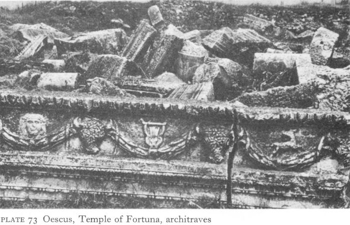
Plate 73 Oescus, Temple of Fortuna, architraves
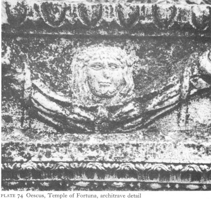
Plate 74 Oescus, Temple of Fortuna, architrave detail
![]()
119
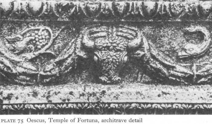
Plate 75 Oescus, Temple of Fortuna, architrave detail
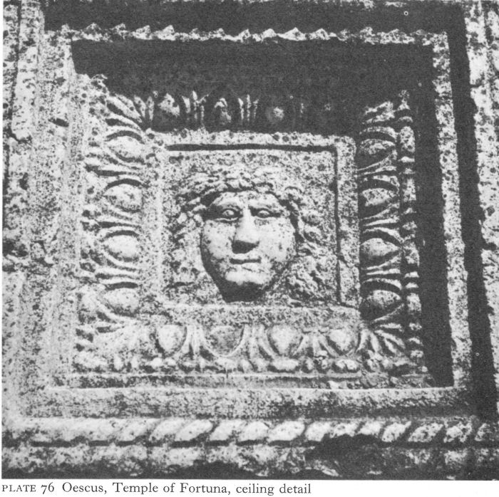
Plate 76 Oescus, Temple of Fortuna, ceiling detail
![]()
120
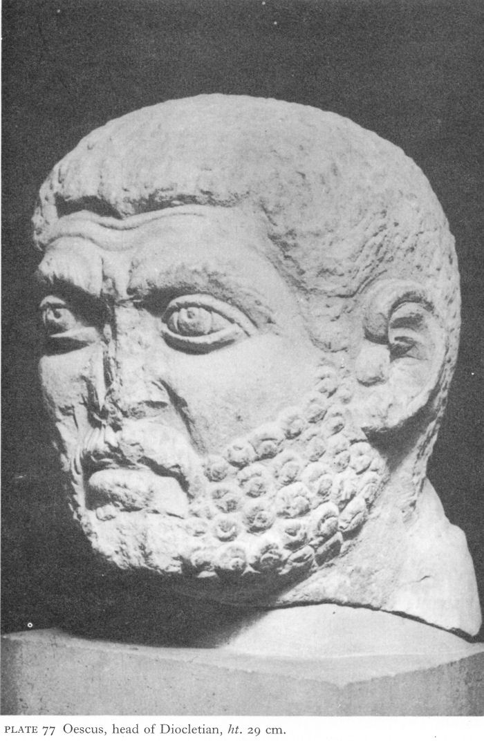
Plate 77 Oescus, head of Diocletian, ht. 29 cm.
![]()
121
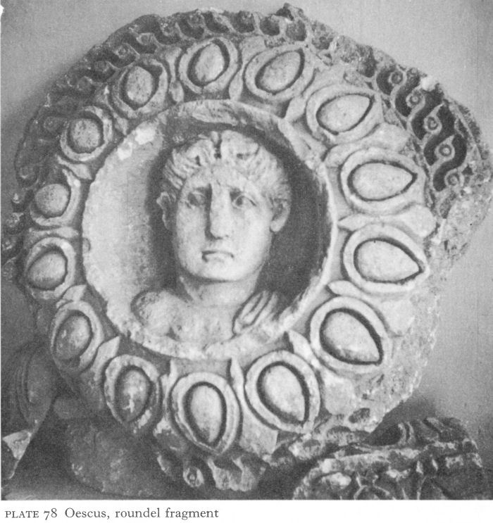
Plate 78 Oescus, roundel fragment
On the east side some 15 rooms were uncovered, most with hypocausts using pillae, or small brick piers. More heating came from warm air circulating between the walls and their marble revetment. An apsed room, 27 metres long and 12 metres wide, was a ceremonial hall. In a room near the entrance, 7.20 metres long by 6.60 wide, was a mosaic floor of literary as well as archaeological interest. A black and white chequered border frames a tripartite coloured picture, the two outer sections being narrow rectangles. On one side, two fighting cocks are separated by a formal garland and a tree; top and bottom are missing. The other side, showing different fishes in a river, is realistic and asymmetrical. The square middle section inscribes an octagon, with a boar, a lion, a bear, and a (now lost) bull in the corners, representing the seasons. In the octagon are four actors, three wearing comic masks. Part of the scene is lost, but above the heads a Greek inscription reads ‘Menander’s Achaians’ (Pls. 79, 80).
Menander is known to have written over a hundred comedies, but this find, probably dating to the first half of the third century a.d., added another, then unsuspected.
![]()
122
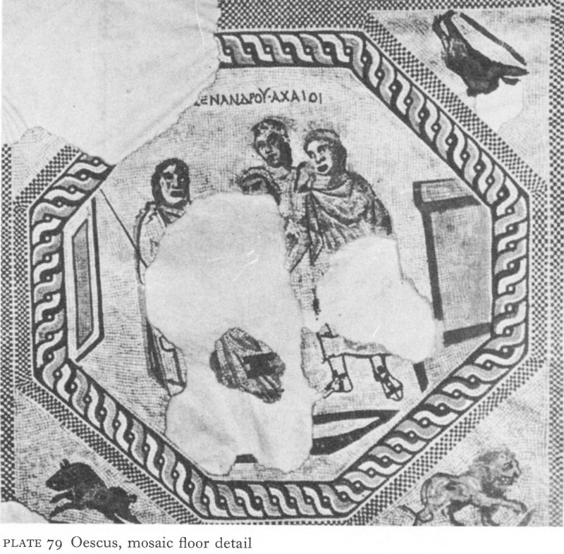
Plate 79 Oescus, mosaic floor detail
A since discovered papyrus [4] listing some titles of Menander’s plays has included ‘The Achaians or the Peloponnesians’, almost certainly the same play. T. Ivanov, who discovered the mosaic, suggests that the scene depicts the quarrel between Agamemnon and Achilles, with Nestor attempting vainly to mediate and Patroklos, without a mask, standing behind; he relates it to scenes in the House of Aion at Antioch, also linked to comedies by Menander. This Trojan war interpretation has been queried, largely on the grounds that all the surviving comedies are based on contemporary - fourth-century b.c. - themes, not on mythological subjects, although this need not necessarily exclude a parody of Homeric heroes. The only Roman mosaic known in northern Bulgaria, its high, if provincial, quality confirms the impression created by the sculptured fragments of the prosperity and even luxury of Oescus.
To the east of this building were the public baths. Built in the second century by the then east wall, they were reconstructed after the extension of the city and covered an area of 700 square metres. The baths have not been published in detail, but it is known that they followed the common Roman pattern;
![]()
123
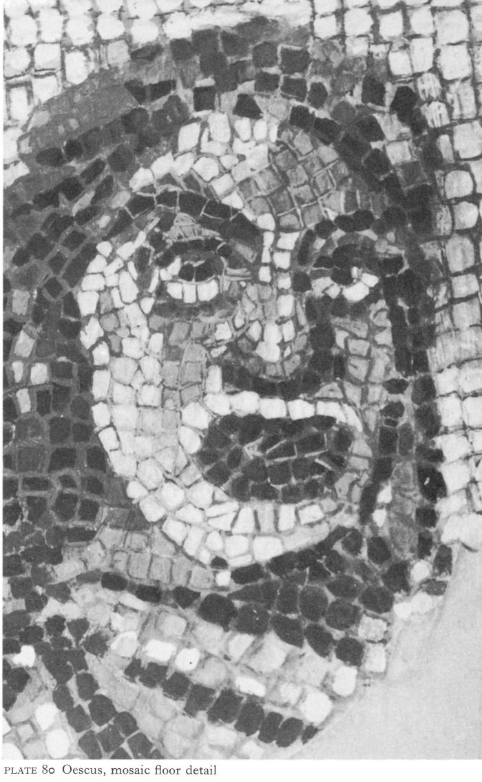
Plate 80 Oescus, mosaic floor detail
![]()
124
the floors and walls were revetted by slabs of white, grey, and pink marble. Across the road to the north was a row of shops.
The 1941-43 excavations uncovered a large complex of unknown purpose occupying some 3,500 square metres outside the walls, immediately south of the original south-east corner (Fig. 16; Pl. 81). On the west side, two apsed rooms, one with three side-chambers, enclosed two rectangular ones. In the centre, a large hall was partitioned into four areas by three pairs of walls which projected from the long sides towards the centre. North of this hall were two other rooms, one apsed, and on the east side is a plain rectangular hall. Whilst the outside walls were solid structures, the foundations of the inner ones were threaded by a system of vaulted corridors, averaging a height of 1 1/2 metres and a width of half a metre, reached by a flight of six steps next to the northern apse. Along most of the internal walls, clay pipes, 15 centimetres in diameter, rose vertically at irregular intervals from the vaults of these corridors to penetrate the middle of the walls.
Such intra-mural corridors are not without parallel in Bulgaria, occurring, for instance, in the baths at Odessos and a building in Serdica (Sofia). Yet in Oescus, although the general plan is not inconsistent with that of a bath, one already existed and the siting of the various entrances makes this unlikely. Also, there were no hypocausts or other evidence of baths, although A. Frova writes that this might possibly be due to later destruction, particularly of the floors. The corridors could not have been parts of a drainage system as, in an already notably damp environment, they would merely have held water. The predominant use of stone, which does not conserve heat as well as brick, would have been unsuited to a heating system. Frova consequently concludes that the corridors were for ventilation.
It must have been an important building. The surviving walls consisted of three courses of brick between a lower section of roughly cut stones and upper layers of ashlar with a rubble filling. Marble revetment slabs of many different colours were imported, perhaps from as far afield as the Greek mainland, the Cyclades, and Egypt. Architectural fragments, including white marble cornices, Corinthian capitals, hexagonal and octagonal floor tiles, emphasised the luxury of this unusual building. On the evidence of coins and of structural comparisons, Frova dates it to the first half of the third century, that is to say before the first Gothic invasions.
Graves, mostly unpublished, were found in all directions round the city, the main cemetery being along the road to Novae (near Svishtov). Inhumation was the most common burial custom and the graves varied from the elaborately carved sarcophagi of the rich to interments straight into the earth. The Triballi in the territory of Oescus continued, like the Thracians elsewhere, to construct tumuli when they were rich enough to do so.
Victories over the Goths by Constantine the Great increased the prosperity of Oescus, but he is especially associated with the city through his bridge across the Danube to connect Oescus with the fortress of Sucidava (Corabia) on the north bank. The importance of this area in trans-Danubian communications as well as defensive strategy is emphasised by the existence of another, unexcavated bridge about 18 kilometres west of Oescus between the fort of Valeriana (Dolni, Vadin) and Orlea on the Romanian bank, built under Domitian.
![]()
125
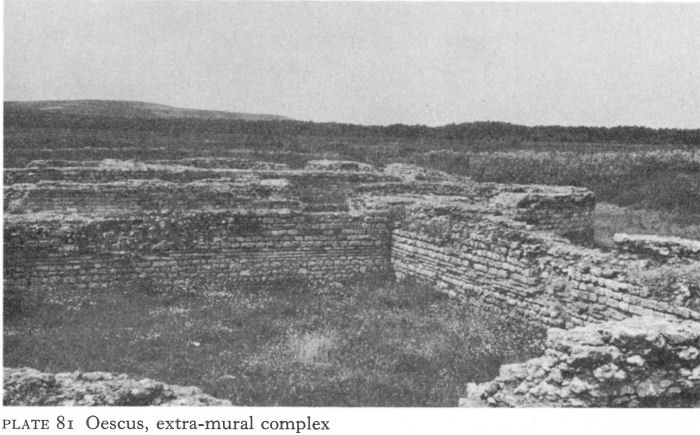
Plate 81 Oescus, extra-mural complex
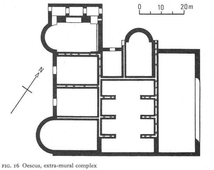
Fig. 16 Oescus, extra-mural complex
![]()
126
In July 328, Constantine visited Oescus to inaugurate the bridge which, spanning 2,400 metres, was the longest bridge in Antiquity. Its life must have been short; possibly it was burnt down, for in 367 Valens had to cross elsewhere by means of a bridge of boats. But the substructure remained. Marsigli, in his Description du Danube of 1744, wrote that in the summer of 1691 the water level fell so low that gigantic piers were visible. He mistakenly referred to them as wooden. F. Kanitz described a similar occurrence in 1871. Early in the last century, a Romanian fisherman hauled up a copper crampon, causing a new legend of a gleaming Constantinian bridge of copper to oust all other local traditions.
Romanian archaeologists have found the ruins of three massive stone piers, sunk in the bed of the Danube. [5] Nearly equidistant from one another, with a longer span to the south bank, they were 33 metres long and 19 metres wide, with tapered ends identical to those of Trajan’s bridge near the ’Iron Gates’. It is assumed that the superstructure was wooden, with fortified masonry towers at each end; the northern one has been excavated, but not the southern. These remains are a reminder that in the time of Constantine the concept of Dacia restituta was more than a dream, although one never to be realised. Oescus itself was to fade into oblivion, perhaps destroyed by the Visigoths or, at latest, by the Huns.
Inscriptions confirm close links between Ad Putea (Riben), a station on the north-south road near the crossing of the river Vit, the ancient Utus, with Oescus and Legio V Macedonica. Paradoxically, its most important find to date is the marble statuette of a ‘peaceful satyr’ (Pl. 82), a lazily smiling boy, naked except for a panther skin. Similar to one from Hadrian’s villa at Tivoli and another from the Palatine, it is considered, like the Eros from Nicopolis-adIstrum (Pl. 98), to be a second-century copy of a statue by Praxiteles.
South-east of Oescus, at Kreta on the river Vit, was the quarry from which came the stone for building the city. Here in an artificial cave was a Mithraeum in which a large relief was found in situ. The plaque, 92 centimetres long and 60 centimetres high, depicting the usual scene of Mithras slaying the bull, stood in a niche on a pedestal, among a number of votive altars.
III. NIKOPOL
A little farther east, past the confluence of the Osum, the ancient Asamus, with the Danube and about half-way between Oescus and Novae, stands Nikopol, where soundings have recently established a stratigraphy to the pre-Roman period. So far its chief claim to fame is a Roman funerary inscription, the elegy of Aelia by her husband, one Fronto, imperial dispensator in Moesia Inferior, which is addressed to the ‘queen of the great realm of Dis’. [6] First he prays for the everlasting peace of his precious love, so that her bones at least may rest in honour, for she deserves much praise, and that Proserpina should bid her dwell in the Elysian fields and bind her hair with myrtle and her temples with blossom. He then eulogises his wife:
. . . Once the spirit of my home [Lar], my hope, my only life; she who wished only as I wished and expressed no desire contrary to mine; with no secrets hidden from me; not lacking in the household arts nor unskilled at the loom;
![]()
127

Plate 82 Ad Putea, statuette, ht. 80 cm.
![]()
128
frugal in domestic management but lavish in marital love; without me taking pleasure neither in food nor in the Bacchic rite; admirable in advice; wise of mind; renowned for her good name . . .
Fronto ends by praying that her monument may be cherished for eternity, by future owners of new and different races, so that in a kindly climate, with the dewy rosebud or the pleasant amaranthus, it shall each year be put in order.
The site of Aelia’s burial is unknown; Fronto was probably stationed at Oescus, or perhaps at Novae, in the latter half of the second century. The fine marble slab, a stele or perhaps the front of a sarcophagus, on which her elegy is inscribed is still in excellent condition - the centrepiece of Nikopol’s public fountain, built at latest by the end of the seventeenth century when Nikopol was a Turkish fortress. In this way at least part of her husband’s prayer has been fulfilled.
IV. NOVAE
Novae (Stuklen, 4 kilometres east of Svishtov) occupies a low, uneven plateau bordered on the north by the Danube and on the east by a little tributary, the Dermen. Like Oescus, earlier the site of a Thracian settlement, from a.d. 46 to a.d. 69 Novae was garrisoned by Legio VIII Augusta. Thereafter it was the headquarters of Legio I Italica for as long as a semblance of Roman military organisation persisted in this vulnerable area. An important road station, Novae also controlled one of the easier Danube crossings. The concentration of two legionary headquarters on this short riparian stretch of about 90 kilometres showed recognition of its strategic importance, apparently better understood by the Romans than by their Turkish successors, for at Novae the Russian army effected an easy crossing into Bulgaria in 1877 to bring the country independence. At the end of the second century, the area was also politically prominent. Septimius Severus owed his throne to the support of the Danubian legions, among which Legio I Italica played an important part.
Although long used as a local quarry, major excavations began here only in 1960, providing a marked contrast with Oescus. Since that date a Bulgarian team has taken the eastern sector and a Polish the western. A fortified area of about 26 hectares has been traced, the approximate extent of the walled town from the end of the third century until the early seventh. The north, west, and south curtain walls have second-century or earlier foundations, but the original east wall was abandoned when the city expanded in this direction. The basically rectangular plan was, as usual, adapted to gain the maximum advantage from the terrain, a bend in the south wall giving, in the third or fourth century, if not before, a slightly pentagonal trace. The north wall, only partially excavated, ran for just over 500 metres along the Danube, here pursuing an almost straight course. The west - and most accessible - side, about 480 metres long and incorporating a monumental gateway, joined the north and south walls at right angles. The south wall, with a centrally sited gate, ran straight for rather over half its total length of 650 metres, then turned slightly northward. The east wall, about 420 metres long, was roughly arc-shaped.
In spite of several building phases, the line of the western defences remained unchanged throughout Novae’s existence. The first wall, of uncertain date,
![]()
129
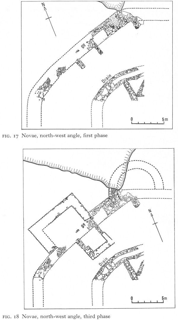
Fig. 17 Novae, north-west angle, first phase
Fig. 18 Novae, north-west angle, third phase
![]()
130
consisted of loose stones piled up and covered with earth. Probably as early as the second half of the first century, this was replaced by a masonry wall, remains of which were found at the north-west corner with, inside, a drain of the same period running roughly parallel. The angle here was rounded off by a flat arc 20 metres long and seemingly strengthened by an internal square tower (Fig. 17). This early wall continued along the Danube, although since little of it has been excavated, its later evolution is unknown. Traces were also found near the west gate. A second stage of the north-west angle occurred when it was destroyed but rebuilt following the same plan. At a third stage, probably during the late third or early fourth century, the wall was reconstructed and strengthened with a rectangular external tower at the middle of the arc. Where the arc joined the north wall there was apparently an external semicircular tower, but its chronological relationship to the other is not clear (Fig. 18). Evidence of several building periods in the inside drain perhaps also indicates enemy penetration. Novae was besieged by the Goths in the mid-third century and was only saved by the appearance of a relief force.
So far the west gate is the most vivid reminder of Novae’s former importance (Fig. 19). It stands just north of the point where the present road breaches the city wall, well within the northern half of the walled area. Preliminary work has established the full width of the gateway as io-6o metres, thus by far the largest known in Moesia Inferior. At the excavated southern end the terminal wall was constructed of large carefully jointed ashlar with a rusticated facing. Below ground level, encased in the foundations of the wall was a vaulted passage, over a metre high and half a metre wide (Pl. 83). This may have been a concealed exit for a surprise night attack on besieging forces, but small enough to defend without difficulty against an attempted entry. The gate is thought to have been constructed in the second century or, at the very latest, the first half of the third, and to have been destroyed and rebuilt during the fourth, to which period are attributed the two external gate towers. As elsewhere, the gate provided evidence of several attacks and repairs.
A well-built horseshoe-shaped angle tower, projecting nearly 10 metres from the south-west corner, can hardly be earlier than the late third or early fourth century. The trapezoidal interior gave the walls a thickness varying from 3.20 to 4.50 metres (Fig. 20). The lower part was faced with large well-cut limestone blocks, the mortared joins strengthened with iron cramps. The obviously later upper levels were of opus mixtum (stone strengthened at intervals with bonding courses of brick), and the masonry was faced with smaller, more roughly cut stones and unusually poor mortar (Pl. 152).
At least nine towers have been identified in the east sector; five, all external, in the excavated part of the east wall south of the present road were either square or rectangular. Going from north to south, tower 1 was built above two earlier constructions, the first late Hellenistic or early Roman, the second incorporating a stone pavement which extended beyond the interior floor and foundations of the wall. In the tower, mid-fourth-century coins, none later than Valentinian I, suggest it may have been built in the reign of Constantine the Great and then destroyed by the Visigoths. Thereupon its military significance ceased; a later dividing wall probably converted it into a dwelling.
The fourth and largest tower on this wall defended the south-east angle (Fig. 21).
![]()
131
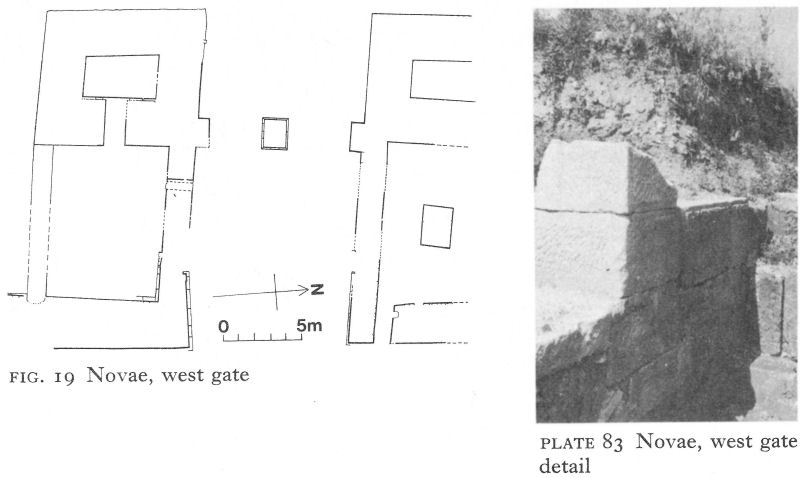
Fig. 19 Novae, west gate
Plate 83 Novae, west gate detail
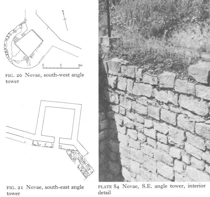
Fig. 20 Novae, south-west angle tower
Fig. 21 Novae, south-east angle tower
Plate 84 Novae, S.E. angle tower, interior detail
![]()
132
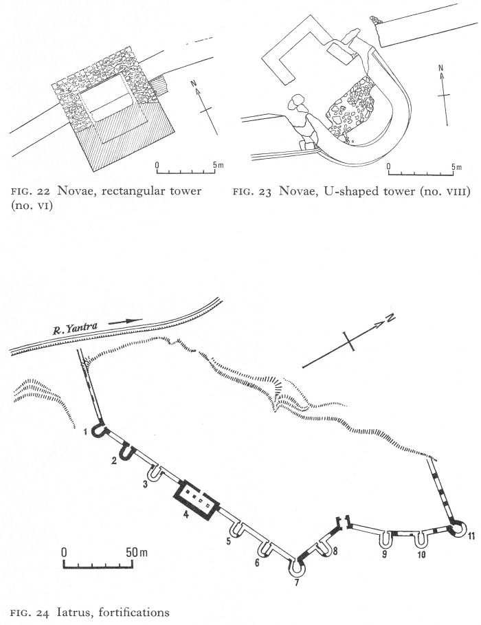
Fig. 22 Novae, rectangular tower (no. VI)
Fig. 23 Novae, U-shaped tower (no. VIII)
Fig. 24 Iatrus, fortifications
![]()
133
It projected about 8 metres and had an exterior width of about n metres. Two distinct building periods have been identified, both within the fourth century (Pl. 84).
Those between the angle tower and the south gate were more varied. Beyond a smaller, square version of the first four was a rectangular tower, no. vi (Fig. 22), which, standing in a slight re-entrant, projected inside as well as, to a greater extent, outside. Another, referred to as no. VIII, was a U-shaped structure linking two unaligned sections of the curtain wall (Fig. 23). Rather surprisingly, it seems relatively weak, with walls only 1 metre thick at the peak of the curve and just over 1 1/2 metres at the sides. This compares with the curtain wall’s thickness of 2.80 metres. The tower bore marks of considerable damage and was rebuilt several times. An adjacent U-shaped external tower had walls about 2.60 metres thick at the sides and nearly 3 metres at the middle.
The curtain wall and towers on the east side of the town appear to have been built after the Gothic wars of the third quarter of the third century and before those of the Visigoths in 376-82. With many repairs and reconstructions, some of which were put into effect before the end of the fourth century, it seems likely to have remained more or less the east line of defence until the beginning of the seventh century. But its relationship to the original east wall has still to be resolved.
Within the walls excavations are bringing to light parts of large buildings, houses and streets, one of which clearly displays two levels, with porticoes, shops and workshops, and many minor finds. Co-ordinated soundings were made by the two teams in 1971 to locate the forum.
V. IATRUS
Iatrus or Iatrum (Krivina) lies on the right bank of the Yantra - in Antiquity the Iatrus, from a Thracian word believed to mean a swift, turbulent river - close to its entry into the Danube, about 16 kilometres east of Novae. Unlike cities such as Ratiaria and Oescus, Roman Iatrus was a fort without significant administrative functions or civilian population on the highway between Novae and Durostorum (Silistra). K. Škorpil traced the walls in the early 1900s and found a Latin inscription of the first half of the second century. Joint excavation by Bulgarian and East German archaeologists, begun in 1958, shows that it was a castellum, a small fortified centre, of strategic importance in the fourth century, when the fortifications uncovered were constructed. A re-used altar dated to the second or third century and dedicated to the ‘invincible god’ Mithras by one Marcus Ulpius Modianus of Legio I Italica links it with Novae. Unfortunately, the Yantra, which once guarded the western walls, has since eroded them, together with an unknown proportion of the castellum, through which it now flows. Flood waters of the Danube have similarly destroyed the north-western part, leaving an irregular lozenge-shaped plateau, 300 metres long with a maximum width of 100 metres (Fig. 24).
The curtain wall was a massive structure about 3 1/2 metres thick, faced on the outside with large rusticated ashlar blocks, the interior dimensions diminishing slightly to avoid mortar being visible on the outside. The western end emerges now from the edge of the cliff which drops down to the Yantra’s present course
![]()
134
and first runs without towers at a right-angle to the river, a steep slope to the south denying easy access. After a slight bend, a long straight stretch follows, with external horseshoe-shaped angle towers at each end (nos. 1 and 7). A large rectangular tower in the middle (no. 4) had two U-shaped ones on either side of it. From tower 7 the wall turned at a near right-angle to make a deep re-entrant which incorporated the gateway and was reinforced by U-towers. It terminated in the horseshoe-shaped angle tower n. The wall then turned sharply to the west, now to disappear into the sector eroded by the Danube.
The walls of the U-shaped and angle towers were 3 metres thick and projected about 9 metres from the curtain wall. The rectangular tower, no. 4, was even more substantial; 30 1/2 metres long and 15 metres deep, it projected 9 1/2 metres beyond the wall and nearly 2 1/2 metres inside it. Within the tower, four great rectangular stone piers, 1.77 by 1.19 metres, standing on 2-metre deep foundations, were aligned along the axis, evidently to support an upper storey capable of carrying artillery such as ballistae and supplies of stone balls. The tower must have given powerful protection to the relatively easy south-eastern approach to the fort. Similar rectangular structures appear in castella in the Dobroudja, notably at Capidava and, without piers, at Tropaeum Trajani.
Little is left today of the only surviving gate. Facing south-east, between but not architecturally linked with towers 8 and 9, it was double and recessed so that its exterior face lay flush with the wall (Fig. 25). The outer gate, 4 metres across, a portcullis, operated between grooves running down the jambs. A space, the propugnaculum, 5 1/2 metres square, separated it from the inner door, which consisted of two pivoted wings. Inside, two gravel-laid streets, both decumani, east-west streets, have been uncovered; one of these was colonnaded (Pl. 85).
One excavated building extended parallel with the wall from its present western end for a distance of 62 1/2 metres, including the first angle tower. It replaced earlier Roman constructions about which little could be ascertained (Fig. 26). The outer wall was formed by the curtain wall. The inner, 12 metres away and, like the two short ends, 1 1/4 metres thick, was of opus mixtum, with remains of only one layer of bricks just discernible. Following the pattern of the rectangular tower, nine piers and pilasters at each end lined its axis. The piers, the majority 1.50-1.60 by 1.80-1.90 metres, were built of finely jointed ashlar, joined by iron cramps and decorated with simple shapes in relief (Pls. 86, 87). Traces of vaulting confirm that they supported an upper storey. This building, later than the curtain wall, must have had some complementary military purpose, such as a storehouse; apart from backing on to the wall, tower 1 could only be entered from it. Like tower 4, artillery could be carried on the upper storey. The careful workmanship of the piers - the facing of the walls has been completely lost - and traces of a tiled floor have close parallels in the walls and towers of Tropaeum Trajani.
Foundations and parts of walls of one other building of the same period, a large rectangular structure 39 metres long and 14 metres wide, were excavated just north of the building described above. Its walls, 1.20 metres thick, were of opus mixtum, using bands of four courses of bricks. A stylobate to carry piers or columns down the centre indicates an upper storey.
![]()
135
Below the building were earlier constructions, including walls of stone and mud and, still lower, a male inhumation burial without grave goods.
In a nearby sector, soundings revealed rather confused evidence of two early building periods. Both were Roman and here, too, were the remains of two stone and mud walls. The first was like the earliest constructions found at Serdica and Abritus, as well as those below the rectangular building, and may date to the first century a.d. At the second level were floors of stone with white mortar. T. Ivanov suggests that the earlier was destroyed during the mid-thirdcentury Gothic invasion; and that the second existed between the end of the third or the beginning of the fourth - it may have been contemporary with the walls - and the late fourth century, when the site was prepared for a Christian basilica (p. 245).
Coin finds, analogies with other Balkan sites, and structural features suggest the walls were built during the period of refortification of the Danube limes by Licinius, Galerius, and Constantine the Great. The long building attached to the wall at the western end was added during the second half of the fourth century or, at latest, the beginning of the fifth. The other rectangular building also belonged to the second half of the fourth century, probably prior to the Visigothic invasions of 376-82.
VI. TRANSMARISCA
West of Durostorum, the castellum of Transmarisca (Toutrakan) occupied the strategic site of an earlier Thracian settlement opposite the confluence of the Danube and the (Romanian) river Arges - the Mariscus of Antiquity. Existing from the second century, the earliest parts of the stone fortifications now being excavated are thought more likely to belong to the late third century, when the fort was garrisoned by detachments of Legio XI Claudia. This connection with Durostorum, which was to continue to be the legion’s headquarters until the sixth century, is confirmed by the find of stamped bricks.
A late third-century inscription honouring Diocletian for his victories over the barbarians, his restoration of peace to the land, and his erection of the praesidium, or fortress, of Transmarisca may mean that the original fortifications had been destroyed by the Goths and that those now being uncovered are the work of Diocletian. Almost identical inscriptions have been found at Sexaginta Prista (Rousse) and Durostorum.
The importance attained by Transmarisca in the fourth century is shown by Valens’ choice of it as a base from which to build a pontoon bridge across the Danube to pursue his campaign against the Visigoths.
VII. DUROSTORUM
Durostorum (Silistra) replaced a Getic oppidum, a fortified hilltop settlement, probably conquered by the Romans early in the first century a.d. To the north, a wide marshy sector of the Danube, extending almost to the delta, protected the Dobroudja. Troesmis (in modern Romania) defended its northern end, Durostorum its southern, and, of greater importance from the point of view of imperial defence, the approach to Marcianopolis, Odessos, and easy passes of the Stara Planina to the south.
![]()
136
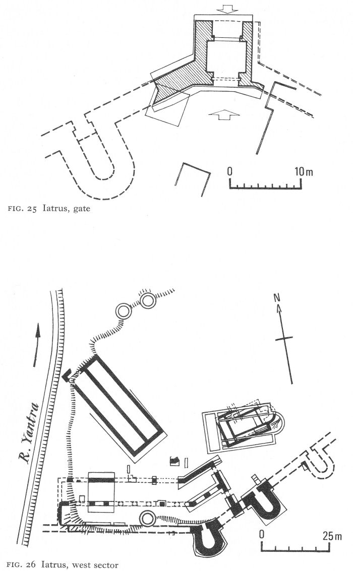
Fig. 25 Iatrus, gate
Fig. 26 Iatrus, west sector
![]()
137
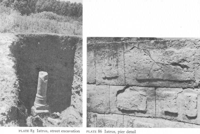
Plate 85 Iatrus, street excavation
Plate 86 Iatrus, pier detail
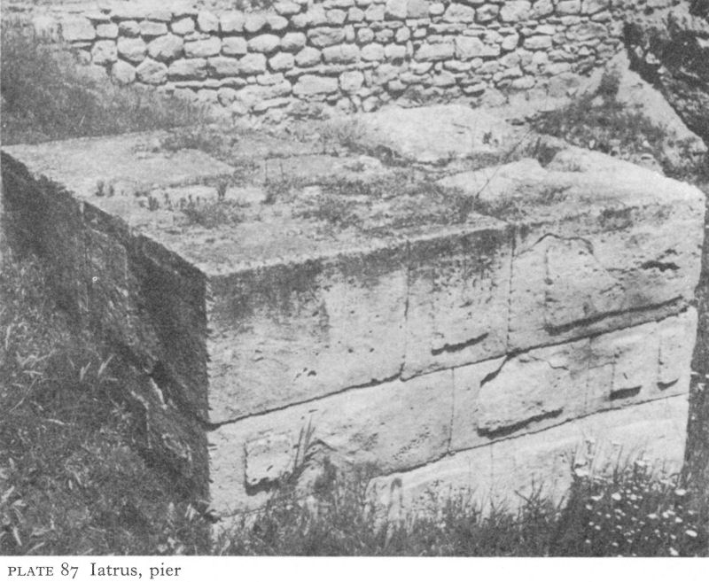
Plate 87 Iatrus, pier
![]()
138

Plate 88. Durostorum, helmet-mask, ht. 25,3 cm.
Plate 89 Siiistra district, Athena, head, ht. 33 cm.
Plate 90 Silistra district, Mithraic relief
Following the First Dacian war of 101-2, during which Decebalus had crossed the Danube near Durostorum to invade Moesia Inferior, the city became the headquarters of Legio XI Claudia and remained so until the legions were replaced by foederati. At the same time, Legio V Macedonica was temporarily transferred to Troesmis. Hadrian visited Durostorum in 123-24 and a flourishing settlement soon grew up - the canabae Aeliae - round the legionary headquarters, to become a major centre for the Romanisation of this part of Moesia Inferior. The settlers were mainly veterans of Italic and Western origin - some from Ratiaria and Oescus but many from Spain, Gaul, Germany, and Britain. Cohors II Flavia Britonum was stationed temporarily here. By the third quarter of the second century, Durostorum had become a municipium, a city granted considerable civic autonomy, and, with the departure of Legio V Macedonica to Dacia, Durostorum was left the sole legionary headquarters on the Danube east of Novae.
Many Getai still lived outside the town - and occupied lowly positions within it.
![]()
139
Some degree of integration is shown by the funerary monument of a legionary, he and his wife apparently of Italic origin but their sons all bearing Getic names, including Decebalus. Some of the hinterland had been settled by members of the warlike Bessi tribe, transported from the Rhodopes and here given favoured status. Besides normal legionary cults, notably Mithraism, an altar was erected by a group of soldiers to the ‘Heros Suregetes’, a probable reference to the Thracian Hero - of whom there is more evidence in the countryside - the epithet being similar to one used at Bessapara (near Pazardjik).
The area suffered severely from a combined invasion of the Karps, Goths, and Sarmatians in 238. A votive tablet from an inhabitant of Durostorum thanks the gods for preserving him from captivity, a fate clearly met by many others. An official inscription thanked Aurelian for his work of reconstruction. Nevertheless, for the next hundred years the Danube defences in the neighbourhood remained vulnerable to the northern tribes lured by the wealth of the coastal cities, notwithstanding an attempt at pacification and political-religious penetration by means of Christian missionary activity in the middle decades of the fourth century.
Durostorum must have played a part in Valens’ campaign against the Goths - he was there in the autumn of 367 - but after his defeat and death, although the fortified town survived, disaster overcame the countryside.
The existence of the modern frontier city of Silistra and erosion by the Danube have until recently prevented much excavation of the site, the earliest fortifications so far discovered being some Early Byzantine foundations of the fortress wall. There are some chance finds, such as a bronze helmet-mask [7] (Pl. 88) attributed to the first or second century, a probably third-century marble head broken from a statue of Athena (Pl. 89), a Mithraic relief in lively local style (Pl. 90). But although the main archaeological remains of Roman Durostorum are hidden, its name is famous in Christian hagiography for the martyrs, chiefly of Legio XI Claudia, who suffered for their faith under Diocletian and Galerius.
The story of the best-known soldier martyr here, St Dasius, is linked with the troops’ custom of celebrating the Roman feast of the Saturnalia. Lots were drawn, the winner designated ‘king’ and allowed a month’s ‘reign’ of unbridled licence, then put to death as a sacrifice to Cronus. In 304, the lot fell to Dasius, a Christian legionary. Knowing he could not escape death, Dasius rejected his Saturnalian role, was thrown into prison, and killed. [8] After the general adoption of Christianity, a cult of St Dasius developed, centred on the shrine containing his relics. Later, perhaps in the second half of the sixth century, the barbarian danger grew so great that the relics were transferred for safety to the cathedral of Ancona. Here they lay in a sarcophagus inscribed in Byzantine Greek with his name and the city of his martyrdom, to be rediscovered in 1908.
A second legionary martyr was Julius, whose story is touching both for the stubbornness with which a veteran of seven campaigns and 27 years’ unblemished service refused to sacrifice to the pagan gods and for the well-meaning attempts of the prefect to devise a face-saving formula to satisfy Julius’ conscience and yet comply with the letter of the law.
If you think it a sin, [the prefect said], let me take the blame. I am the one who is forcing you, so that you may not give the impression of having consented voluntarily. Afterwards, you can go home in peace, you will pick up your ten-year bonus and no one will ever trouble you again. [9]
![]()
140
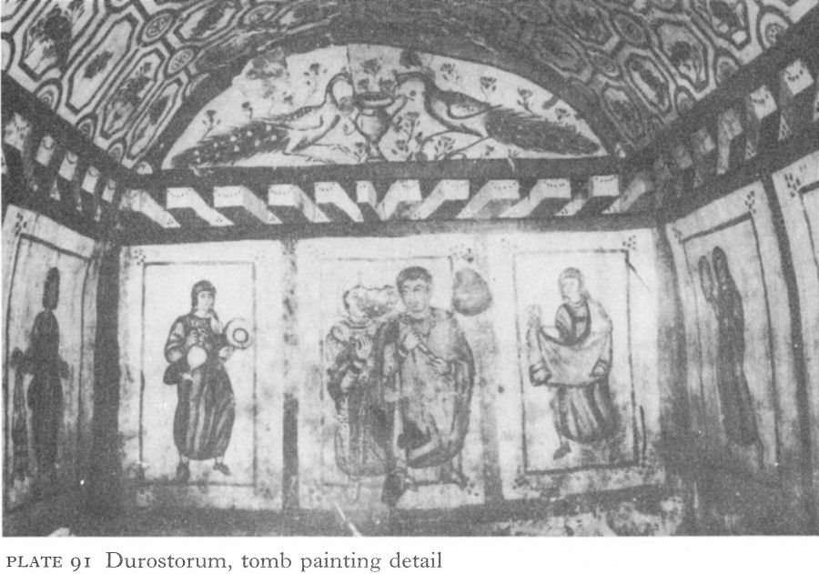
Plate 91 Durostorum, tomb painting detail
All his persuasions were of no avail. Julius insisted on being beheaded.
Nevertheless, a painted pagan tomb is the most important surviving monument of the fourth century in Durostorum. The almost completely preserved painted decoration covers both walls and ceiling of an ordinary Roman masonry tomb chamber, aligned east-west and measuring 3.30 by 2.60 metres, with a shallow brick-built vault rising to a height of 2.30 metres in the centre. The entrance is in the middle of the east wall.
Round the walls, a series of rectangular panels a little over 1 metre high and 1 metre wide and enclosed by tile-red borders contain lively portraits of a man, his wife, and their household. Within the light background of the panels, a second rectangle, outlined in dark green, sets off each figure. The master and his wife occupy a joint, wider panel, facing the entrance (Pl. 91). They stand with heads turned towards each other, but whilst she gazes at her husband, he looks into the distance, obviously preoccupied. He carries a scroll; she rests one hand on his shoulder and holds a rose in the other. The heads are unnaturally large, possibly a conventional indication of their rank or status. He wears a long tunic with full-length sleeves and decorated cuffs under a loose mantle fastened by a fibula at the shoulder. A white kerchief hides almost all the wife’s brown hair. She, too, wears a long tunic, over which is a white dalmatic splashed with grey and an embroidered ochre and red clavus or vertical stripe.
Maidservants are advancing in the panels on either side; one carries a jug and a long-handled dish, the other a drape; next, on the side-walls, are two more, one holding up a mirror and another bearing three jars in a special holder, perhaps for her mistress’s toilet (Pl. 92).
![]()
141
The last wears a bead or pearl circlet in her hair, rings in her ears, and two bangles on each wrist - and the smug expression of a favourite. Next, a youth carries over his shoulder a pair of tights, complete with belt, one hand holding a pair of shoes by their laces (Pl. 93). Like the other menservants, his dress is a short, long-sleeved, belted tunic, reaching to just over the knee. Behind him a boy is carrying and adjusting the folds of a mantle; his hair down to his shoulders probably indicates a Gothic slave. On the opposite wall are two more youths, both wearing torques, one holding a napkin and the other carrying a heavy ornamental belt. On either side of the door, narrower panels each enclose an ornate candelabrum, the candles alight and wax spilling down their sides. Above, a painted band gives a rather crude impression of beams projecting from a building into a courtyard, the central court of a modest Roman villa.
In the west lunette, above the beams, two peacocks drink from a vase, against a floral background. This symbol of immortality is so common in early Christian iconography that the tomb was at first considered Christian, an idea supported by the orientation as well as, no doubt, by the hagiographical reputation of Durostorum. In the east lunette, the scene is repeated with smaller birds, perhaps doves. The vault is covered by a network of tiny panels enclosing rural motifs - flowers, fruit, palm trees, birds, animals, and hunters - no two the same.
The paintings in the tomb, probably built in the second half of the fourth century and apparently never used, are unusually interesting, although naturally provincial in style. Clearly commissioned by the two prospective occupants, it presents a delightful picture of the bourgeois Roman citizen at home in this
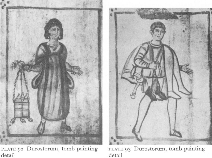
Plate 92 Durostorum, tomb painting detail
Plate 93 Durostorum, tomb painting detail
![]()
142
corner of the empire. By comparison with those in the Kazanluk tomb of some six hundred years earlier (Pls. 63-5), the paintings lack any note of mourning. Superficially the scene is similar, but here death is shown as a perpetuation of the pleasanter aspects of life. Only the lunettes carry reminders of immortality, but it is an afterlife in which ordinary people continue in their appropriate earthly station. The roughly contemporary saints’ heads from the fourth-century church at Tsar Krum (Pls. 163, 164) present as great a contrast in their spirituality as do the dignity and solemnity of the Thracians of Kazanluk.
However, Christianity developed strongly in fourth-century Durostorum, reinforced by the teaching of the Arian Gothic translator of the Bible, Ulfilas, one of whose pupils, Auxentius, a leading protagonist of Arianism, became bishop of the city in 380. Meanwhile the martyrdom had happened in 362 of another famous local saint, Aemilianus, during Julian’s brief persecution. Julian’s representative, Capitolinus, was appointed to enforce the revival of the old cults. During a huge banquet to celebrate his achievements, Aemilianus entered an unattended pagan temple, smashed the idols with a hammer, upset altars and candlesticks, spilt the libatory wine, and departed unseen. The furious Capitolinus ordered an inquiry, punishment of the temple guards, and the immediate apprehension of the culprit. No time was lost in arresting an innocent peasant passing by and dragging him to the praetorium to be executed. This demonstration of zeal was upset by Aemilianus’ confession of responsibility. His bold replies to Capitolinus’ questions enraged the envoy, who ordered him to be thrown to the ground and beaten. When Aemilianus admitted he was the son of a prefect, Capitolinus imposed a heavy fine on the father who had brought his son up so badly, and sentenced the latter to be burnt alive. But the flames, respecting his body, devoured the soldiers instead. Aemilianus then made the sign of the cross, commended his soul to God, and expired in peace. The story achieved much fame in succeeding centuries and, as can be seen, did not lose in the telling as it became part of the Christian tradition of Moesia. [10]
NOTES
1. Gerov, B., Romanizmut III, no. 186.
2. Velkov, I., IBAI XIV, 1940-42, 183 ff.
3. NAC, Arh XIII/4, 1971, 78.
4. Pap. Ox. XXVII 2462, discussed in Charitonidis, S., Kahil, L., and Ginouves, R., Les mosaiques de la maison de Ménandre à Mytilène, Berne, 1970, 98-9.
5. Tudor, D., Sucidava; une cité daco-romaine et byzantine en Dacie, Brussels, 1965, 74 ff.
6. CIL III Supp. 7436.
7. Venedikov, I., Eirene I, 1950, 143 ff.
8. Analecta Bollandiana XVI, 1897, 5 ff.; Zeiller, J., Les origines chretiennes dans les provinces danubiennes de l'empire romaine, Paris, 1918, no ff.
9. Musurillo, H., The Acts of the Christian Martyrs, Oxford, 1972, 263.
10. Analecta Bollandiana XXXI, 1912, 260 ff.
6 The northern foothills (I)
I. NICOPOLIS-AD -ISTRUM AND THE CENTRAL SLOPES
Nicopolis-ad-Istrum
Nicopolis-ad-Istrum, 18 kilometres north of Veliko (Great) Turnovo, was identified in the last century by F. Kanitz who, studying Roman ruins still known locally as ‘Stari’ or ‘Old’ Nikyup near the present village of Nikyup, found the base of a statue erected in 203 by the council and assembly of Nicopolisad-Istrum to Julia Domna, wife of Septimius Severus. The resulting official treasure hunt produced many finds, but the site, like Oescus, was left in disorder and unrecorded. Recent research and limited excavation have established some major features, but these can only be regarded as a beginning of an enormous but rewarding task.
Nicopolis-ad-Istrum - Trajan’s ‘city of victory on the Danube’, founded in 102 in celebration of the Danubian battle which brought the First Dacian war to a victorious conclusion - was probably the emperor’s first foundation in Thracia, then extending some way north of the Stara Planina. The main purpose was restoration of the economy of a fertile area devastated by the Dacian invasions of 85-86 and 101-2.
The chosen site was an important crossroads. Three roads led north to the Danube, two apparently to Novae, the other to Sexaginta Prista; two ran south over the Stara Planina, one over the Shipka pass to Philippopolis and the other more easterly to Augusta Trajana-Beroe. The city also stood on the road roughly parallel with the Danube which linked Marcianopolis and Odessos with the west, joining the Oescus-Philippopolis road at Melta and, farther west, the highway connecting Ratiaria with Lissus on the Adriatic. Only the city’s vulnerability under the impact of later invasions caused the inhabitants to move a short distance south to Turnovo, a stronghold which later developed into the capital of the second Bulgarian kingdom and is one of Bulgaria’s leading cities today.
Nicopolis, as its name implies, was neither a ‘colonia’ nor a ‘municipium’, but founded as a Hellenistic city. Romanisation was a costly business and generally considered unnecessary in Hellenised lands except for overriding reasons of military necessity. The Danube limes was one such exception and behind it the main objective was to achieve stability as economically as possible, with a sufficient prosperity to subsidise the empire and its armies. So, with Roman encouragement, once more a wave of Greek - or Hellenised - immigrants arrived from Asia Minor and also from Syria, and found opportunities for their skills and commercial acumen that would have been the envy of the founders of the Black Sea colonies. With all the advantages of its situation, Nicopolis prospered rapidly during the second century, stimulating industries such as the ceramic factories at Hotnitsa and Butovo and emporia, or official rural marketing centres, such as at Butovo and Discoduratera (Gostilitsa). Many of the wealthier citizens were landowners and had country villas. Inscriptions show that often the proprietors were Roman or Romanised - Novae was only some 50 kilometres way - and although the city’s official language was Greek, the educated citizens were almost certainly bilingual.
![]()
143
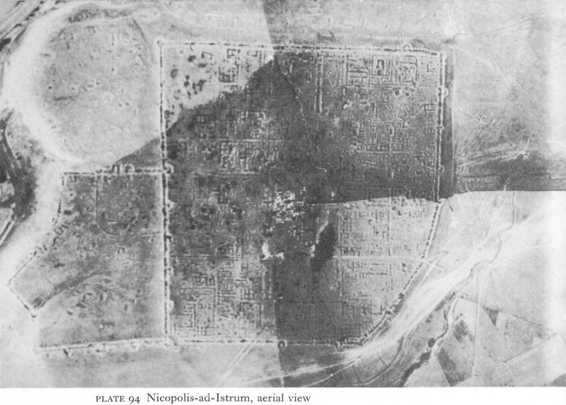
Plate 94 Nicopolis-ad-Istrum, aerial view
![]()
144
The city was on a low plateau, sloping steeply on three sides either to a gully or to the river Rositsa. With the north-east corner cut off to conform with the terrain, the area enclosed was pentagonal rather than rectangular, 450 metres long on the west side and 505 metres long on the south, on which side the curtain wall partly coincided with the north wall of a smaller, irregularly shaped fort, the towers of which projected into the city proper. At first glance this suggests an earlier castellum, but an aerial photograph (Pl. 94) reveals a much more complicated situation. [1] The ‘fort’, besides rounded angle towers, apparently had others - U-shaped or semi-circular, rectangular, possibly triangular, and even pentagonal, thus suggesting various dates from the end of the third or fourth century into the Byzantine period.
The city’s curtain walls also lack homogeneity. Except at the angles, no towers or bastions are discernible on the south side. Along the west wall it is possible to make out one U-shaped tower and another in the form of a horseshoe; there may be others. In the western half of the north wall, two semicircular towers are visible; at the join with the eastern half, an external rounded angle tower is less clear. The east wall is again different; it is strengthened by two circular half or three-quarter projecting towers; the northern angle tower seems to be external and rounded, but the site of a southern one is occupied by the angle tower of the ‘fort’. Pending excavations, none of the main fortifications of Nicopolis can be regarded as earlier than the second century, whilst those of the southern ‘fort’ may perhaps date to the end of the fourth or the fifth century.
![]()
145
The city had two gateways, one on the north, the other on the west. Starting from the former, the cardo maximus, or main north-south street, continued past the east side of the forum to the annexed ‘fort’. The decumanus maximus, running from the west gate along a line slightly south of the east-west axis, led into a large central area comprising several public buildings and the forum (Fig. 27). The streets, paved with large stone slabs, irregularly laid, probably to minimise earthquake damage, covered the drainage system (Pl. 95).
The space enclosed by the inner portico of the forum was 42 metres square, paved with huge, well-cut stone slabs. The colonnaded portico stood three steps higher; its Ionic bases, monolithic columns, capitals, and architraves were carved from limestone from the nearby Hotnitsa quarries. Rows of shops on the east and south porticoes probably had frontages to streets five or six steps below. The north side is unclear. Finds included two parallel rows of large square bases, with a row of smaller ones between.
The main entrance to the forum was on the west, where the decumanus maximus stopped at a propylaeum, or monumental entrance, of four great Corinthian columns, 8 metres high, a coffered ceiling and a richly decorated architrave (Pl. 96). The Greek inscription on the last shows it was erected by the city in 145 in honour of Antoninus Pius, Marcus Aurelius, and his wife, Faustina the Younger. [2] The propylaeum led to a narrow peristyled courtyard, from which, between two rooms, access was obtained to the forum’s western portico.
North of this courtyard was the bouleuterion, or council chamber, with a frontage of 15 1/2 metres on the forum portico. Its walls were lined with stone seats and many fragments of inscriptions recording civic decrees and pedestals of statues were found among the ruins.
On the south side of the courtyard the odeon, a rectangular, roofed theatre, had a 26-metre frontage on the forum. The scena occupied the south side; in front, tiers of seats rose round a semicircular orchestra, the lower benches being stone and the upper, probably, of wood, in all sufficient to accommodate some three or four hundred spectators. The front seats were high, giving protection to spectators of gladiatorial combats and displays involving wild beasts. Rooms under the upper tiers were probably shops, those on the western side profiting from facing on to the forum portico.
The plan and architectural style of the forum and the conventionalised representations of public buildings and city gates on coins reflect the dominant influence of Hellenistic Asia Minor. This is supported by the many Greek inscriptions, altars to oriental gods, and architectural fragments littering the central area. In some cases these bear such ‘signatures’ of the master masons as a lizard (Pl. 97) or a dog. There must have been masons’ guilds, just as inscriptions show that there were guilds of woodcarvers, leather-workers, and fullers, again on an Eastern pattern. Nicaea, Nicomedia, and Antioch in Syria are the only towns mentioned as origins of the settlers, but the many Greek names and gods displayed on coins and mentioned in votive inscriptions, such as Priapus, said to have been brought from Bithynia, Sabazius, the associated cult of Magna Mater, Serapis, Mithras, and others, as well as those of the GrecoRoman pantheon, are additional evidence of oriental immigration. The city may also owe to this influx a fine white marble statue of Eros (Pl. 98), believed to be a mid-second-century copy of that carved by Praxiteles for the city of Parion and now known only from its coins.
![]()
146

Fig. 27 Nicopolis-ad-Istrum, reconstruction of city centre
![]()
147
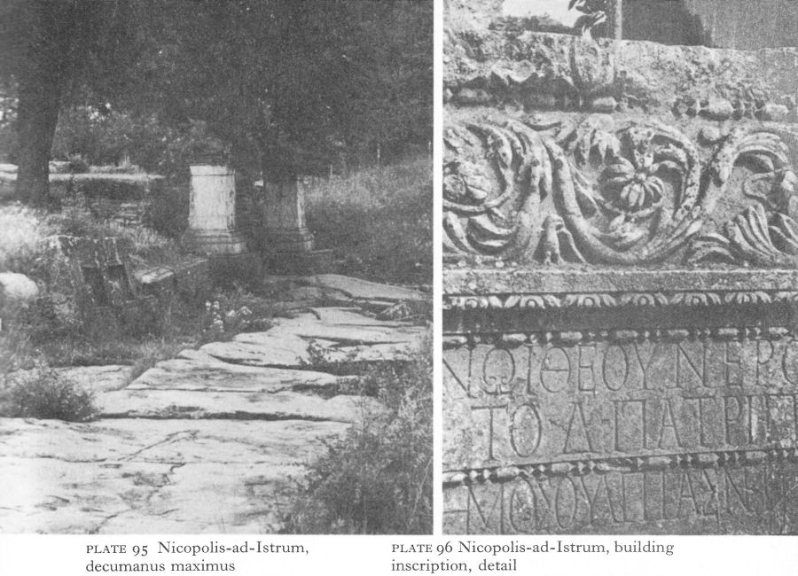
Plate 95 Nicopolis-ad-Istrum, decumanus maximus
Plate 96 Nicopolis-ad-Istrum, building inscription, detail
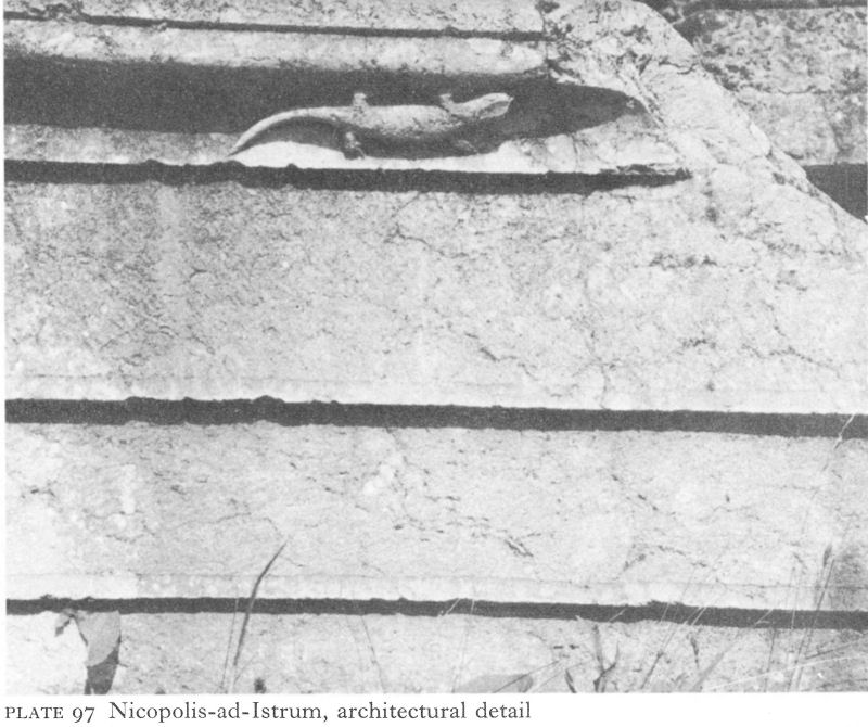
Plate 97 Nicopolis-ad-Istrum, architectural detail
![]()
148
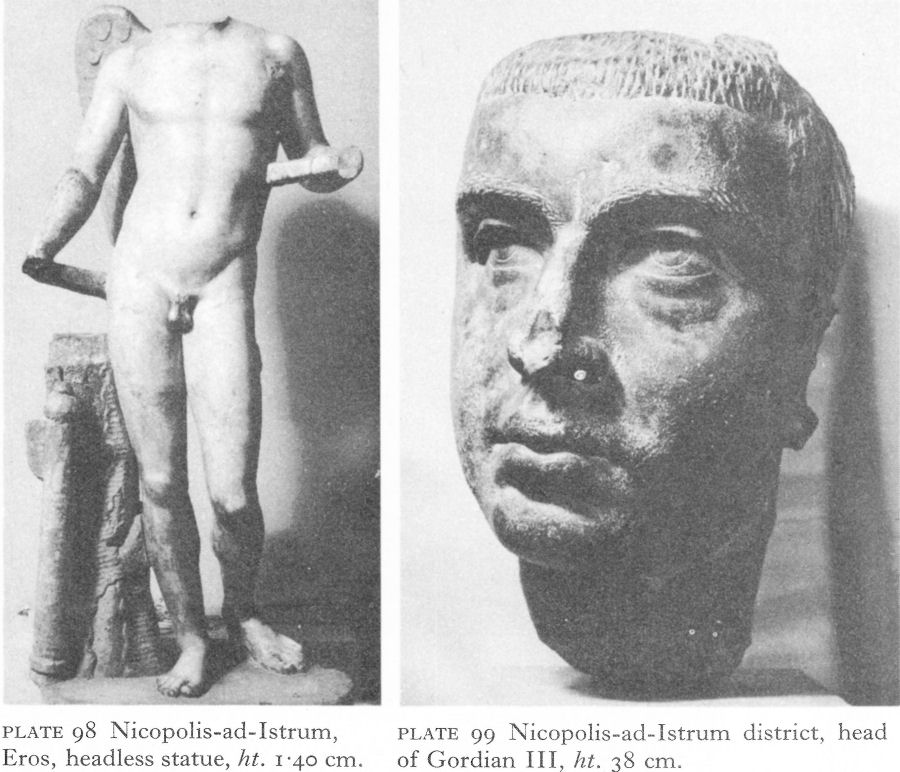
Plate 98 Nicopolis-ad-Istrum, Eros, headless statue, ht. 1.40 cm.
Plate 99 Nicopolis-ad-Istrum district, head of Gordian III, ht. 38 cm.
Huge quantities of coins were issued during the period of prosperity. Subjects represented naturally included Nike, and also Haimos, the personification of the Stara Planina, shown as a young hunter, half-reclining on a rock but holding a spear; in front of the rock is a bear, sometimes attacking a stag by the tree behind it. According to the coins, temples were dedicated to deities including Zeus, Apollo, Artemis, Concordia, and Fortuna.
Early in his reign Septimius Severus transferred Nicopolis and its surrounding territory from Thracia to Moesia, which greatly increased the city’s economic opportunities. His subsequent visit in 202 enabled the citizens to demonstrate their gratitude; the celebrations included a gift to the emperor of 700,000 denarii and the many finds of inscriptions and bases of statues of him and his family testify to his popularity. The first third of the third century saw the peak period of Nicopolis’ prosperity. The earliest serious breach of the Danubian defences of Moesia Inferior occurred during the reign of Gordian III. Aptly, in the circumstances, the bronze head of a statue of this emperor (Pl. 99) was found in the bed of the river Yantra some 10 kilometres to the north, possibly where it had been dumped by a retreating looter.
In 250, the Goths, having failed to take Novae, invested Nicopolis, but suffered a severe defeat.
![]()
149
The event establishes the existence by this period of the city walls. Further confirmation comes in Nicopolis’ survival during the Gothic rampages of the next 20 years, culminating in another unsuccessful siege in 270. Aurelian’s withdrawal from Dacia added the loss of a valuable market to the economic distress caused by the Gothic devastation. It also brought the barbarian threat closer. Minting ceased abruptly about 250 and buildings begun in happier times remained unfinished. The great pediment (Pl. 100) appears never to have been erected.
The peace along the limes imposed by Galerius and Constantine was a welcome respite; it could not revive the prosperity of the past, but a certain degree of recovery about this time is indicated by the erection of a brick and stone building occupying a large area, beginning 16 metres inside the north wall near the cardo maximus (Pl. 101). The plan, the evidence of hypocausts, and the debris of toilet articles, lamps, and glass vessels which littered one of the rooms suggest a public bath.
About 346, Bishop Ulfilas and his Visigothic Christian followers were given sanctuary and settled peacefully in the neighbourhood of Nicopolis. The Visigothic invaders of 376-82 were another matter. According to Ammianus Marcellinus, the fortified cities held out, but the countryside was devastated and depopulated. For a city so dependent on commerce, the effect on its economy must have been disastrous, even if the majority of its inhabitants survived to come to terms with the new, largely Gothic rural population.
Hotnitsa
Excavations at Hotnitsa, some 10 kilometres south of Nicopolis, show that besides being the main quarry for the city, it was an important centre for the manufacture of pottery and was probably an emporium. By 1969, 17 kilns were located, and finds of bronze statuettes and other objects reflect its share in the second- and early third-century prosperity.
Butovo
Even more important for ceramic production was present-day Butovo. Situated on the original border between Thracia and Moesia and on or near the Nicopolis-Novae and Nicopolis-Melta highways, Butovo was also the site of an important emporium, probably to be identified with Emporium Piretensium. Founded in the second century as a fortified trading post, the remains of defence walls, foundations of large buildings, and existence of re-used architectural fragments are evidence of a prosperous evolution. Successful trading and the excellence of the local clay led to the creation of production industries. Both stonemasons’ and potters’ quarters have been excavated. This development seems either to have been instigated by or to have attracted immigrant potters from Asia Minor, who, working alongside Thracian craftsmen, were able to turn out pottery with decorative motifs produced nowhere else in Bulgaria, although some influence appears in the Hotnitsa work. By the end of the second century imports were almost entirely superseded and Butovo factories were supplying both Novae and Nicopolis.
There were four main decorative techniques: barbotine, stamped impressions, incised drawing, and the application of clay relief figurines to a soft clay surface.
![]()
150
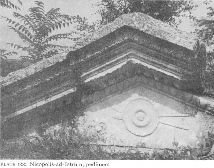
Plate 100 Nicopolis-ad-Istrum, pediment
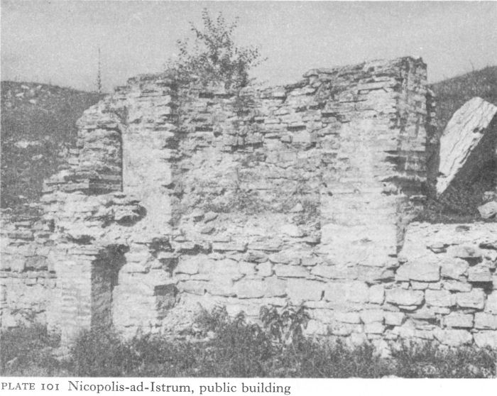
Plate 101 Nicopolis-ad-Istrum, public building
![]()
151
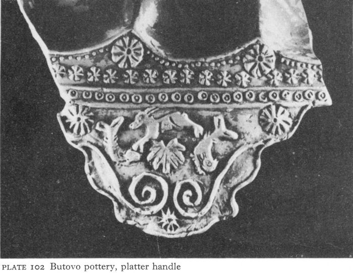
Plate 102 Butovo pottery, platter handle
Numerous moulds were found, and bowls, plates, and lamps, their surfaces crammed with naturalistic plant and animal ornament interspersed with geometric and various stylised designs (Pl. 102). Children’s toys - miniature clay horses, goats, cocks - and figurines were found in the debris, as well as votive tablets, including one of Orpheus surrounded by the wild beasts.
Butovo’s fate after the middle of the third century is unknown. Perhaps damaged or evacuated in the first Gothic invasions, some commercial advantages may also have been lost as a result of Aureban’s and Diocletian’s administrative changes. Few of the finds yet brought to light are likely to be post-third century.
Discoduratera
Discoduratera (Gostilitsa) lies on the upper reaches of the Yantra, 32 kilometres south-west of Nicopolis-ad-Istrum and about 16 kilometres north of modern Gabrovo. It was founded, probably about the middle of the second century, as an emporium of the territory of Augusta Trajana and stood at the junction of the highway from this city over the Shipka pass to Novae and a road from Nicopolis and Hotnitsa. Less exposed than Butovo, Discoduratera escaped the first Gothic invasions, although it was probably badly damaged in the last quarter of the fourth century. The surviving fortifications belong to the endfourth to sixth centuries.
There is no evidence of auxiliary industries, as at Butovo, but the emporium was a convenient overnight halt before or after crossing the Stara Planina. An inscription proves its existence in the reign of Marcus Aurelius, although it may have been settled earlier.
![]()
152

Fig. 28 Prisovo, villa rustica
Except for a few coins from local mints, the earliest found were silver of the first half of the third century; they were the only silver ones - from the mid-third century onwards all were copper. Bronze or copper coins of Nicopolis, Marcianopolis, and Pautalia (Kyustendil) occurred at the mid-third-century building level, all minted under Septimius Severus and Caracalla but evidently brought again into circulation by a currency crisis due to Gothic disruption of the local economy.
Above, more coins were found, dating to the reign of Aurelian, and his successors continued to be relatively well represented until the reign of Jovian. With renewed Gothic invasions came another gap - until Theodosius I - from which only a few coins of the Western emperors Gratian and Valentinian II have been found. Thus the pattern of coin finds reflects the effect of the invasions on the local economy; doubtless greater care was taken in hard times.
Although Nicopolis and its territory were transferred to Moesia about the end of the second century, an inscription shows that Discoduratera remained under Augusta Trajana, probably until the reign of Aurelian when it, too, came under the administration of Nicopolis.
Inscriptions and coins have yielded most information about Discoduratera, but a building of the third or fourth century excavated in the north-east part of the walled settlement has also produced items of interest.
![]()
153
It consisted of an L-shaped group of rooms enclosing in its angle a peristyled courtyard and with two small rooms projecting on the south-west side (Fig. 61). The monolithic columns were 2.15 metres high, carved from limestone, like their bases and Ionic capitals. This building did not outlast the fourth century. Soundings showed that earlier Roman structures lay below; and re-used materials in Early Byzantine constructions included dressed stone and even parts of bronze statues. Among secondand third-century debris near the gateway were votive plaques to Zeus and Artemis and bronze statuettes of Dionysos and Herakles, as well as fragments of good-quality pottery.
Prisovo
A modest villa rustic a, here a farmhouse not a manor, at Prisovo, near Turnovo, gives some idea of the life of a working farmer as distinct from that of a wealthy landowner. On a hill near a small tributary of the Yantra, the site remained unknown beneath trees and scrub until mechanical ploughing made it agriculturally viable. Following the discovery of archaeological material, thanks to a watchful local schoolmaster, a rescue dig took place in 1961.
Stone foundations were found of a rectangular building, 22 1/2 by 24 metres (Fig. 28). It had been a single-storeyed wooden structure, fastened with iron nails and then plastered with clay that, baked in the fire in which the villa perished, retained the imprint of the beams. The roof was tiled. In the southwest corner, finds of Thracian ceramic and a coin of Alexander confirmed other evidence of an earlier Thracian settlement.
Rooms of various sizes were grouped round a central courtyard; in several cases, objects found in situ indicated their purpose. On the south, the largest room, divided by a stone wall from the courtyard, served as a kind of barn; it contained iron agricultural implements and harness ornaments, such as two bronze bells. There was a doorway in the south wall and another, 1 1/2 metres wide, in a wood and mud-brick wall at its western end. An iron-bound wooden door led from the corner room to the next along the west side; both these had traces of plaster decoration in red, black, and white, the only rooms so ornamented. The many finds, chiefly of pots, suggested that the neighbouring small, narrow room was a storeroom. In the next along the west side, square brick paving on a mortared foundation was found on top of clay hypocaust pipes.
On the north side, a narrow corridor separated the north-west corner room and its neighbour, between which and the north-east corner room, with a doorway in the east wall, was a portico, shown by the remains of wooden beams from the eaves and of two wooden pillars, the base of one of which remained. Another long rectangular room, of undetermined use, occupied the middle of the east wall. It is considered that the roof sloped towards the inner courtyard and projected sufficiently to provide a rustic peristyle borne on wooden columns. There were probably other farm buildings in the vicinity. A lime pit was found about 9 metres north of the villa and 75 metres north a well, whence no doubt water was fetched in a bucket of which the iron handle was found.
There was a great deal of pottery, all wheel-made but clearly divided into rough kitchenware and finer vessels. The source of some of the latter, including lamps and other vessels with relief and incised decoration, was probably Butovo and dated to the first half of the third century. The owner possessed such items
![]()
154
as bone spoons and a comb, as well as a useful collection of iron farm implements with whetstones and other accessories. The only luxury object found, if one excepts some of the finer ceramic, was a tiny glass gem engraved with a single-masted ship in full sail. It is easy to imagine that the farm belonged to a Thracian veteran of the Roman navy.
No inscriptions were found and the 17 Roman coins (seven of them minted in Nicopolis-ad-Istrum and Marcianopolis) were issues ranging from Commodus to Ottalicia, wife of Philip the Arab. The excavator dates the villa to the end of the second or the beginning of the third century. Razed in a fierce conflagration, there can be little doubt that this modest farmhouse was one of many similar victims of the mid-third-century Gothic terror.
II. MARCIANOPOLIS
In north-east Bulgaria the largest and most important city was Marcianopolis (Reka Devnya), founded by Trajan just within the borders of Thracia and named after his sister Marciana. Situated on the Devnya springs less than 30 kilometres from Odessos, which remained in Moesia, the new foundation demonstrated the emperor’s reluctance to increase the power of the old, essentially Greek city; although he probably disliked but found it impolitic to destroy its autonomy.
Marcianopolis was a strategic communications centre - the convergence of a road network running from the lower reaches of the Danube and the Dobroudja, crossing the Stara Planina to the south, and coming eastwards from Melta via Nicopolis-ad-Istrum to reach the Black Sea at Odessos. The little existing evidence suggests that Marcianopolis, like Nicopolis, was organised on the pattern of a Hellenistic city, with many settlers of Greek, especially east Greek, origin, its Hellenistic character strengthened by contact with the coastal colonies. As one city served as a rear headquarters for Novae, so did the other for Durostorum. The fortified area is estimated at about 70 hectares, whilst Odessos, no mean city, had only 43 hectares. Like other cities, Marcianopolis reached a peak of prosperity under the Severi, when it was transferred from Thracia to become the capital of Moesia Inferior.
Valiant resistance led by Maximus, a philosopher and citizen, withstood a Gothic siege in a.d. 248. The gravity of the danger and the extent of the previous prosperity are illustrated by a hoard of two jars containing over 100,000 silver coins, dating variously from Mark Antony to Decius. Angered over Marcianopolis, the Goths took revenge on the countryside, with disastrous effect on the economy. The city ceased to issue coins. Recruitment of local Thracians into the imperial army - especially Legio XI Claudia at Durostorum - already begun in the second century, was accelerated by the general impoverishment; in the third century many also served in the praetorian guard in Rome. When these Romanised Thracians achieved veteran status, they tended to settle in or near the city and with freed slaves, ex-gladiators, and the like, gradually diluted the original population of predominantly Hellenised immigrants from Asia Minor. On the evidence of funerary and votive monuments and reliefs, B. Gerov points out that the municipal aristocracy may have included as many Romanised indigenous families as those of obvious Greek stock. [3]
Marcianopolis in the late 360s was a focal centre for the war against the Goths and was Valens’ temporary seat of government for about four years.
![]()
155

Plate 103 Marcianopolis, amphitheatre
This access of importance was not entirely beneficial to the countryside - a visitor to the city wrote that the soldiers were bandits who fought the local peasantry rather than the Goths. When in 376 the starving Visigoths were allowed by Valens to cross the Danube, probably via Durostorum, to settle in Moesia, the officials in charge of the resettlement were so avaricious the Goths were forced to sell their children and themselves into slavery in return for dogs to eat. Rising in desperation, and joined at some stage by Ostrogoths and Huns, they moved on Marcianopolis, where were the main Roman forces in the vicinity. Two fierce battles took place near the city. The first, in 376, was a Gothic victory; in the second, the following year, huge losses were suffered on both sides with no clear result and the remnants of the Roman army retreated behind the city walls, which were to remain intact for another 70 years.
There has been relatively little excavation of Roman Marcianopolis. The fortress appears on a coin as roughly square, with 14 towers and a vaulted gateway. On the south, sections of excavated wall reach a height of 3 or 4 metres; faced with large, smoothly dressed stones, joined by iron cramps and a mortar mixed with finely crushed tile, the wall here was nearly 2 1/2 metres thick.
Traces of what were probably baths have been found; outside the walls, necropolises have been located. The remains of a two-storeyed peristyled villa were only 500 metres away. The main monument fully excavated is the amphitheatre, so far unique in Bulgaria (Pl. 103). Little but foundations remain to show the customary oval plan, with vaulted entrances on the north-west-southeast axis and the usual tiers of seats: one fragment bore the name ‘Alexander’. A third-century funerary stele commemorating a gladiator named Narcissus shows him armed with a hauberk, a short sword, a rectangular shield, and knee-guards.
![]()
156
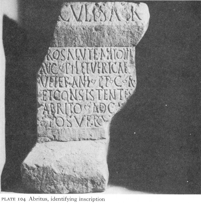
Plate 104 Abritus, identifying inscription
Marcianopolis must have provided recreation for troops from Durostorum and other stations on the Danube; the amphitheatre, probably built in the second half of the third century, was an appropriate attraction.
Besides the existence of an imperial munitions factory which probably obtained iron ore from state-owned mines in the Strandja and perhaps the Rhodopes, the industries of the city are unknown, although they must have been many.
Coins, inscriptions, and votive reliefs show the variety of gods worshipped by the inhabitants. Coins provide evidence of the erection of temples to Zeus, Serapis, Apollo, Cybele-Urania, and the imperial cults. Altars and reliefs add Dionysos, Asklepios, Hygieia, Telesphoros, Hermes, and the Thracian Horseman. In the same way as some of the pagan cults, Christianity arrived early from the East, probably from Bithynia, and Marcianopolis, too, had its martyrs.
III. ABRITUS
Archaeology began at Abritus, or Abrittus (Razgrad), in the 1880s, when a local school inspector in natural history, A. Yavashov,
![]()
157
helped by his friend the indefatigable Karel Škorpil, made preliminary soundings on the ‘Hissarluk’, a low hill outside the town. As early as 1887, only 8 years after Bulgaria became independent, he held an exhibition of finds in the local school. Forty years later, roadworks uncovered the north-west angle tower of a Roman fortress and he was still there to excavate and preserve it.
It is sad that Yavashov died unaware of the identity of ‘his’ city. Abritus was believed to be farther north-east until 1953, when a rescue dig unearthed a second-century altar with an inscription saying: Dedicated to Hercules for the health of Antoninus Pius and Lucius the veterans, Roman citizens and settlers in the canabae in Abritus have erected [an altar] (Pl. 104). Further confirmation came from other inscriptions and finds showing that Cohors II Lucensium was stationed at Abritus in the second century. A third-century inscription at Aquileia commemorates a centurion of Legio I Claudia born in the castellum of the ‘Abritani’ - another name used for Abritus.
Abritus is historically linked with the battle nearby in which Decius lost his life in 251. Pursuing the Goths on their way home from the sack of Philippopolis, he forced them to join battle. The tide flowed strongly in favour of the Romans until dusk, when Decius was misdirected into a swamp where he was thrown from his horse and engulfed. The consequent defeat of the Romans and the shameful terms accepted by their general, Trebonianus Gallus, suggest the probability that a mist of treachery as well as swamp surrounded the emperor’s death. Torrential summer storms are a feature of the local climate and fully capable of converting dry land into a morass. I have seen the Beli Lorn river flowing so strongly above a bridge here that even trucks were unable to cross it.
The sources which describe the other fortifications of this period make no mention of Abritus. Some defences may be assumed, but their nature and extent are still unknown. The excavated walls, enclosing about 10 hectares and built like those of Iatrus and Tropaeum Trajani, date to the end of the third or the early fourth century (Fig. 29). Situated on a low plateau, this fortress was basically rectangular with the east side curving where the ground falls steeply to the river Beli Lorn, which also bordered the north defences. Elsewhere a moat afforded additional protection. Preserved in places up to 2 metres high and 2.40 metres thick except at the towers and gates where they were stronger, the curtain walls were faced with smooth rectangular stone blocks, larger on the outside than the inside, as at Iatrus, and with a filling of stone, mortar, and brick rubble. In some sectors, opus mixtum was found with three or four courses of brick in each band. The city - having now outgrown its earlier status of castellum - had three gates and 31 projecting towers. Because of the steep slope and river, the east wall had no gate and only one tower. Fan-shaped angle towers defended each corner. The spacing of the 20 U-towers, each on a socle of carefully rusticated ashlar and extending about 10 metres from the curtain wall, varied according to the vulnerability of the sector. Thus the south wall needed the strongest defences. Between the west angle tower and the central gate were two pairs of U-towers on each side of a massive rectangular tower; inside this two masonry piers supported an upper storey, probably for a ballista, as at Tropaeum Trajani and Capidava in the Dobroudja and the even larger structure at Iatrus. East of the gate, in a re-entrant of the wall, came first a U-shaped, then another, rectangular tower.
![]()
158
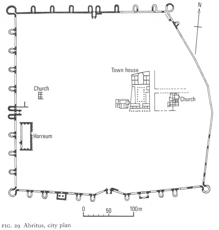
Fig. 29 Abritus, city plan
After this two more U-towers were separated by a stretch of uninterrupted curtain wall from the south-east angle tower. The walls are estimated to have been originally 10 metres high, crenellated and roofed with wooden beams and tiles.
The carefully constructed north gate, flanked by U-towers (Pl. 105; Fig. 30), had a portcullis and inner wing gates with an intervening propugnaculum, containing the probable remains of a decorative niche in one wall. The west gate, similar in plan, showed evidence of hasty building, for a stonemason’s stock of funerary stelai were used as well as normal blocks; ready carved, the spaces for the prospective purchasers’ inscriptions were blank. Unfinished stelai and some with inscriptions were also built into the socles of several towers.
The situation of the south gate in a re-entrant of the wall was not dictated by the terrain, its purpose was purely defensive. The flanking towers were at the beginning of the re-entrant, not integrated with the gate like those on the north and west sides.
![]()
159

Plate 105 Abritus, north gate
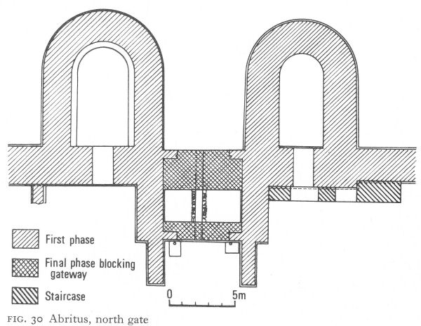
Fig. 30 Abritus, north gate
However, unlike the Iatrus gate, the propugnaculum and outer portcullis projected 5-60 metres beyond the curtain wall as well as inside it (Fig. 31). On a stone facing the propugnaculum the Greek letter alpha was carefully carved. There were similar stones in five towers. ‘A’ may have stood for Abritus; more likely it was a master mason’s mark, corresponding to the lizard or dog at Nicopolis. Clay water-pipes running below the floor of this gate and west of the south-east angle tower brought water from springs at Poroishte, about 5 kilometres away.
Two large buildings stood parallel to the walls on either side of the gravelled street inside the west gate. The southern one was a horreum, or granary, 56 metres long by 22 metres wide, contemporary with the gate and planned so that country carts delivering loads had no need to pass farther into the city.
The forum has not been excavated, but its whereabouts are clear from the position of the gates. East of it the town house of a leading citizen has been uncovered (Pl. 106; Fig. 32).
![]()
160
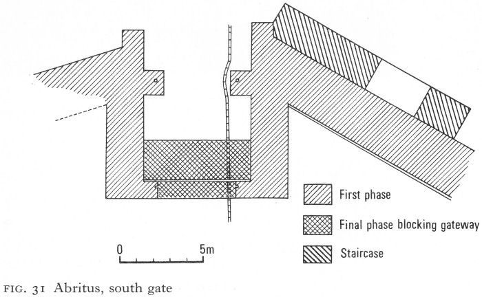
Fig. 31 Abritus, south gate
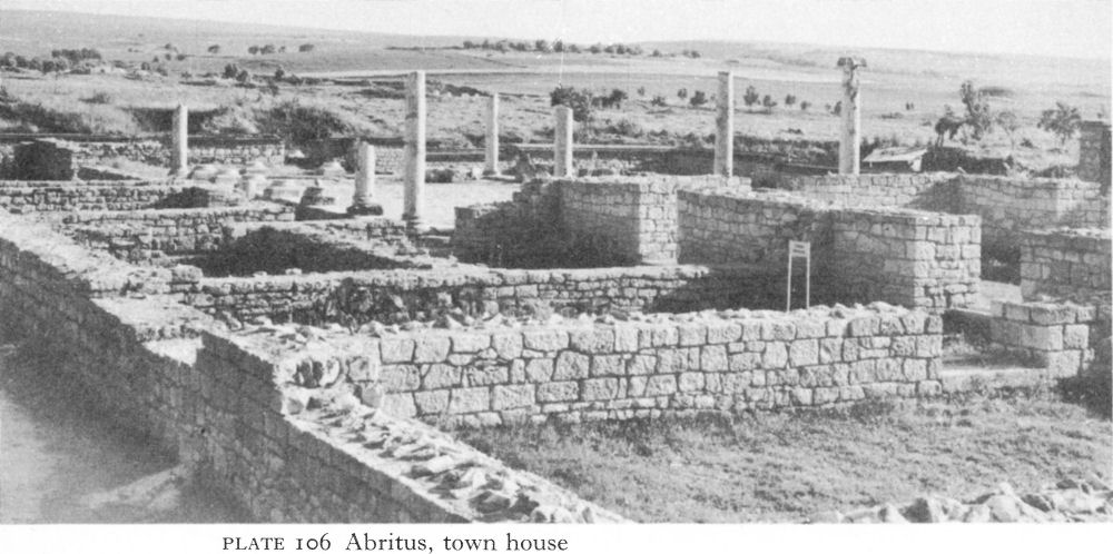
Plate 106 Abritus, town house
Its large rectangular paved courtyard was enclosed by a peristyle of re-used monolithic white marble columns with Ionic capitals, their total height, including the bases and stylobates, about 5 metres. A single long room on the west side was balanced by one large and one small on the east, separated by an entrance from a street. The southern and main entrance was through a string of shops, probably belonging to the establishment, behind the colonnade of the decumanus maximus.
![]()
161
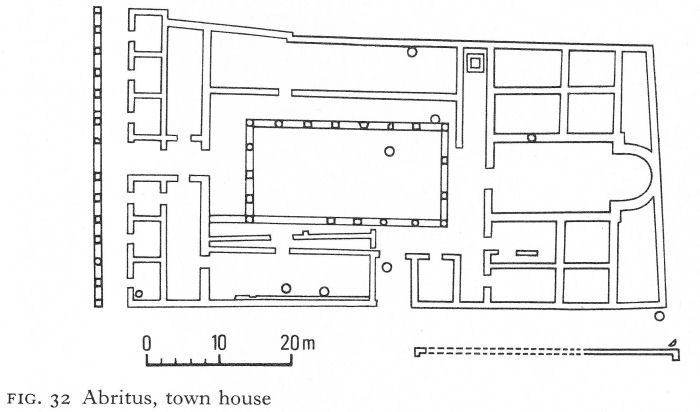
Fig. 32 Abritus, town house
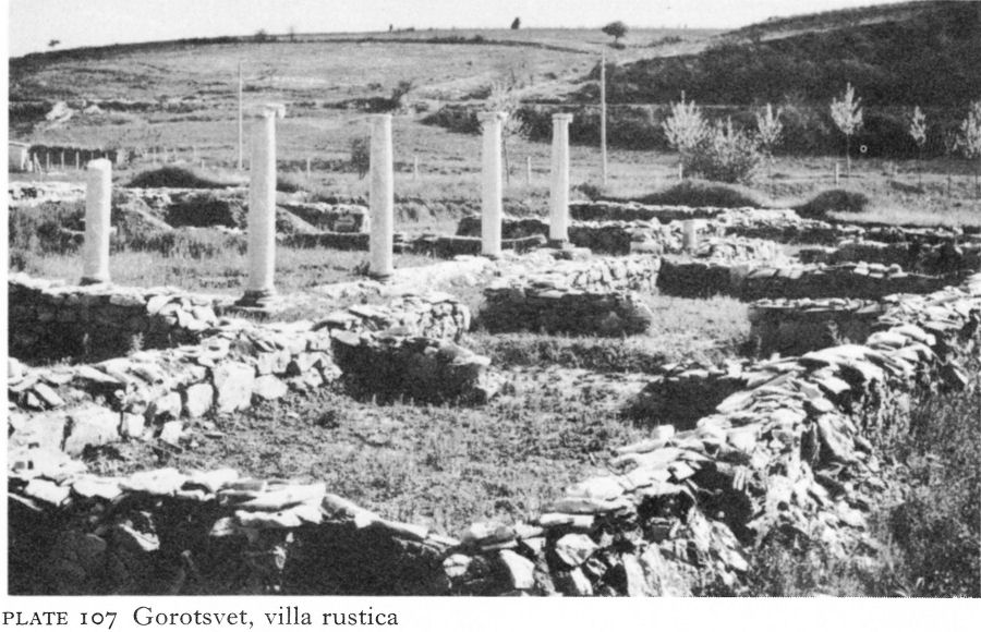
Plate 107 Gorotsvet, villa rustica
The private quarters were on the north,four rooms on either side of a big rectangular apsed hall, with traces of painting on the remains of the walls.
The town house belongs to the fourth-century revival of Abritus. Remains of second-century buildings were found beneath it and the Ionic columns and capitals come from this period. No evidence of enemy destruction was observed at the lower level, thus implying that these buildings did not suffer after the Gothic victory over Decius.
![]()
162
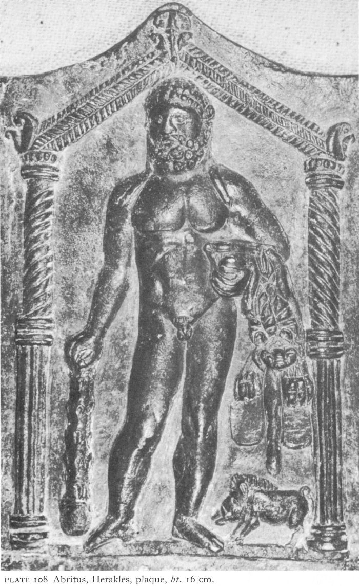
Plate 108 Abritus, Herakles, plaque, ht. 16 cm.
![]()
163
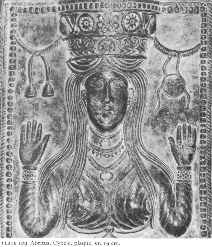
Plate 109 Abritus, Cybele, plaque, ht. 19 cm.
The prosperity of the region in the late second and early third centuries is illustrated by a recently discovered villa rustica at Gorotsvet, south-west of Razgrad. This spacious structure with living accommodation and work rooms has a smaller version of the Abritus Ionic peristyled courtyard (Pl. 107). This villa could hardly have escaped the fury of the Goths.
Graves have been found outside the Abritus walls in all directions. Yavashov pioneered their recording and the collection of contents for the museum. Although the unidentified Thracian settlement known from a Greek inscription re-used in the floor of an Abritus church [4] has not been found, large tumuli of the Roman period, some containing the cremated smaller bones of the dead in an urn, testify to the continued habitation of the neighbourhood by rich as well as poor Thracians.
![]()
164
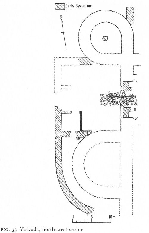
Fig. 33 Voivoda, north-west sector
Roman burials followed a normal pattern. A rescue operation in the southern cemetery has recently recorded several hundred poor interments of the second to the fourth centuries.
In 1921, labourers in a vineyard outside Razgrad dug up 26 bronze votive plaques, most of them portraying deities. Differing in size and shape, none measured more than 25 by 20 centimetres; most were rectangular, sometimes an aedicula with a gabled roof and columns framed the figure of a Greco-Roman or, more rarely, an oriental deity. Artemis and Herakles are thus shown on two plaques; another has Zeus and Hera side by side in individual aediculae (Pl. 108). Oriental cults are represented more variously.
![]()
165
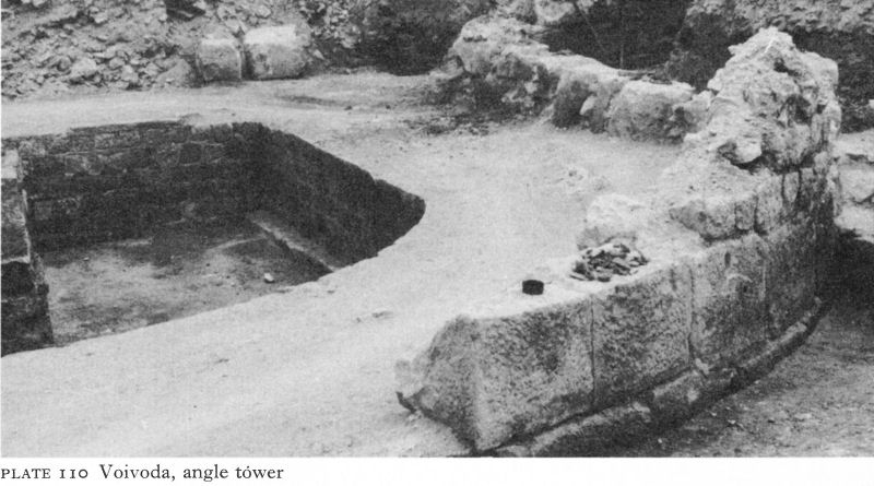
Plate 110 Voivoda, angle tower
In three cases the central figure is a horseman, Sabazios, carrying a horn of plenty and surrounded by other symbolic motifs. Seven depict a female-bust - Cybele-Anahita-Ishtar - with long hair falling over her shoulders and on her head an elaborate crown, a murus coronalis (Pl. 109). If forearms are shown, they are raised with outstretched palms in the pose which Christian iconography terms orans, or praying. A single example of the Eastern goddess Ma is shown in a manner to identify her with Roman Bellona.
Even when subjects are similar, iconographic variations are often considerable. The craftsmanship also varies, but the skill behind many, irrespective of subject, suggests a local workshop where, about the second century, plaques of very high quality or cheaper, clumsier types could be bought, according to the purchaser’s means and preferred cult. Such plaques were not uncommon at this time; in Bulgaria, clay versions were found at Montana (p. 116). G. Katsarov considered that the Razgrad find indicated a nearby sanctuary. [5] In the absence of excavation and in view of the variety of cults, it is also possible that the plaques formed a trader’s stock, although it is tempting to associate them with the unidentified Ara Decii (Altar of Decius), where the emperor made many sacrifices on the night before the fatal battle.
IV. VOIVODA
An important fortified centre, first reconnoitred by K. Škorpil some 70 years ago, lies near the village of Voivoda, 23 kilometres north-east of Shoumen and 10 kilometres north of Pliska, the first capital of the medieval Bulgarian state. About half-way between Marcianopolis and Abritus, the road from Marcianopolis probably forked either here or at Shoumen to Durostorum and to Sexaginta Prista. Soundings in the ruins, and coins of Aurelian, show that the settlement existed in the late third century, when - or in the early fourth - its walls were built.
New excavations show that Škorpil’s original rough plan, based on surface evidence, needs revision. The fort was an irregular pentagon, enclosing an area of about 10 hectares. Parts of the north and west curtain walls have been traced,
![]()
166

Plate 111 Madara, villa rustica
and excavations have uncovered a fan-shaped north-west angle tower, an external U-shaped tower in the west wall, and, between them, a gateway (Fig. 33). The angle tower was a massive structure, its diameter 13.60 metres and the thickness of its walls 3.05 metres. The socle carried an ashlar layer, above which were five rows of smaller, more roughly cut stones, surmounted by the remains of a brick bonding course. Smaller stone blocks with carefully dressed faces lined the inside; the fill consisted of broken stones and mortar with brick fragments. A square pier in the middle of the tower to support an upper storey is thought to be a slightly later addition (Pl. 110).
The neighbouring tower along the west wall was even more massive and was unusual in that, although U-shaped, its width was greater than its projection. The gateway between did not project outside the line of the walls and at the time of the preliminary publication the excavation of the inner part was not complete. The outer gate consisted of two pivoted wings and small vaulted side-chambers branched north and south from the propugnaculum. Although not the main gate, it showed signs of considerable use.
Part of the north wall has also been excavated, revealing a second side-gate and three towers, two said to be the largest of the Roman or Early Byzantine periods yet found in Bulgaria, a fact which stresses the strategic importance of the fortress. [6]
In one of these large towers was a hoard of tegulae, or flat roofing tiles, stamped dules. In all, over a thousand bricks and tiles bearing the names of Dules, Dionysos, and others, presumably their manufacturers, have been found in the excavations of the last few years. Besides a fortress, Voivoda seems to have been a major centre for brickmaking.
![]()
167

Fig. 34 Madara, pars urbana of villa rustica
V. MADARA
South of the road from Marcianopolis to Abritus the great cliffs of Madara shelter the ruins of a large villa rustica (Pl. 111) which, on the basis of fragmentary inscriptions, Ts. Dremtsizova suggests was imperial property. Certainly it controlled wealthy agricultural land and must have employed a large labour force. Built about the mid-second century on earlier foundations, the villa was sacked a century later, no doubt during the Gothic invasion. Rebuilt, it flourished
![]()
168
until about 376 when it fell victim to the Visigoths who, according to Ammianus Marcellinus, destroyed all the villae rusticae of the region. [7]
The pars urbana, or residence in which the interior arrangements corresponded to a town house, of the second-century villa was square, enclosed by walls about 40 metres long, with an inside promenade on the west and south (Fig. 34). A southern entrance led past two blocks of rooms into a peristyled courtyard, in its centre a shallow paved pool supplied with piped water from outside. The southern portico continued to a gate in the east wall. North of the courtyard, opening on to the portico, was the largest of the 40-odd rooms, probably the reception hall. The rooms on the west side appear to have been purely residential; some had hypocausts. Rebuilding to a different plan had largely effaced those in the north-east sector, but the presence of a furnace just outside the rebuilt area suggests the possibility of private baths. A large baths was also excavated east of the pars urbana.
The pars rustica, or farm buildings, lay in several groups north of the villa; these flimsier structures, often altered and rebuilt, are hard to date. Besides shelter for animals, there were barns for storing grain. A more substantial outbuilding only a few metres north of the villa served for wine-making. The wine presses have survived, and some dolia, large jars used for storage.
After the first sack, most of the villa seems to have been rebuilt on the original plan. The radical alteration of the north-east part has similarities in its plan to the early third-century extramural building at Oescus (Fig. 16). In both cases the purpose is unknown, although for sound reasons the excavators of both dismiss the possibility of baths. At Madara, a group of rooms including a furnace, between the east gate and the new building, are believed to have continued to function as baths during the second period. It seems possible that the triple-apsed building in the north-east corner may belong to a later phase of the first period rather than the second or post-Goth period.
During the second building period the villa and the building with the wine press and store were enclosed by rectangular walls between 60 and 65 metres long, with a southern gateway opposite the villa’s main entrance. This wall was later reinforced by internal square angle towers and buttresses. Another ominous portent was the apparent cessation of viticulture shown by the conversion of the large outbuilding into a granary. But none of these measures availed against the Visigothic fury.
NOTES
1. I am indebted to Professor T. Ivanov for the aerial view of Nicopolis (Pl. 94) which represents the plan of the city walls more accurately and in greater detail than the plan first published in IBAI V, 1928-29.
2. IGB II, 604.
3. Gerov, B., Romanizmut III, 115.
4. IGB II, 743.
5. Kazarow, G., Archdologischer Anzeiger (Jahrbachs des deutschen archaologischen Instituts), XXXVII, 1922, 186 ff.
6. NAC, Arh XIII/4, 1971, 76.
7. Amm. Marc. XXXI, 12, 4.
7 Serdica and the West (I)
I. SERDICA AND ITS TERRITORY
Originally a Thracian settlement named from the local Serdi tribe, Serdica (Sofia) became the centre of a strategia, an administrative district, of Thracia in a.d. 46. Sixty years later, its key situation as a communications centre as well as its economic potentialities received recognition from Trajan, who raised it to civic status, with his family name Ulpia as a prefix to its title. Urban development on Hellenistic lines as in the rest of Thracia was intensified under Hadrian and his successors. Doubly protected by the Danube limes and the Stara Planina, it seems that walls were not considered necessary; with the Dacian conquest danger from the north became even more remote.
The Costoboki shattered this illusion in 170. Crossing the Danube, sweeping through Moesia and Thracia and southward to Athens, they devastated the countryside and damaged several cities on their path, probably including Serdica. Marcus Aurelius’ decision to fortify the city was a direct result and his work was completed under Commodus.
The area enclosed by these walls was some 15 or 16 hectares, by no means the entire city. Oriented north-south, it was basically rectangular, but without the north-west corner, where the land was marshy. The north wall was slightly arc-shaped, perhaps to incorporate an existing bath complex or water-supply (Fig. 35). In the most fully excavated east sector, the wall crossed paved streets and foundations of buildings, others remaining outside. Frequently and extensively restored, the original curtain wall is thought to have been built of brick on an ashlar socle, rusticated on the outer side. It was 2.15 metres thick, except on the south, where it was at least 2.60 metres. Probably the wall was about 8 metres high; the round angle towers and the semicircular projecting ones which strengthened it at intervals were 2 metres or so higher (Fig. 36). The north and east gates have been excavated. By imaginative town planning, the City Council and the archaeological service have preserved the east gateway in its sixth-century aspect in a pedestrian underpass beneath the Boulevard Dondoukov (Pl. 165).
Evidence of burning about the mid-third century suggests some damage from the Gothic invasion, but recovery was rapid. By the fourth century the city had grown so much in size and importance - it had become the capital of the new province of Dacia Mediterranea - that the wall was extended. An area north of the original fortress and three to four times its size was enclosed, the old and new sections being linked in the vicinity of the old north gate, presenting the shape of an angular, top-heavy figure ‘8’. Those parts of the new wall which have been studied were ashlar with a filling of mortar and smaller river stones; it was 2.85 metres thick. A large octagonal tower projected from the north-west angle and a large round one from the north-east; others, both round and rectangular, projected at intervals along the straight stretches. About the same time, a fortified outpost or barbican seems to have been built outside the east gate.
169
![]()
![]()
170
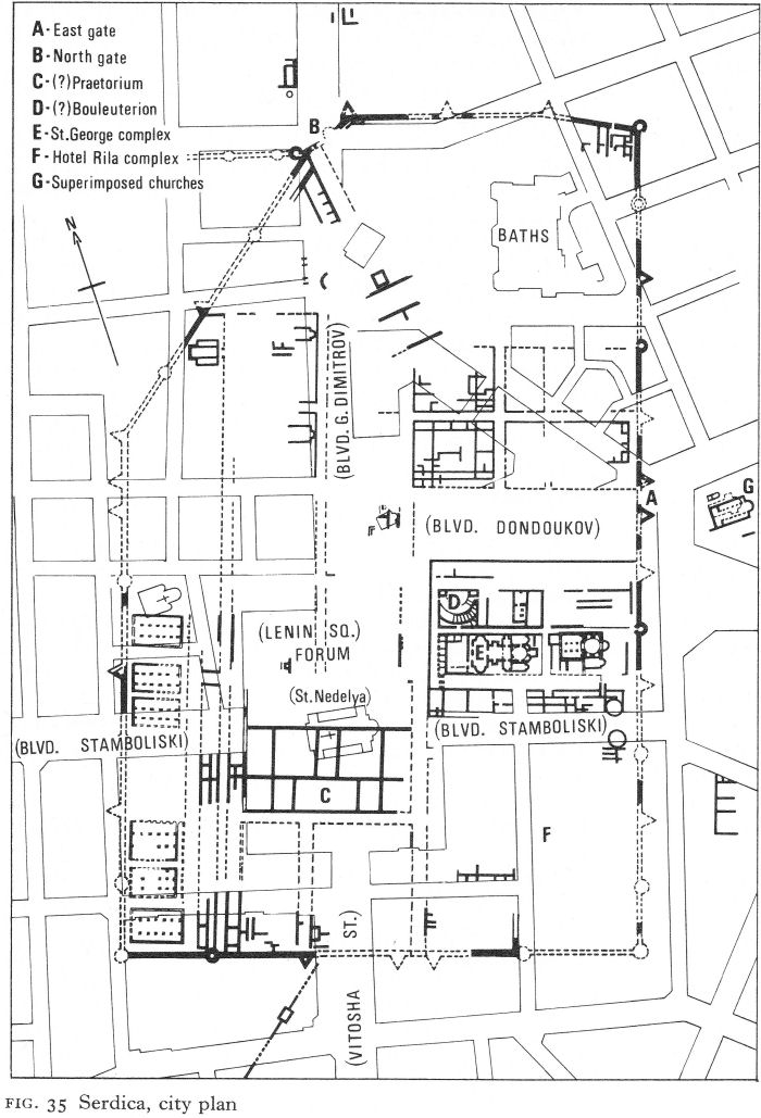
Fig. 35 Serdica, city plan
![]()
171
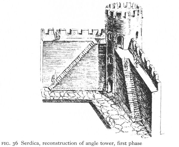
Fig. 36 Serdica, reconstruction of angle tower, first phase
The resemblance of the new walls to those of Abritus, Iatrus, and Dobroudjan fortresses suggests the expansion was due either to Galerius or, more probably, to Constantine, who for a time made his headquarters here and even considered it as a possible site for the new imperial capital. In 343 the city, poised almost on the boundary of the Eastern and Western halves of the empire, was chosen as the seat of a Church Council intended to heal the Arian breach, which had political as well as religious aspects. But the two sides could not even be brought to sit together and, although the Council’s canons were important for the Roman Church, it was ecumenically disastrous.
The Roman plan of the city has lasted with remarkably little change. Sofia has been superimposed on Serdica. The streets in the centre run parallel to and occasionally above those built by Rome. The forum, already subject to modifications in the Roman period, is now a little larger; it has been renamed Lenin Square but has not been moved. Instead of passing through the east gate to Philippopolis, the modern traveller drives over it to Plovdiv. But for the railway station, the Boulevard Georgi Dimitrov, passing above the original north gate, would still be the direct route to the Iskur gorge and the Danube. In such circumstances, chances for excavation have had to be taken as they came and only very gradually is a picture of Roman Serdica being pieced together.
From the centre of the new pedestrian underpass it is possible to walk through the east gate and for a short distance along the decumanus maximus. This street - the via principalis - originally 16 metres wide and probably colonnaded, continued north of the forum, possibly to another gate in the neighbourhood of Trapezitsa street. From the north gate, the cardo maximus, 12 metres wide, joined the via principalis at the forum.
Damage during the Second World War gave an opportunity for excavation in the eastern part of Serdica,
![]()
172
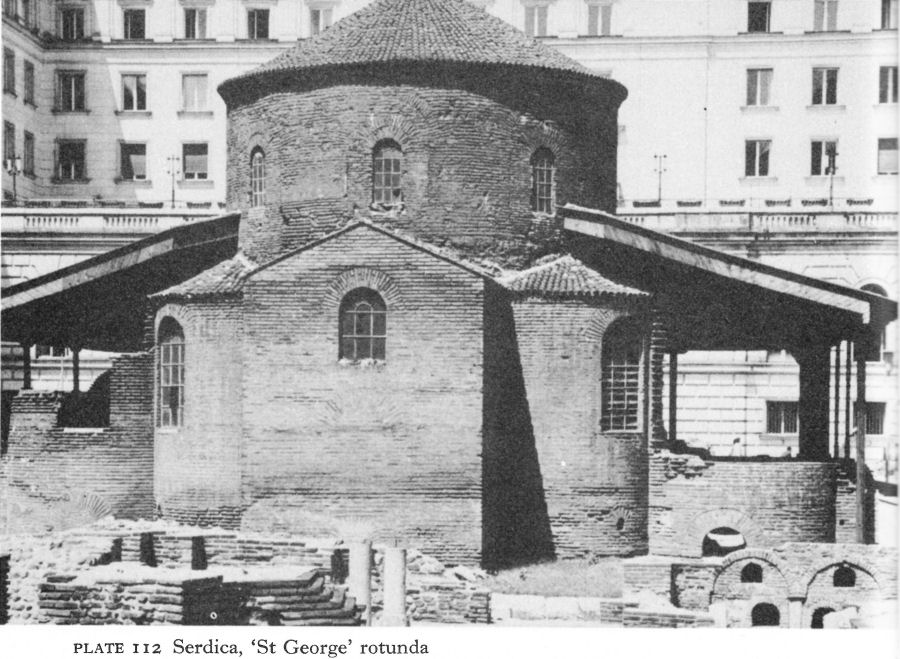
Plate 112 Serdica, ‘St George’ rotunda
both north of the via principalis near the TSUM department store and south of it in the area of the Hotel Balkan. Although the Roman street network changed very little, there were several building phases, not necessarily related to historical events or to developments in adjoining insulae.
The forum was 26 metres wide, but its length varied; there were changes in the third century at both ends, but only limited excavations have been possible. The east side was investigated during the construction of the Hotel Balkan and neighbouring buildings in the 1950s. This sector, presumably porticoed, now lies under the front rooms of the hotel and extends south to the Boulevard Stamboliski and north to TSUM. On the west side were found remains of a large and ornate two-storeyed building with a porticoed façade of the Severan period.
South of the forum, a large public building has been partially excavated as opportunity offered over the last 80 years. About 115 metres long from east to west and about 45 metres wide, it extended well beyond the west side of the forum. Today its remains lie partly under the church of St Nedelya and the south end of Lenin Square. The walls, 2 1/2 metres thick and built of broken stone with bonding layers of brick, incorporated vaulted corridors, reminiscent of the extramural building at Oescus; they were 2 metres high and 65 centimetres wide, with air vents at intervals of 6 and 4 metres. The plan, as known, could be that of a public baths and has similarities with the second-century one at Odessos (Fig. 53). Baths fed by natural springs existed in the north-east sector in the second century, but the growth of the city may have called for others, or for one more modern; it has not been possible to excavate the earlier. This large building is dated by S. Bobchev to the third century, a time of general expansion when reasons for erecting monumental edifices are not always logical.
![]()
173
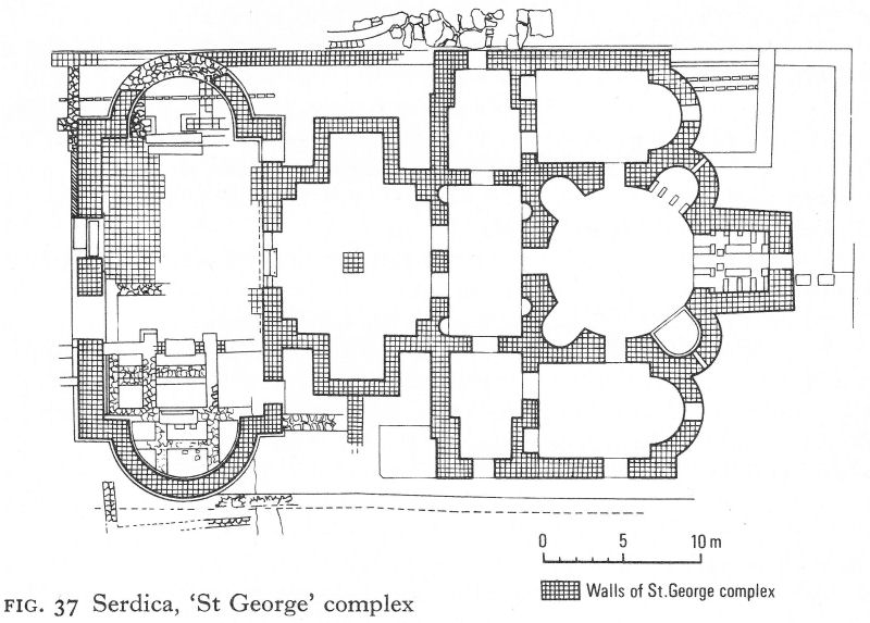
Fig. 37 Serdica, ‘St George’ complex
Nevertheless, conclusive evidence for baths is lacking, and, especially in view of its prominent situation, a more generally accepted theory is that this was the praetorium, or residence of the governor.
Between the forum and the east wall, the width of an insula south of the via principalis, four insulae occupied the greater part of what is now a large block with the Hotel Balkan at its western end. During the construction of the hotel the western sectors of the two insulae facing on to the forum were excavated and recorded. In the northern, the earliest remains discovered belonged to an almost square building, probably of the second century. This was rebuilt, it is thought in the second half of the third century, along similar lines, but either by the end of that century or early in the fourth a reconstruction included tiers of stone seats rising from a semicircular orchestra on its north side. On the basis of the earlier plan and the position on the forum, the excavators considered the building was the city bouleuterion, given an amphitheatrical ‘new look’ when Serdica became the capital of a province, rather than an odeon. [1]c7_1 In the absence of supporting epigraphic or other evidence, this theory cannot be regarded as proven.
Much of the southern insula was, as it still is, an open space containing Sofia’s oldest standing monument, the ‘church of St George’. The rescue excavations to its west, however, uncovered three building phases. The first seems to have consisted of shops fronting the forum and the streets leading to it. The second was a reconstruction of the first on a slightly different plan. The third was the construction of what is usually termed the St George complex, of which the present church was only the eastern part (Pl. 112).
The shopping precinct was replaced by an open courtyard, about 28 metres wide and 20 metres deep, which extended from the forum to the entrance of a new building.
![]()
174
Aligned on an east-west axis, this stretched back about 45 metres and was a maximum of 27 metres wide. First, double portals led through a large outer hall, apsed on the north and south, and down three steps into a narrower, inner hall with corresponding square apses. From here another double entrance opened into a rectangular tripartite antechamber with doors into the present rotunda and, through its side compartments, into two rectangular apsed chambers flanking the rotunda and opening into it. This last had a large square eastern apse and four U-shaped apses (Fig. 37).
Minor details apart, the plan of the complex is quite symmetrical, except for the outer hall. Not only is this out of alignment, but its floor was higher, although it lacked the hypocaust-like system of small brick piers beneath the floors in the rest of the building. [2] The natural assumption that it was a later addition is contradicted by the excavators who state categorically that they were unable to detect any structural joints in the parts that survived, and who found beneath its floor a coin of Valentinian I, emperor of the West from 364 to 375. [3]
The date and purpose of the building - which are interrelated - have long been the subject of controversy, still unresolved and accentuated by the fact that the complex with its courtyard has occupied this central position for over 1,500 years, so that, earlier buildings apart, it has had many later building phases and several excavations, archaeological and destructive. If the complex is accepted as a whole and dated after Valentinian I, it could have had a Christian purpose, but the overall plan resembles no known type of church or ancillary building, such as a baptistery, of the late fourth or early fifth century. It is now generally considered that, as suggested by P. Karasimeonov, the ‘hypocaust’ was a precaution against the excessive damp of this quarter rather than for heating, thus disposing of an earlier hypothesis of baths.
If the possibility that the coin was dropped during a repair to the floor of the outer hall is admitted, the early fourth century is the most likely date for the complex. This is favoured by other archaeologists concerned with the excavations, who suggest that it was built as a martyrium for the tomb or relics of an anonymous early saint. [4] However, the likelihood is small that Christianity would have achieved so prominent a site by this time, especially for a saint so undistinguished as to have remained quite unknown.
Less attention has been given to such possible purposes as a mausoleum or as a heroon or shrine to the pagan patron-protector of the city, who could later have been translated into St George, the national patron saint, sometimes associated in a healing context with the Thracian Horseman. A tradition of a ‘holy spring of the church’ was still alive in 1940, when excavations in progress were visited by a peasant from a remote village seeking a cure for his blindness. The workmen gave him water from the fountain supplied by the city mains, with which he returned home - to be cured, it must be hoped, by his faith. Yet neither of these possibilities adequately explains the architectural arrangement.
Only a building of exceptional importance would have possessed the open court linking it to the forum, and this court must itself have fulfilled some special function, probably of a ceremonial nature. It would be consonant with a purpose as yet ignored: that the whole complex was erected as an imperial reception hall of the Constantinian period. Space was available for the deployment of guards or attendants in the courtyard and for attendants and officials
![]()
175
in the side-rooms, while the emperor could have appeared from the square east room to greet envoys and other persons to be honoured in the rotunda. The two eastern apses in the rotunda contained pools, but originally these may have been fountains.
The tradition of such imperial reception halls is a long one, ranging from Nero’s Domus Aurea to the mid-sixth-century Chrysotriklinos in Constantinople. A recently excavated octagonal building belonging to the Tetrarchic palace in Thessalonica is likely to have served such a function and at the Constantinian villa at Mediana outside Naissus a smaller but basically similar structure has been uncovered.
South-east of the ‘St George’ complex, in the vicinity of the Hotel Rila, new excavations are revealing a large complex with a peristyled courtyard enclosed by rooms, including octagonal and circular chambers, some decorated with mosaic. Hypocausts and water-pipes of lead and tile have also been found. When published, this building, believed by the excavators to have been constructed as a residence for Constantine, should be a notable addition to knowledge of Roman Serdica.
North of the via principalis, the construction of TSUM in the 1950s uncovered architectural fragments of the second-third centuries suggesting the existence of a spring or fountain enclosed in a hexagonal structure in a courtyard. A pre-Roman cult of Apollo the Healer existed in the city and a coin of Serdica shows the god beside such a fountain. Outside the east gate, a life-size bronze head of Apollo, still retaining traces of gilding, was found during building work (Pl. 113). Ascribed to the second century, but after some earlier Greek model, this fine head may well have come from one of his shrines.
Another important early cult was that of Zeus-Jupiter identified with Serapis-Helios, and later transformed into the state cult of Capitoline Jupiter. A three-naved building of the late third or early fourth century in the north-west part of the city has been identified on architectural grounds as a Mithraeum, but no ritual objects remained in situ to provide clinching evidence.
What, in Roman eyes, was the lighter side of life in Serdica appears on a fragment of a slab showing circus scenes (Pl. 114). It is carved in low relief and was found among the ruins of the ‘praetorium’. [5] The presentation of the various incidents all together does not exclude their being separate ‘turns’ which could have taken place in an odeon. In the centre, on a garlanded platform, four men in dog-head masks act a scene with a performing animal. There are fights between bulls and bears, between a bear and a crocodile (possibly, it has been suggested, a wooden model) accompanied by an armed man, a bear attacking a man whose arms and hands appear protected. Elsewhere a bear is mauling a naked woman. On the extreme left, a tower is carved in lower relief. Two men clashing cymbals stand on the first storey; on the second Serapis, with sceptre and patera, is enthroned between two lions; on the third, an almost naked female, perhaps Aphrodite, may be holding a mirror and a comb. Except for the crocodile, the figures are skilfully depicted with gusto and savage realism. The portrayal of pagan gods dates this relief to the third or at latest fourth century.
Country estates grew up around Serdica, which offered a ready market for their industrial as well as agricultural products. Half a dozen villae rusticae have been identified in the environs of Sofia, although it is doubtful if any enjoyed the continuity found at Madara.
![]()
176
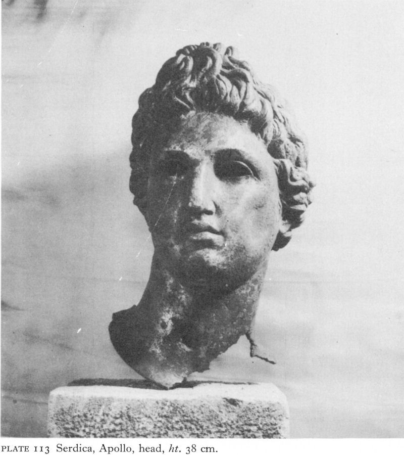
Plate 113 Serdica, Apollo, head, ht. 38 cm.
Perhaps one of the earliest was an L-shaped building enclosing a courtyard, open on the north and east, at Gara Iskur, not far from the Philippopolis road (Fig. 38). Construction was mostly of local stone and white mortar, but brick was also used. Little pilasters projected at regular intervals along the outer side of the south wing, perhaps to support some kind of portico.
The south wing probably contained the living quarters and the west the farm buildings. At the east end of the south wing a series of little rooms, some semicircular and all smoothly plastered, were probably baths, the two little rooms annexed to the north side serving perhaps for heating water and for cooking. No finds were reported, but the open plan suggests an early and peaceful date - and also an early end, perhaps during the third-century Gothic raids.
In the fertile territory of Serdica the inhabitants remained largely Thracian;
![]()
177
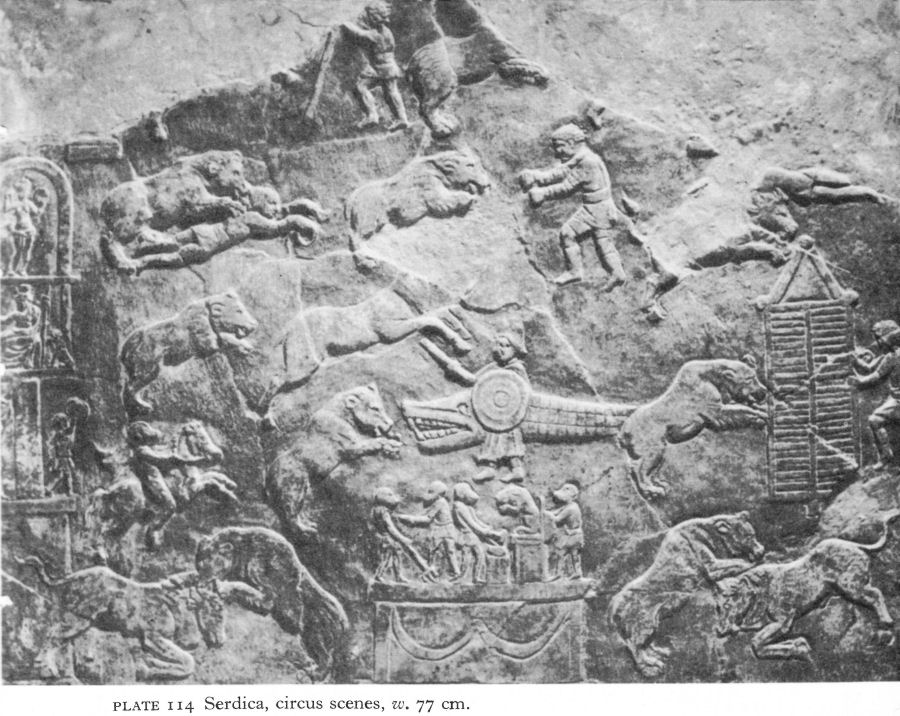
Plate 114 Serdica, circus scenes, w. 77 cm.
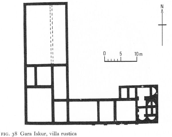
Fig. 38 Gara Iskur, villa rustica
![]()
178
there were many primitive sanctuaries to the Thracian Horseman; Zeus and Hera and Asklepios were also revered. According to the scanty archaeological information available, any new settlement in the Roman period was concentrated near the road stations along the main highways.
Travelling south-west along the ‘Diagonal’, on the present frontier with Yugoslavia, Balanstra (Kalotino) had an organisation of army veterans to defend the pass. The mansio, or overnight stop, of Meldia was identified at the end of the last century near Dragoman. On a hill north of Meldia were a sanctuary and cave dedicated to Sabazios; votive inscriptions were re-used in a church built on top of the shrine. On the eastern side of Serdica the settlement pattern continued, with a string of para-military settlements along the Ihtiman pass. Similarly the region of the Iskur gorge was dotted with road forts, later used for refuge during barbarian invasions.
II. PAUTALIA AND ITS TERRITORY
Pautalia
Pautalia (Kyustendil), probably formerly the chief settlement of the Dentheletai, stands at the western edge of the largest and most fertile ‘pole’ or upland plain of the upper Struma valley. The encircling mountains are rich in pasture and in silver, copper, and iron ores; remains of mining galleries have been found in the mountainsides, and there was gold in the hills and in the river sands. The Struma carves a southward route to eastern Macedonia and the Aegean. Westward, the road from Serdica continued over the easier mountain passes to Stobi and thence to Thessalonica or to the Adriatic.
The gods also blessed Pautalia with warm, healing springs. Their temperature
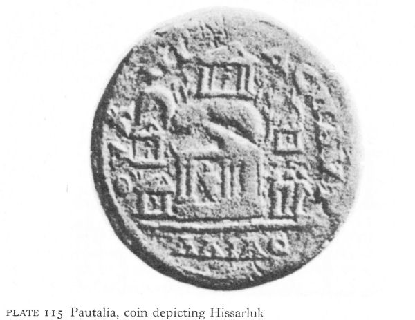
Plate 115 Pautalia, coin depicting Hissarluk
![]()
179
reached as high as 75° Centigrade and the aqueducts which have been traced may have been a main source of much-needed cold water. The grateful population built temples by the springs at the foot of the ‘Hissarluk’, a steep abutment of the Osogovska Planina rising acropolis-like behind the city. Coins issued under Caracalla show temples on its sides and summit (Pl. 115). Here, under a ruined church - in which a pagan altar was re-used, probably as a column-base - were the remains of a sanctuary which must have occupied the prominent position on the heights shown on the coins. Votive inscriptions to Greco-Roman gods were found nearby.
Coins minted in Pautalia from 139 to 217 and inscriptions of the late second and early third centuries using the prefix ‘Ulpia’ show it was one of Trajan’s foundations. One inscription of 135, [6] referring to a basilica built under Hadrian and probably the administrative centre of the town, has the earliest known mention of the name Pautalia. The city was organised on Hellenistic lines, Greek remained the administrative, commercial, and cultural language and Roman influence seems to have been generally less than in more strategically situated Serdica. Despite a Hellenistic influx from Macedonia and the south and, as the city grew in prosperity, to a lesser extent from Asia Minor, a (now lost) inscription of the second century [7] suggests that the administration was then virtually in Thracian hands, however much Hellenised or Romanised.
Another sign of Thracian continuity is the discovery of two buried chariots within the confines of modern Kyustendil. One is unpublished. The other, found in a specially dug trench, was a four-wheeled chariot with a suspended chassis, decorated with ornamental nails and other metalwork as well as bronze busts and statuettes of Greek mythological subjects. More unusual ornaments were five round harness plaques, flat but inset with concentric and sometimes chequered bands of yellow, green, red, and blue enamel. The small salvage dig that alone was possible prevented any search for the front of the chariot and possible horse skeletons, but the burial is thought to have been associated with a tumulus which, according to local knowledge, had existed some 50 metres away. The chariot was of a type dated to the Roman period and found in a number of places west and south of the Stara Planina. On the grounds of the clumsy expressionless bronzes, the chariot is attributed to the end of the second or beginning of the third century, by which time local industry would be sufficiently developed to produce such ornaments.
Like neighbouring Serdica, Pautalia is now a busy city where opportunities for excavation are limited. But work still in progress has shown that the city walls, although frequently repaired later, were likewise the work of Marcus Aurelius in the latter half of the second century. Parts of the early east, north, and west walls have been uncovered, including a rectangular tower, and the east gate excavated. Some paved streets have been traced inside the city.
Appropriately, the two buildings of the Roman period partially uncovered are baths, more or less contemporary and both oriented north-east to south-west. In one, discovered in 1962 during digging for a new water main, parts of six rooms were explored. A frigidarium, for the cold bath, on the north-east side had a floor in opus sectile, a pattern of variously shaped marble slabs. Less than half an octagonal room could be excavated. Apparently a tepidarium, a warm room, on its south-east side an apse-like niche, doubtless repeated on one or
![]()
180
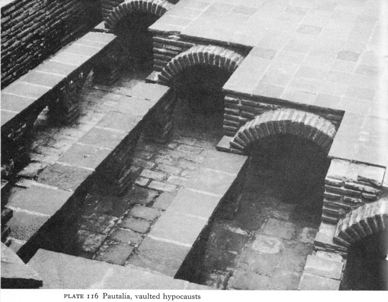
Plate 116 Pautalia, vaulted hypocausts
more of the other sides, accommodated a pool, thought to be for individual therapy.
The other baths excavated were a small sector of a monumental edifice, usually linked with the great Pautalian shrine, the Asklepieion. The fame of this was widespread. Votive inscriptions at the great Asklepieion of Epidauros included one dedicated to the Pautalian god. Again, little work was possible, but the five rooms partially conserved as an extension of the museum are on a much larger scale than those of the other baths. One room, probably occupying the eastern corner, was nearly 20 metres long and 11 1/2 metres wide. It had a thick floor of mortared stones and crushed brick to eliminate rising damp. In an adjoining room clay pipes were found with a combination of square and round brick pillae. In another, levelled summits of parallel rows of brick arches springing from low brick piers supported series of brick vaults aligned at right-angles to the openings below (Pl. 116). On these the suspensura, or floor, was laid. The reason for a vaulted hypocaust alongside the other type is not clear, but possibly hot water was used for heating here instead of air.
The opus mixtum construction of the walls consisted of uncut stones with bonding layers of four courses of brick, but miscellaneous fragmentary finds suggest a rich decoration, with marble floor and wall revetment slabs, fine Corinthian and other capitals, fluted pilasters, multicoloured mosaics, iridescent window-glass, and marble statues, now unidentifiable. Of a collective find of 61 silver coins on the floor of the room with both round and square hypocaust
![]()
181
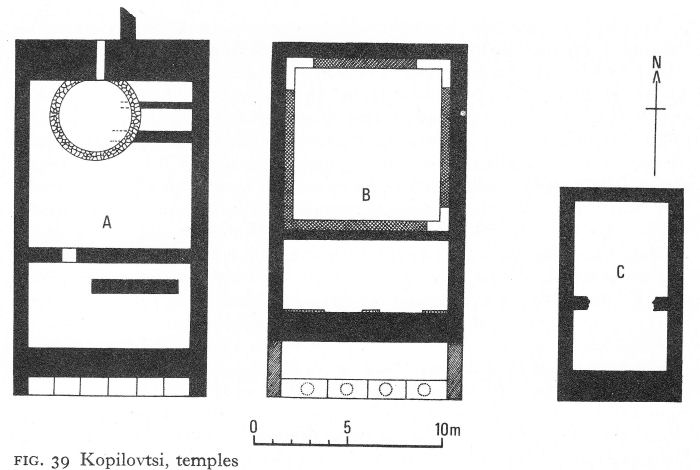
Fig. 39 Kopilovtsi, temples
piers, one of Antoninus Pius and 48 of Gordian III were identified. The dating of this and the other baths is not certain, but the coins of Gordian suggest the latter part of the third century, when Pautalia was a flourishing city in the new province of Dacia Mediterranea.
Aspects of the city’s cult of Asklepios, often in conjunction with Hygieia and Telesphoros, are manifold. A ritual marble egg has been found; this symbol also appeared on coins, with or without Asklepios, as did a serpent, coiled and sometimes haloed. A collection of iron knives from the general area of the Asklepieion may well have been used for sacrifices. Just over fifty years ago, I. Ivanov described a custom ‘observed until recently in Kyustendil’ of throwing knives into the hot springs after using them to sacrifice a cock. [8]
The religious orientation of the Pautalians was overwhelmingly GrecoRoman. Cybele and Serapis, for instance, appear only on single coins. Zeus and Hera came into prominence later than Asklepios perhaps, but inscriptions show that a college of 13 or 14 priests was probably dedicated to the service of Jupiter, Juno, and Minerva and to the imperial cult. Women participated in the priesthood; one inscription records the erection by a priestess of a statue to herself and another shows that a husband and wife were jointly engaged in priestly duties.
A sanctuary especially sacred to Zeus and Hera was established some 5 kilometres from Pautalia, near the present village of Kopilovtsi. This was an extension of the Pautalian religious complex and used by its citizens. The remains of three temples were found, side by side, 3 to 5 metres apart (Fig. 39). Each was subdivided, the northern, roughly square compartment being the larger. The southern end of the middle temple was porticoed and its north room was later ‘lined’ with an inner wall.
![]()
182
The temples were very thoroughly and deliberately destroyed. Of the architectural decoration, two massive plain granite capitals were found intact; otherwise only a small piece of a huge marble Corinthian capital and a few fragments of pillars remain. Heads of Zeus and Hera, their faces badly battered, and two hands, survive from two colossal statues. All around were broken votive tablets. Most depicted Zeus and Hera, but Dionysos, Herakles, Hermes, the triple Hekate, and the Thracian Horseman were also represented. Finely made needles and pins of bone, bronze, and silver, the ornamental lead frames of hand mirrors, clay lamps, and other objects, among them many iron knife blades and spearheads, were either offerings or otherwise connected with the rites. Coin finds, ranging from Claudius II to Arcadius, indicate the long life of the sanctuary and its especial popularity during most of the third and fourth centuries, even after the acceptance of Christianity, no doubt its ultimate destroyer.
The territory of Pautalia
The territory of Pautalia was extensive. Archaeology, although sporadic, has demonstrated the same general continuity and an even more marked absence of Romanisation than existed in the city, providing a strong contrast to the situation on and behind the Danube limes. Among the cults of the countryside the most popular was that of the Thracian Horseman, of whom many small local sanctuaries were found, often associated with Zeus, Hera, Asklepios, Athena, Dionysos, and other Greek gods. A single example of a Mithraeum occurs 15 kilometres from Pautalia at an unidentified emporium at Tavalichevo, where veterans had perhaps settled, and occasional Mithraic votive reliefs have been found.
Three early villas have been located. One at Kadin Most, excavated at the beginning of this century, at a crossing of the Struma 13 kilometres from Pautalia, was associated with other settlement buildings and a necropolis, of which ten mounds were excavated. One contained three brick vaults, dated by coins from the mid-first century a.d. to the mid-fourth. The excavations showed a long Thracian cultural continuity, including chariot burial, antedating the Roman period and continuing into the late fourth century, when the large villa was destroyed, probably by the Visigoths. Another villa at Kralev Dol, southeast of Pernik, has been dated by finds of large quantities of Roman pottery to the end of the second century. From a third, north of Pernik, at Meshtitsa, came a fine second-century bronze statuette of Athena.
The Roman presence was of course felt. Within the territory of Pautalia were the Krakra stronghold at Pernik, a road fort of growing importance on the highway to Serdica, and Germania (Sapareva Banya). The latter commanded a gap between the Vitosha and Rila mountains and thus the road linking the upper Struma valley with the Thracian plain; inscriptions show it to have been a vicus, or rural community, garrisoned by the auxiliary Cohors Lucensium at the end of the second century. The earliest walls, ascribed to the late third century, were carefully built of broken stone, rubble, and mortar and enclosed an area 180 metres long by 140 metres wide; today their maximum height is only 70 centimetres. The buildings inside the settlement were separated by a network of narrow passages with an unusual south-east-north-west orientation, presumably so that the houses, shaded in winter mornings by the Rila peaks, could enjoy the afternoon sun.
![]()
183
The site had (and still has) warm mineral springs, so naturally the healing gods were especially venerated; among chance finds of votive tablets, Asklepios, Hygieia and Telesphoros, the Three Nymphs, and the Thracian Horseman figure prominently.
On the southern edge of the territory was the village of Scaptopara (now a suburb of Blagoevgrad), famous for an inscription of a.d. 238 found in a vineyard outside the town in 1868 but since lost. [9] The long Greek inscription contains a plea to Gordian III from the inhabitants of Scaptopara, with a detailed description of their situation and difficulties.
The village had previously been happy and self-supporting, with enough land in the fertile Struma valley for cornfields, vineyards, and orchards and enough mountain pasture for grazing cattle. But two Roman miles away (at the modern village of Strumsko) were warm mineral springs associated with a cult and here an important fair had grown up which took place several times a year. The chief occasion was a 15-day event after the harvest, when cattle and agricultural produce were exchanged for manufactured goods brought by traders thought to have come from all over western Thrace and eastern Macedonia. Furthermore, Scaptopara lay between two unnamed Roman garrisons, one almost certainly Germania, the other unidentified.
The villagers were mainly free Thracians and included some army veterans. They paid a variety of heavy dues to the state and to distant Pautalia, including, for some, a land tax, and possibly also a sales tax. But their geographical position made intolerable a further obligation then commonly imposed: that of providing free board and lodging to civil servants, military personnel, and anyone visiting the area on a legal mission. The nearness of the two garrisons and the popularity of the fair and the springs meant that the peasants were so frequently compelled to give hospitality to all who found some pretext for being in this agreeable neighbourhood that, from being self-supporting, they were rapidly becoming destitute. Numbers had already abandoned their homes and lands. As Oliver Goldsmith, in The Deserted Village, wrote:
Ill fares the land, to hast’ning ills a prey,
Where wealth accumulates and men decay;
Princes and lords may flourish or may fade;
A breath can make them, as a breath has made;
But a bold peasantry, their country’s pride,
When once destroyed, can never be supplied.
In the case of Scaptopara, after complaints to Pautalia had proved unavailing, the remaining ‘bold peasantry’ addressed a petition to their emperor, threatening that they, too, would be forced to depart, an act which, they were careful to point out, would also mean a loss to the exchequer.
The fair was later concentrated in Blagoevgrad itself - the Turkish name of the town meaning ‘fair’ - and continued to be held until about the end of the nineteenth century.
III. SANDANSKI
Sandanski - its ancient name is disputed - controlled the southern opening
![]()
184
of the Struma gorge and was strategically and commercially the main city of the middle Struma region. Within the north-eastern boundary of Roman Macedonia it was uniquely placed for trade between the two provinces. Inscriptions demonstrate how much Sandanski’s prosperity depended on this function. The earliest, carved in Greek on a funerary tablet re-used as a paving stone in a church, is dated to 121 and commemorates one Marcus Herennius Rufus, a veteran and beneficiarius of Legio I Italica. [10] Herennius joined the legion on its formation in a.d. 67, when recruitment was confined to persons of Italic origin; the name appears in some other Macedonian inscriptions and B. Gerov suggests he may have come from Philippi. [11] By 69, the legion was established at Novae, in which neighbourhood Herennius must have spent the rest of his 25 years’ service. He then retired to Sandanski and, dying at the ripe age of 75, was survived by his Thracian wife, a freed slave.
The main event in Sandanski’s calendar was an annual three-day fair, attested by several inscriptions. Locally, cattle were raised on the rich hill pastures.
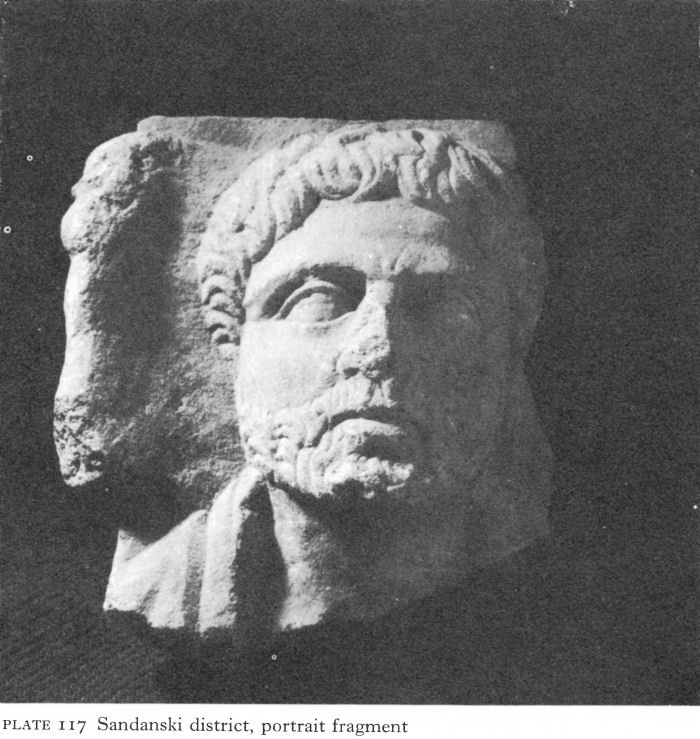
Plate 117 Sandanski district, portrait fragment
![]()
185
Silver probably came from the mines of Mount Pangaeus and was worked by craftsmen in Sandanski, who also used locally mined iron. Merchants from the north brought slaves; the importance of the Struma route for this traffic is endorsed by an inscription at Amphipolis. One wonders if during his army service Herennius built up a useful Danubian connection in the slave trade and thus provided for a comfortable retirement as well as finding a wife.
Sandanski’s wealthiest period was the century between the reigns of Antoninus Pius, who increased the status of the city, and Gordian III. The agora was built under Caracalla. Thereafter decline set in. Possibly the defeat of the Goths by Claudius temporarily flooded the slave market.
The outline of the Roman city is completely covered by modern Sandanski; so little of the walls has been uncovered that they can only be dated sometime between the second and fourth centuries. An inscription refers to a temple erected to the Tyche, or Fortune, of the city. The cult of Artemis-Bendis was widespread in the middle Struma valley - more popular even than that of the Thracian Horseman - but it is likely that shrines to both existed. There were at least two mineral baths and D. Dechev suggests that the annual fair, like that near Scaptopara, was related to the cult of the healing gods, Asklepios, Hygieia, and Telesphoros, a cult here subsequently transferred to the Christian doctors Cosmas and Damian, still patron saints of the main church. [12] Sandanski itself was formerly called ‘Sveti Vrach’, which in Bulgarian means ‘Holy Healer’.
The rural prosperity of the area in the Roman period is attested by large numbers of carved funerary monuments from the surrounding villages - relief portraits of the deceased with his or her family being the most common form of decoration. They are executed in varying degrees of rustic realism and only occasionally attain the dignity of this fine fragment from near Sandanski (Pl. 117).
IV. THE UPPER MESTA VALLEY
From the archaeological viewpoint, the western Rhodopes and the Pirin are an undeveloped region. In the Roman period, the area was mainly inhabited by survivors of the fiercely independent Bessi and other tribes. The remoter parts, so far as is known, seem scarcely touched by Roman influence or authority. That, except in the broader plains, the Romans chose to build their roads along the mountain ridges rather than in the narrow, densely forested valleys emphasises the tenuous nature of their control. Their main concern seems to have been the maintenance of strategic lines of communication, such as links between the Thracian plain and the Aegean. This must have necessitated chains of road forts, few of which have been located and none excavated.
The epithet ‘Ulpia’ shows that Nicopolis-ad-Nestum (the village of Zagrade, near Gotse Delchev) was another of Trajan’s foundations. Situated very near the river Mesta, the ancient Nestos, it controlled two highways. One came via Drama from the Via Egnatia and the Aegean coast and continued north; the other, coming from the Struma valley, crossed the Pirin range near the modern Greco-Bulgarian border and continued north-east to Philippopolis. The northern terminus of the Mesta road was probably met by another route, which crossed the Pirin from near Blagoevgrad and thence onwards to Philippopolis.
![]()
186
Nicopolis-ad-Nestum has still to be studied. Until recently the substantial ruins seen by many nineteenth-century travellers were a local quarry. Chance finds of votive tablets and inscriptions demonstrate the worship of Artemis, Zeus and Hera, Dionysos, and the Thracian Horseman, a general pattern not dissimilar from that of the middle Struma valley. In spite of the relative nearness of the Roman colony at Philippi, the surviving inscriptions, all in Greek, contain only one Roman name. It was the centre of an area rich in minerals, including gold, silver, and iron ore, and mining galleries of the Hellenistic period almost certainly continued in use.
That remoteness was not total isolation is shown by a hoard of silver coins - from Nerva to Decius - at Kochan in the upper Mesta valley. Its burial was no doubt due to the invasion of a Gothic group, a similar hoard being found at Velingrad. Nicopolis may have been damaged during these Gothic raids, being too remote for help to reach it in time. Certainly the road to Philippopolis was repaired under Constantine and again under Theodosius I. It grew in strategic importance as the insecurity of the Thracian plain increased.
NOTES
1. Ivanov, T. and Bobchev, S., Serdika 1, 1964, 17 ff.
2. Karasimeonov, P., GNM VII, 1942, 189 ff.
3. Ivanov and Bobchev, op. cit., 33 ff.
4. Venedikov, I. and Petrov, T., Serdika I, 1964, 77 ff.
5. Velkov, I., IBAI I, 1921-22, 20 ff.
6. IGB IV, 2057.
7. IGB IV, 2074.
8. Ivanov, I., IBAD VII, 1919-20, 73.
9. IGB IV, 2236.
10. IGB IV, 2270.
11. Gerov, B., Prouchvaniya, 51, n. 3.
12. Dechev, D., IBAI XIII, 1939, 190 ff.
8 The Thracian Plain (II)
I. PHILIPPOPOLIS AND ITS VICINITY
Philippopolis
When the Romans annexed Thracia, Philippopolis (Plovdiv) still occupied the site of Philip IPs chief centre in Thrace, the ridge of three closely grouped hills, Nebet-tepe, Djambaz-tepe, and Taksim-tepe, overlooking the river Maritsa. The Hellenistic walls surrounding it were repaired, for it was a ready-made strongpoint commanding one of the peninsula’s main road junctions. The Romans renamed it Trimontium, but Philippopolis remained, like the Greek language, in general use. A degree of autonomy was also retained and under Domitian the city began tpdssue coins.
One of the earliest finds from the Roman period is a 'head-mask’ from a mid-first-century Thracian tumulus (Pl. 118). Compared with the probably later helmet-masks from Durostorum (Pl. 88) and Chatalka (Pl. 139), this represents a different tradition. The face is of beaten silver and less idealised than the others. The rest of the head, worked to represent hair, not a helmet, is iron, with a silver laurel wreath.
Trajan’s promotion of a city-based economy in Thrace, vigorously pursued by his successors during the next 100 years, caused the city to grow in importance and to expand far beyond the immediate vicinity of the 'Trimontium’. But the Costoboki invasion of 170 sent tremors through the pax Romana and its attendant prosperity. A new wall enclosing a far greater area was constructed in the reign of Marcus Aurelius; a bilingual inscription [1], probably placed above the new east gate of the road to Hadrianopolis, commemorated it.
The line of this wall lies under buildings and streets, and has been hard to trace. D. Tsonchev first established the presence of a wall outside the original ‘Trimontium’ fortifications in the shape of an irregular polygon. East and south, the line was based on excavation; on the north-west it was largely hypothetical (Fig. 41). The short south-west stretch taking in the Sahat-tepe hill appears on a coin of Marcus Aurelius minted in Philippopolis and is further supported by the existence of a third- to fourth-century cemetery just outside. Examination of different sectors resulted in various datings, but apparent inconsistencies seem to have been resolved by the recent excavation of parts of a 250-metre stretch of undeniably second-century wall, similar to the north-east sector and the east gate, much farther south than Tsonchev’s line, which clearly represented a contraction of the city after the disastrous invasions of the fifth century. Accepting Tsonchev’s hypothetical north-west line, the walls of Marcus Aurelius comprised a circuit of almost kilometres, enclosing 78 or 79 hectares. This is about five times the contemporary fortified area of Serdica and impressive evidence of the city’s wealth and importance.
The foundations of the second-century south wall consisted of roughly shaped stones of medium size, mortared together, supporting a wall 2.10 metres thick. The outer face of a section 2 1/2 metres high had three rows of rusticated ashlar, up to 1 1/2 metres long, clamped together and laid as ‘headers’ at irregular intervals (Fig. 40).
187
![]()
![]()
188
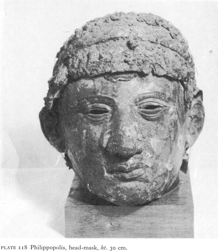
Plate 118 Philippopolis, head-mask, ht. 30 cm.
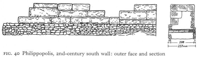
Fig. 40 Philippopolis, 2nd-century south wall: outer face and section
![]()
189
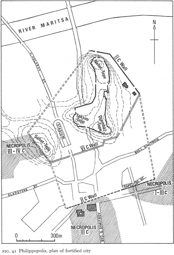
Fig. 41 Philippopolis, plan of fortified city
![]()
190
The inner face consisted of rows of smaller roughly cut stones; between was a rubble and mortar filling. No towers were found.
The fortification of Philippopolis by Marcus Aurelius may have been a precautionary measure and not due to Costoboki destruction. In any event, soon afterwards the city reached a peak of prosperity under Septimius Severus, who conferred on it the title of metropolis in 196 and revisited it in 202. A coin of the former date, showing Dionysos enthroned in an aedicula, suggests the erection of a temple to the god, an hypothesis supported by several votive plaques found to the south of the ‘Trimontium’. Caracalla was also specially honoured: Apollo was the city’s patron and there were Pythian games for this emperor’s visit in 214, when a special issue gave him the title of Alexander, thus equating him with the great conqueror. Four years later, a visit by Elagabalus, who awarded the city the honorific title of neokoros, or guardian of the imperial cult, was again the occasion for special games.
This prosperity was not to last. In a.d. 250, having failed before Novae and Nicopolis-ad-Istrum, the invading Goths crossed the Stara Planina, defeating on their way a Roman army led by Decius. After a siege, Philippopolis surrendered, probably through treachery from within, and for the first time the Goths obtained unrestricted possession of a wealthy city. The booty was immense; the victims, whether slaughtered or enslaved, were said to number a hundred thousand, no doubt an exaggeration but implying a substantial proportion of the inhabitants. Returning home, the Goths defeated and slew Decius outside Abritus (p. 157) and were then allowed to recross the Danube with their captives and other loot.
For some 15 years, although the pickings must have been small, Philippopolis lay open to raids. The last attack, in 267, was followed by repairs to the defences by Gallienus, commemorated in inscriptions as the city’s protector and benefactor. The second-century circuit of walls seems to have been retained. Economic recovery was gradual, but the chief city of Thracia could not be allowed to decay. Diocletian stayed in the city in 293 and 295. His administrative reorganisation made it the capital of the new diocese of Thracia as well as of the smaller province bearing the same name. In the first half of the fourth century it was well on the way to regaining its earlier importance and affluence. An historical illustration is the part played by Philippopolis in relation to the Council of Serdica in 343, at which time the city’s bishop, Euthymius, was an Arian. Here some 80 Eastern opponents of Athanasius met prior to the Council to organise their opposition, and again afterwards.
Some 20 years later, Philippopolis took an independent line and was a prominent supporter of Procopius, a kinsman of Julian, against Valens, refusing to admit the latter’s general into the city. Although, after the defeat of Procopius, Philippopolis was retaken, punished, and garrisoned with troops picked by Valens, this last measure probably helped to preserve it in the wars that followed - ironically so, since Procopius’ revolt had also been backed by the Visigoths and their heavy losses led on to the later struggle in which Valens was killed and so much of the land laid waste (Pl. 119).
Opportunities for excavation in Philippopolis have been minimal and only very recently has the forum been located. Inside the second-century walls, one important building was the stadium, built in the first half of the second century as part of the city’s extensive development under Hadrian to replace an earlier, more modest structure.
![]()
191
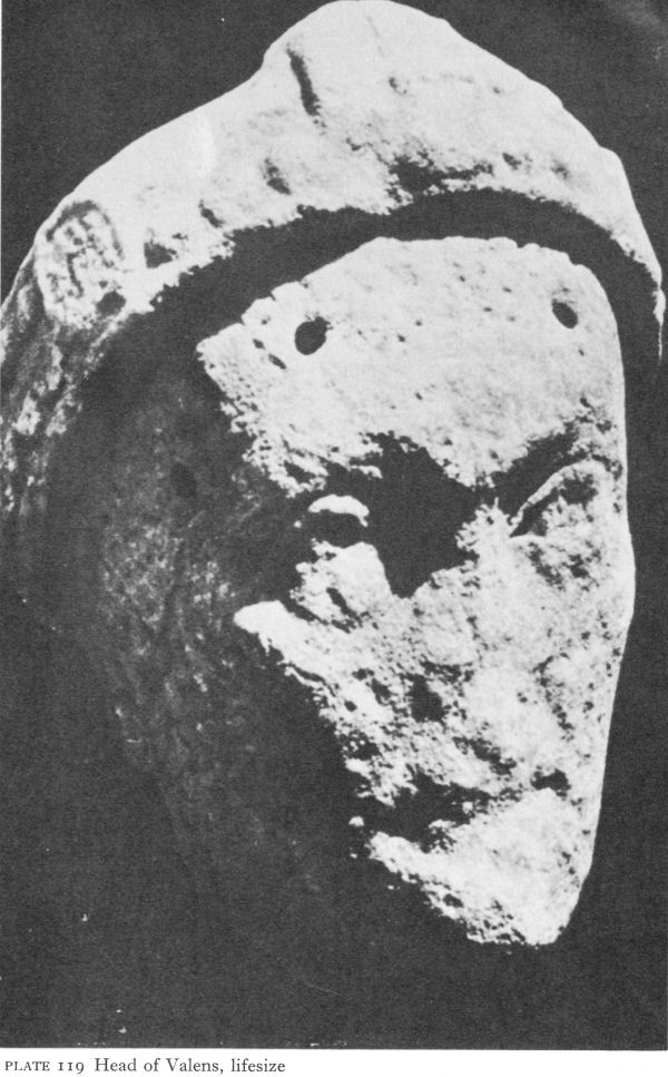
Plate 119 Head of Valens, life-size
![]()
192
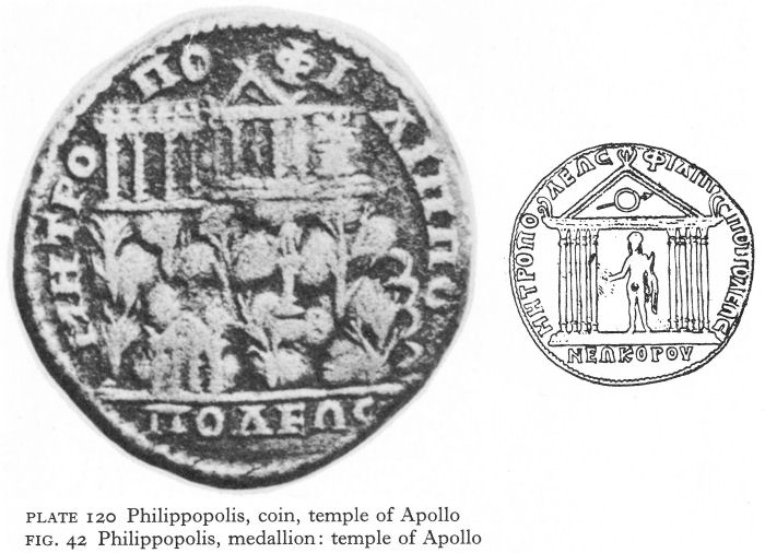
Plate 120 Philippopolis, coin, temple of Apollo
Fig. 42 Philippopolis, medallion: temple of Apollo
Measuring overall 250 by 70 metres, the site - now hidden under modern Plovdiv and roughly aligned with Vasil Kolarov street - was between Taksim-tepe and Sahat-tepe, enabling the slopes of both hills to be used for seating some 25,000 to 30,000 spectators. The entrance, at the southern end, was an ornate two-storeyed edifice with Corinthian marble columns, aediculae, and five arched doorways between piers with relief herms. Curved architraves carried the common Roman motifs of bucrania linked by garlands and interspersed with masks and rosettes.
South of the stadium remains of public baths have been partially excavated. The original second-century building was adorned with marble and with floor mosaics; it may have suffered in the mid-third-century sack, for a new and larger baths complex was built early in the fourth century, its floor level only 60 centimetres above the old one. Nine rooms at the second level were excavated. The plan followed the usual Roman pattern; the decoration was probably very rich, judging by the many shades and colours of glass tesserae from wall mosaics, as well as by the natural colours of the stone floor mosaics, laid in formal geometric and vegetal patterns. This second phase did not outlast the fourth century. Another baths, also with wall mosaic but mainly with marble revetment, was found near the foot of Djambaz-tepe. Its first phase was contemporary with the rebuilding of the baths near the stadium, but it was to survive for a much longer period.
On Djambaz-tepe, behind the Hellenistic gateway in the double wall linked by a narrow corridor (p. 83; Fig. 9), remains of a monumental and richly sculptured portico were found, dated to the latter part of the second century.
![]()
193
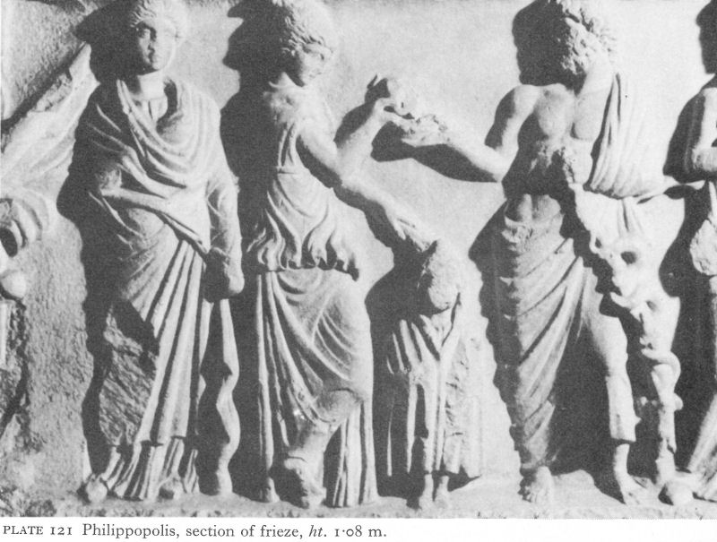
Plate 121 Philippopolis, section of frieze, ht. 1.08 m.
The stylobate of the outer colonnade bore columns with marble Corinthian capitals and a carved architrave. Behind this, another stylobate carried pilasters attached to an unexplored building with two entrances, the main one roughly corresponding to the axis of the vaulted corridor.
The city’s main temple of Apollo was outside the walls, on another of Philippopolis’ hills, Djendem-tepe. A coin of Caracalla shows its wooded slopes, a temple at the foot, half-way up a statue of Apollo standing naked on a column, holding a bow and a patera, and on the summit the temple. Beneath its pediment, between four columns, stood a similar statue of the god and at the side of the temple one of the Thracian Horseman stood on a pedestal. Another building with four columns was at a slightly lower level (Pl. 120). Medallions commemorating the visit of Elagabalus show both the temple and cult statue (Fig. 42) and the emperor and Apollo together holding the model of a temple - seemingly a different one - thus signifying the association of the Apollonian and imperial cults. A statue of Elagabalus was found in the ruins of the Djendem-tepe temple, which was destroyed under Christianity and replaced by a church.
The cult of Asklepios was only less widespread than that of Apollo, both being often identified with the Thracian Horseman. An Asklepieion is the probable origin of a marble frieze showing, in high relief, eight health deities. From left to right are laso, goddess of health - her name today the popular Greek word of greeting - Panacea, daughter of Asklepios, the small hooded Telesphoros, Asklepios with his serpent-entwined rod, Hygieia, Epione, wife of Asklepios, and, finally, his sons, Mahaon and Podaleirios, doctors to the Greeks in the Trojan war (Pl. 121). On stylistic and iconographic grounds the frieze is dated to the first half of the third century.
Worship of Zeus is also well attested but, judging from finds, Artemis-Bendis had a comparatively small following.
![]()
194
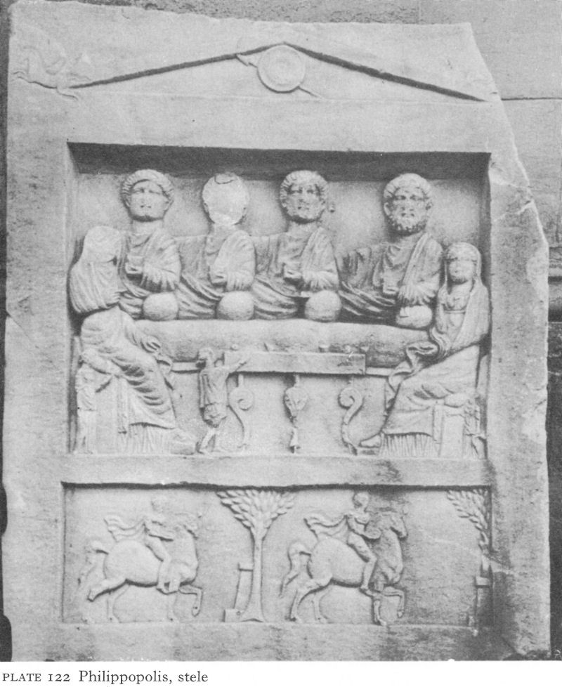
Plate 122 Philippopolis, stele
The Thracian Horseman represents the Hero himself as well as Apollo and Asklepios; a sanctuary to him was found on top of the great prehistoric tell of Yasa-tepe. A second-century stele, a chance find in Plovdiv, depicting a funerary feast in which the Roman spirit has effectively ousted the Greek, has a Pegasus in each of its stylised acroteria and two Horsemen in a lower zone (Pl. 122). In the early fourth century a painting of the funerary feast - again with six figures - was used to decorate a tomb outside the city’s southern wall.
The streets and houses of Roman Philippopolis are almost unknown, but south of the city wall, a rescue dig in 1960 uncovered parts of one north-south and three east-west streets with drains under the irregularly shaped flagstones.
![]()
195
Six rooms of a large house on the widest street were excavated (in the area now the garden restaurant of the Hotel Trimontium). In spite of massive stone foundations over 2 metres deep, possibly part of some earlier, more solid structure, the building was relatively flimsy, with a wooden framework containing lath and plaster or mud bricks. In another house was a peristyled courtyard with wooden columns on stone bases. Coin finds date this extramural quarter from the late first century to half-way through the third, when it was destroyed by the Goths.
The residential district of Philippopolis stretched some way beyond Marcus Aurelius’ walls into the flat land between the city’s outlying hills. Only to the north was the land useless, due to the marshes and flood waters of the Maritsa. Beyond the suburbs, south-west, south, and south-east, were the three main Roman necropolises, the earliest graves found being to the south, near the road to Kuklen, where one of the city aqueducts began. Many tombs, usually brickbuilt but sometimes ashlar joined with iron cramps, are dated by coins to the reigns of Antoninus Pius and Marcus Aurelius. Towards the end of the Antonine period tiles began to be used to cover the inhumation burials.
Although there are written indications that Hellenised or Romanised Thracians continued to play a part in the life of the city, archaeological evidence is lacking, except in the cults and in the tumuli. North of the Maritsa, the neighbourhood of the domed fourth-century Hellenistic tomb (p. 81) continued in use as a Thracian necropolis in the early Roman period. Two tumuli with incineration burials have been dated to the second or early third century a.d. Thracian tumuli of the Roman period were also found in the old south necropolis on the Kuklen road.
The Gothic sack no doubt included wholesale tomb robbery, for which there was ample time before the city fell. At the same time the suburbs outside the walls, including the one partly excavated, were razed. Depopulation and shock left neither immediate need nor resources for rebuilding. The ruins, within easy reach of the walls, became an obvious place to bury the dead. For about a century after the sack the main areas in use appear to have been just outside the south wall and on the western slopes of Sahat-tepe.
Peroushtitsa and Kurtovo Konare
In the fertile countryside, the larger settlements were generally either road stations, sometimes also serving as emporia, or Thracian villages mainly subsisting on agriculture. Except for fragments of defence walls many times rebuilt, the chief remains are often of sanctuaries, more solidly constructed than the houses and even after destruction more likely to leave recognisable traces of their original purpose.
Peroushtitsa, 15 kilometres south-west of Philippopolis, was evidently a wealthy and Hellenised site of the first category. A life-size polished marble head of a young man, dated to the first half of the third century, is one of the finer examples found in the Thracian plain (Pl. 123). A hole drilled in the hair above the forehead is for the attachment of a chaplet. Near the ruins of the ‘Red Church’ is a great spring, and close by were found votive tablets to the Thracian Horseman, Cybele, Hera, the Dioskouri, and the Greek gods. There were also marble statuettes of Asklepios, Hygieia, and Telesphoros and fragments of statues. The evidence here suggests a rich community and an appropriately elaborate sanctuary.
![]()
196
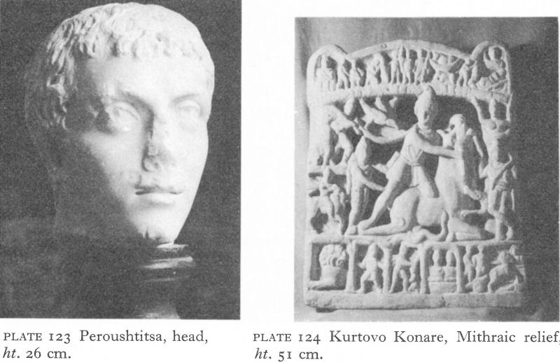
Plate 123 Peroushtitsa, head, ht. 26 cm.
Plate 124 Kurtovo Konare, Mithraic relief, ht. 51 cm.
The general prosperity of the neighbourhood is endorsed by the find at Kurtovo Konare, some 6 kilometres distant, of an intricately carved marble Mithraic relief (Pl. 124), perhaps set up by a Bessi veteran.
Burdapa and Batkoun
The excavation of two shrines farther up the Maritsa proved especially rewarding. The first, on the left bank of the river near the village of Ognyanovo (formerly Saladinovo), some 30 kilometres from Plovdiv and 10 kilometres from Pazardjik, is identified by inscriptions as the nymphaeum of the vicus of Burdapa and dated to the second-third century. Excavated in 1896, two parallel walls about 6 metres long were found, no doubt the long walls of the usual rectangular structure. There was no architectural decoration, but V. Dobrusky found 95 small votive relief tablets depicting the Three Nymphs; there were also a few fragments dedicated to the Thracian Horseman and one inscription suggesting an identification with Bendis-Artemis. Many little clay lamps and toilet articles were also found. The few coins were mainly from local mints of the third century.
The nymphaea which are known to have been associated with springs and the baths of cities in Bulgaria have not yet been fully studied. Thus the cult of the Nymphs, here widespread, is chiefly known through small votive tablets. Invariably a trio, the Nymphs are sometimes associated with other deities, and are carved from local stone with varying skill. Often they appear by themselves, generally in three iconographical versions. In one, standing side by side, each is decorously dressed in a long chiton. In another, the three are quite naked, except possibly for a headdress; the central Nymph, her arms embracing her companions - although a hand reaches towards a round object held by one - presents her back, although twisting her head to look over her shoulder. The third Nymph usually holds a mirror in her hand. Water gushes from two urns in the lower corners (Pl. 125).
![]()
197
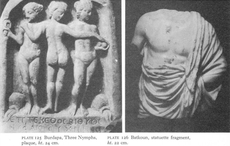
Plate 125 Burdapa, Three Nymphs, ht. 24 cm.
Plate 126 Batkoun, statuette fragment, plaque, ht. 22 cm.
In the third and least common version, the Nymphs, naked and presented frontally, perform a spirited dance, whirling scarves over their heads. All three types are represented at Burdapa.
The other sanctuary, some 15 kilometres farther west by a spring near the village of Batkoun, was a secondto fourth-century Asklepieion, with nearly 200 Greek and few Latin inscriptions, chiefly on altars and relief tablets of Asklepios - shown alone or with Hygieia and Telesphoros - and sometimes identified with the Thracian Horseman, Statues, statuettes, and tablets without inscriptions numbered over 100. In contrast to many local reliefs, the marble torso of a statuette (Pl. 126) assigned to the second century may well have been imported; the splendid plasticity of the folds of the himation emphasises the smooth body and makes full use of the fine marble. A small head of Asklepios is ascribed to the following century. Carved in a coarser-grained marble, this may be local work, although the masterly combination of dignified repose in the features with the animation in the slightly concave pupils of the eyes shows a master’s hand. Whilst Burdapa is purely local and Thracian, Batkoun reflects a wider world.
II. HISSAR
Hissar, 40 kilometres north of Plovdiv, possesses the best-preserved Early Byzantine walls in Bulgaria, yet strangely little is known of its early history. In the Roman period it seems primarily to have been a health resort for the wealthier inhabitants of Philippopolis, but although the mineral springs which have made the present town a leading Bulgarian spa were used in the Hellenistic period, there is no archaeological evidence to connect it with the nearby princely necropolis of Douvanli. No identifying inscriptions have been found, and the historical sources offer a choice of possibilities - Augustae, Sevastopolis, and Diocletianopolis.
![]()
198
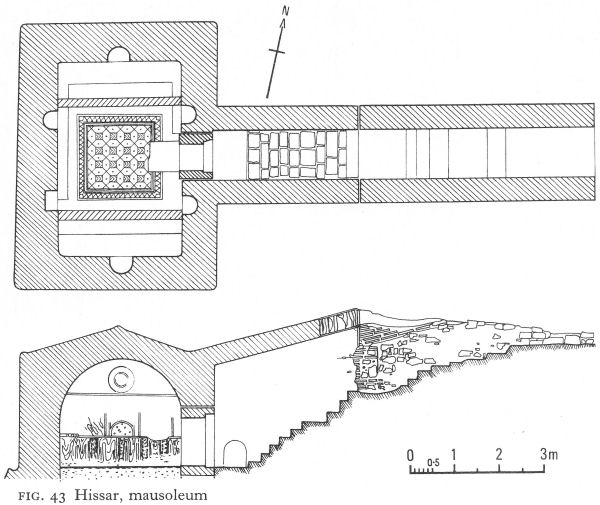
Fig. 43 Hissar, mausoleum
There is considerable evidence to support the last, but this still leaves the earlier name unknown and it is generally called by the Turkish and Bulgarian name of Hissar, meaning fortress.
There has been little excavation of the first phase of the city walls, which seem to have provided the foundations for those visible today. They enclosed a roughly quadrilateral area of about 30 hectares, protected on the east, west, and south by streams, their banks steep and beds quite wide. Only on the north was access easy; this was defended, perhaps from an early period, by a double wall, and by a ditch which also enclosed the east and part of the south walls (Fig. 86). The earlier gates and towers that have been located were often at approximately the same sites as the later ones, the towers being square and projecting externally from the walls. Opinions differ whether these walls were built about the end of the second century, destroyed by the Goths who sacked Philippopolis in 250, and rebuilt with some modifications towards the end of the century - or whether they were built soon after the Goths had demonstrated the vulnerability of a hitherto peaceful area. Pending fuller excavation, the later date for the original construction seems more probable and would also accord with the name of Diocletianopolis. There is general agreement that the walls were badly damaged by the Visigoths in the third quarter of the fourth century.
Excavation of two baths, one in the western half of the walled city, the other
![]()
199
beyond the east wall in the locality known as Momina Banya, has also been limited since both are in use today. A Turkish establishment covers part of the former, but excavation in the 1930s suggests there was a complex on customary Roman lines, including two large stepped pools and two small ones, apparently for individual treatment. The complex occupied an area about 45 metres long and 35 metres wide. The opus mixtum construction, revetted with marble, was dated to the second half of the fourth century. Water was piped from a spring outside the west gate, but in the hot mineral springs above which the baths were built and which heated its rooms, coins were found ranging from Philip II of Macedon to Valens. Visigothic destruction is thus probable; some clumsy repairs were impossible to date. Fourteen votive tablets to the Three Nymphs were built into the wall of a nymphaeum - and chance finds elsewhere in the town testify to the cult of Asklepios, Hygieia, and Telesphoros.
There has been even less opportunity to examine the Roman remains at the Momina Banya. They are thought to have been similar to, although rather smaller than, those inside the walls. A building inscription of about 303 mentioning the Tetrarchy probably refers to the baths, but its exact provenance is unknown.
More evidence of fourth-century prosperity comes from the cemeteries lining the roads outside the walls. Of five identified, none has been systematically excavated, but the largest stretched for about half a kilometre from the south gate. The earliest graves here are ascribed to the third century, but the majority date from the fourth to the sixth. Several brick-vaulted family tombs have been found, but the most interesting is a fourth-century mausoleum about 300 metres south-west of the town. The tomb was entirely underground. There was no trace of a mound. A now partly destroyed dromos, probably originally brickvaulted, led to a staircase descending to a rectangular vaulted chamber with six niches in the walls and two funerary beds (Fig. 43). Remains of wall painting, including stylised rosettes, are still visible; on one bed is a painted imitation of drapery. The floor of this chamber is paved with a mosaic in two shades of red, black, and white; it has a regular geometric linear pattern enclosed by a wide border, the whole strongly reminiscent of a kilim, or non-pile type of rug woven in many parts of the Balkan peninsula as well as the East. The beds are oriented east-west, but the grave was throughly looted centuries ago and it is impossible to say whether it was pagan or Christian.
Hissar is remarkable among Roman towns in Bulgaria in possessing, according to present archaeological evidence - and no other exists - a first real flowering in the fourth century.
III. BEROE - AUGUSTA TRAJANA AND ITS VICINITY
Beroe-Augusta Trajana
East of Philippopolis, at the foot of the Sredna Gora in the north of the Thracian plain, Augusta Trajana (Stara Zagora) replaced Thraco-Hellenistic Beroe. The two sites were so close that both names were used for the Roman city until, in late Antiquity, Augusta Trajana dropped out of use. The new city administered a wide area, extending over the northern slopes of the Stara Planina and south to the east Rhodope foothills. Doubtless Trajan considered it wise for Philippopolis,
![]()
200
with its long traditions of autonomy and power, not to enjoy unrivalled supremacy in the Thracian plain.
The virtual destruction of Stara Zagora in the liberation war of 1877-78 uncovered parts of the city wall, originally constructed under Marcus Aurelius in his fortification programme for Thracia. More was found when a theatre was built in 1911 and a plan of the Roman city established which later research has augmented but not substantially changed. Irregular in shape, the walls enclosed an area of 48.5 hectares, thus inferior in size to Philippopolis and Marcianopolis, but much larger than, for instance, Serdica or Nicopolis-ad-Istrum.
The transfer of Nicopolis-ad-Istrum from Thracia to Moesia by Septimius Severus diminished the influence and ultimate prosperity of Beroe-Augusta Trajana, but in the contemporary atmosphere of economic expansion, the immediate impact was probably small. Coins struck in the city between the reigns of Marcus Aurelius and Gallienus circulated all over Thracia and Moesia Inferior until the mid-third-century Gothic invasions. Under Diocletian’s administrative reforms, all territory north of the Stara Planina, including the emporium of Discoduratera (p. 151), became part of Moesia Secunda. This territorial loss was partly offset by the increasing importance of the city’s site which, however, increased its liability to attacks and, together with the administrative changes, may largely account for the unusual lack of expansion beyond the early walls. Probably another reason was that Beroe-Augusta Trajana owed its wealth more to its vast and fertile territory in the Thracian plain than to any industrial, military, or political prominence; so far as the last is concerned, it was chosen as Pope Liberius’ place of exile when, in 355, he refused to excommunicate Athanasius. But, while flimsy ephemeral dwellings must have existed in the early years for those whose status did not permit them to live inside, no permanent expansion was apparently needed for craft, commercial, or other quarters. Instead there seems only to have been an outdoor market for country produce south-west of the walls, where a large paved area was found with a big drainage channel under it but no trace of any superstructure. The scene here must have been very much like the daily or weekly markets of today. Apart from this, in the course of time, cemeteries, not suburbs, bordered the walls, extending in no particular date order towards a ring of Thracian settlements 3 or 4 kilometres away.
The second-century wall was 2.60 metres thick and faced with regular rows of small tufa blocks. Bastions, 1.60 metres square, projected internally at 8-metre intervals. Later, probably during the mid-third-century Gothic danger, the spaces between the bastions were filled in, making the walls 4.20 metres thick. The city did not suffer the fate of Philippopolis, although the territory was devastated and Decius, unexpectedly attacked nearby in 250, was obliged to flee with the survivors of his army to Oescus.
A projecting square tower constructionally linked to the curtain wall was found on the south side in 1911; its sides measured 6-30 metres. A similar one was found 50 metres away in 1950 and two others since. The south gate has been excavated; the site dates from the building of the first wall, but the present structure to the Early Byzantine period.
Despite its irregular shape, the city plan followed the usual grid pattern, which remained unchanged from the second to the sixth centuries.
![]()
201
The later streets were laid on the earlier ones and made use of the original water-supply. Most of the drainage channels had to be hollowed laboriously out of the rock on which Augusta Trajana was built and had their exits through vaulted openings in the curtain wall. The water came from springs north of the city and, apparently dispensing with any central storage point, reached the citizens’ individual clay pipes from the street mains simply by force of gravity.
The earliest streets were carefully paved with large, irregularly shaped flagstones. The cardo maximus had a pavement of long narrow slabs on either side, as did another street, 6.20 metres wide, which may have been the decumanus maximus. Chances to excavate buildings have been limited. Decorative reliefs suggesting a theatre and stylistically dated to the time of Hadrian have been found, but not its site. One street cuts through the remains of a huge unidentified building dating to about the end of the second or early third century. Sculptural fragments include oval marble columns and a large frieze of oak leaves in high relief. Some glass mosaic tesserae were also found.
A rescue operation is gradually uncovering another monumental building covering some 7,000 square metres. The south rooms so far explored have brick hypocausts and this complex, dated by the excavators to the reign of Commodus, may well be the city baths. An amphitheatrical construction, stone paved and with stone benches, backing on to the south wing of the building, is also being excavated. [2] Of the temple to Zeus-Sabazios, restored on the occasion of Septimius Severus’ visit in 202, no trace has been found except the first lines of a commemorative inscription. [3] A Latin inscription from below the present market hall is likewise the only evidence for the construction of an Augustaeum in 223 by legionary veterans.
The Constantinian period, when a statue of the emperor was erected, was one of prosperity. A large, probably residential building (excavated during the construction of the opera house) at the corner of the cardo maximus and the probable decumanus maximus was built in the first half of the fourth century, although later substantially reconstructed (Fig. 98). To the first phase are attributed the outer walls, surviving up to a height of 1 1/2 metres, built of opus mixtum with bonding courses of five layers of bricks, and a fine floor mosaic, carefully laid on a mortared rubble base in an almost square room with sides of about 9 1/2 metres. The tiny tesserae of marble and other stones, tile, and glass, were white, black, grey, yellow, red, blue, brown, and green in a wide variety of shades. Although somewhat damaged by later rubbish pits, the composition is reasonably clear. Lour zones surrounded a central field or emblema, the first three were purely geometric, the last had octagons with a corded border and a white ground containing different animals, a hare, deer, dog, and so on. The central field was unequally divided into a narrower section with vines enclosing deer and ducks facing a large hydria, and an almost square section in which was a brick-paved octagon. Triangular areas outside the octagon were filled with fishes, ducks, and nereids, and an almost totally destroyed Greek inscription. Opposite the probable main entrance was another mosaic inscription of which only ‘Καλος’ is left. In an adjoining room the remains of a stove and a hand-mill suggest that the room with the mosaic floor could have been the dining room; the central octagon no doubt contained a pool or fountain. Excavation of the street at the same level produced coins from Alexander Severus to Constantine.
![]()
202
This town house, like the one at Abritus, probably bordered the not yet identified forum and was an official residence, damaged but not destroyed in the fourth-century Visigothic raids.
Starazagorski Mineralni Bani
Besides the baths in the city, yet to be firmly identified, there were others in the rural surroundings of Starazagorski Mineralni Bani some 15 kilometres to the west, where warm mineral springs emerge in a deep cleft of the Sredna Gora’s southern slopes (Pl. 127). The baths used today were built in the eighteenth century by the Turks with many of the Roman materials, but the healing attributes of water in the locality have not been confined to the springs. D. Tsonchev writes that a double trough, probably a Thracian or Roman winepress, hollowed in the rock of the hill above the baths was locally known as late as the 1930s as ‘the Virgin’s Trough’ and, when filled with rainwater, was visited by sick peasants seeking a miraculous cure.
Only a brief note and a plan of the Roman baths have been published. The complex consisted of 12 rooms covering an area of 2,500 square metres (Fig. 44). According to the building inscription published by D. Nikolov [4] (Fig. 45), the baths and adjoining nymphaeum (not yet excavated) were erected about 163 in honour of the Nymphs and for the citizens of Augusta Trajana at the personal expense of Ulpius Hieronymus. Born in Bithynian Nicomedia, he may have been one of the immigrants encouraged by Hadrian to promote the urbanisation of Thracia.
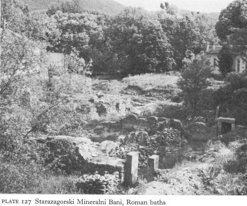
Plate 127 Starazagorski Mineralni Bani, Roman baths
![]()
203
By the reign of Marcus Aurelius he had made a fortune, achieved the rank of chief priest, and married; his wife, also a Roman citizen, is described as a priestess. It seems clear that the baths and nymphaeum were built for her to preside over and thus achieve promotion, an example of marital co-operation in professional life capable of various interpretations.
The springs were so hot that no artificial heating system was needed. The chief supply point, built above the main spring, was a square vaulted underground shaft, the vaults supported by small brick piers; pipes brought cold water from outside. The decoration (much of it mentioned in the inscription) included marble revetment, floor mosaics, statues, and reliefs.
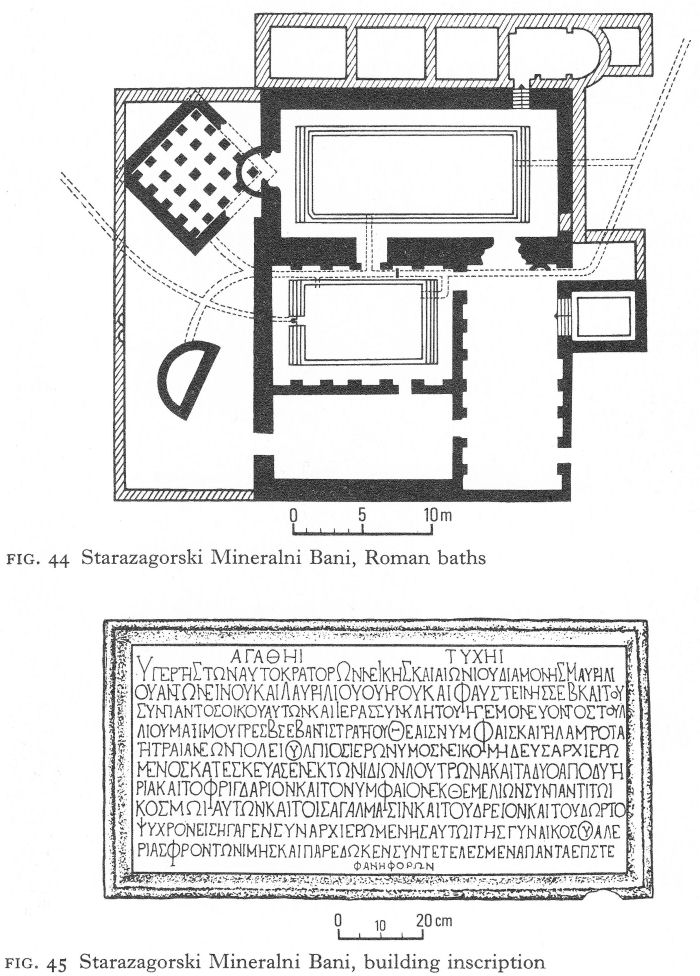
Fig. 44 Starazagorski Mineralni Bani, Roman baths
Fig. 45 Starazagorski Mineralni Bani, building inscription
![]()
204
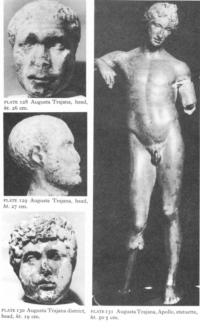
Plate 128 Augusta Trajana, head, ht. 26 cm.
Plate 129 Augusta Trajana, head, ht. 27 cm.
Plate 130 Augusta Trajana district, head, ht. 19 cm.
Plate 131 Augusta Trajana, Apollo, statuette, ht. 50-5 cm.
![]()
205
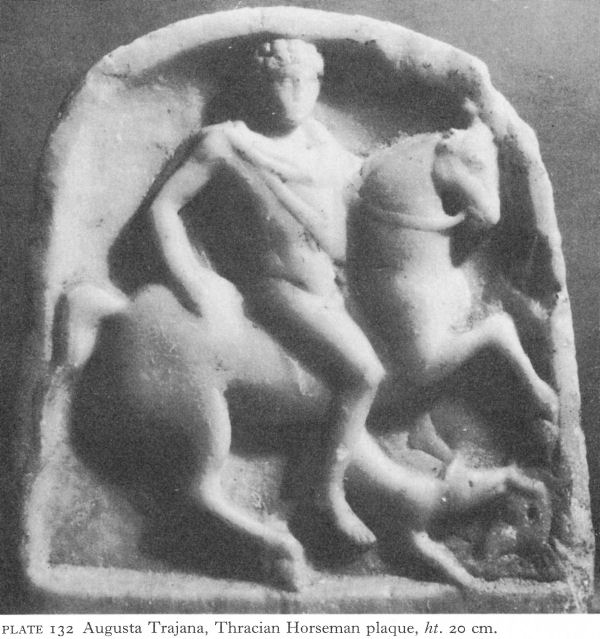
Plate 132 Augusta Trajana, Thracian Horseman plaque, ht. 20 cm.
Reconstruction was necessary from time to time. A fragment of a dedicatory inscription to Alexander Severus was re-used in the Early Byzantine period. But coins and other finds suggest that, with brief interruptions, the baths remained in use for a thousand years.
The construction of fine public baths so far from the city suggests not only stability but affluence. Although this has not yet been demonstrated architecturally within the walls, it is reflected in sculptural finds. The portrait heads from life-size marble statues (Pls. 128-30), a bronze statuette of Apollo (Pl. 131), and a marble relief of the Thracian Horseman (Pl. 132) illustrate both the standard of art and the population blend in this Hellenised Roman city of Thracia.
Arzus and Pizus
Urban wealth was balanced in the countryside by rich Thracian estates.
![]()
206
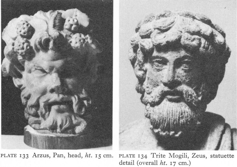
Plate 133 Arzus, Pan, head, ht. 15 cm.
Plate 134 Trite Mogili, Zeus, statuette detail (overall ht. 17 cm.)
Finds in the city cemeteries are no richer than those from rural tumuli built by those who, no doubt also possessing town houses, drew their wealth chiefly from agriculture, gloriously symbolised by a head of Pan (Pl. 133) found in the ruins of Arzus (near Kalugerovo) in the south. Arzus was a station on the ‘Diagonal’; 12 Roman miles west along the road lay the emporium of Pizus (near Dimitrievo), made famous by a long inscription which not only records its foundation - in 202 - by Septimius Severus but sets out in detail the conditions in which the new market was established. [5] The names of each of the 171 chosen settlers and the nine villages from which they were drawn were listed. The terms of reference of the local administration, its relationship with the officials of Beroe-Augusta Trajana, and the emporium’s special privileges, particularly its immunities concerning the supply of corn and draught animals and exemptions from military charges and exactions, were all carefully drawn up and inscribed on a stone tablet which good fortune has preserved. The potential prosperity of Pizus makes an interesting contrast with the plight described in the petition of Scaptopara.
Trite Mogili, Mogilovo, and Krun
Chariot burials provide more archaeological evidence of Thracian rural wealth. At Trite Mogili, about 4 kilometres north-east of Stara Zagora, the necropolis of an unexplored settlement from which came a fine bronze statuette of Zeus (Pl. 134) contains three large tumuli, about 200 metres apart, which gave the modern village its name. In 1960, between two of the mounds, the skeletons of ten horses, together with five chariots broken into pieces, were discovered in a trench io| metres long by 5 metres wide and less than 2 metres deep. In spite of their damaged condition, some idea was gained of the original form of the chariots.
![]()
207
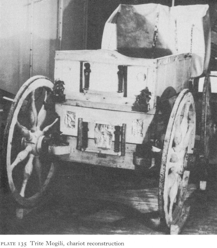
Plate 135 Trite Mogili, chariot reconstruction
One was two-wheeled, presumably for sport or war. The others were four-wheeled, one at least of the simple cart type still sometimes used in rural areas. The metal parts of a four-wheeled travelling chariot were found in situ and a reconstruction was attempted (Pl. 135). Both the box of the cart and its seats had been elaborately decorated with bronze statuettes and silver reliefs of a variety of Greco-Roman deities and mythological scenes, probably local work. Yokes and harness were also much adorned and, in all, over a hundred bronze objects were found. This chariot must have been the ‘state coach’ of its owner. The trench contained many bronze and copper vessels, strigils, and a double-edged, Sarmatian-type sword, objects normally placed near the remains of the dead, instead of 60 metres from the base of the nearest known tumulus. The horses’ skeletons were of the same size and general type as those of today and aged between three and seven years.
![]()
208
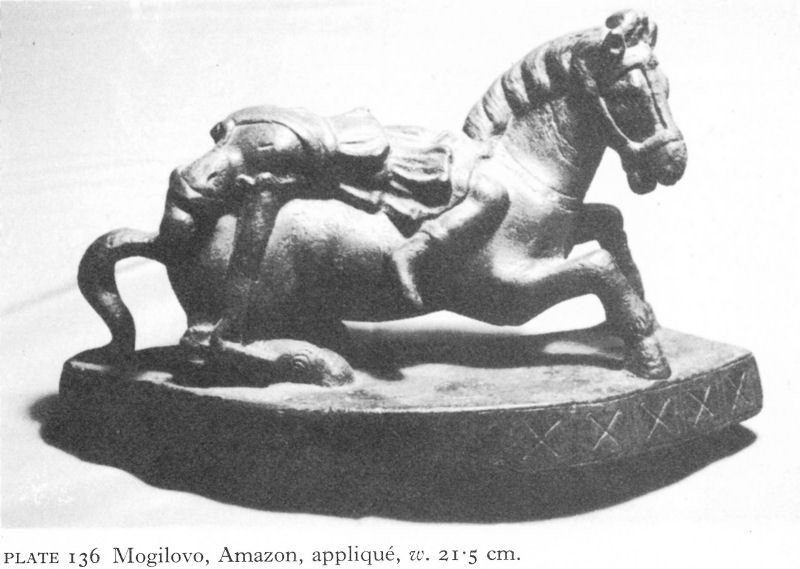
Plate 136 Mogilovo, Amazon, appliqué, w. 21-5 cm.
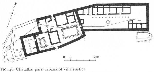
Fig. 46 Chatalka, pars urbana of villa rustica
The finds have been only briefly published, but the chariots are dated on stylistic grounds, especially of the metal finds, to the latter half of the second century.
Similarly dated are some much finer bronze ornaments from the remains of another, less well-preserved chariot, found at Mogilovo, south-west of the city. These include a striking statuette of an Amazon, no doubt Hippolyta, dying on horseback, probably an imported copy of a statue, and a well-executed bust of Herakles or rather, it is thought, of Commodus with Heraklean traits (Pl. 136).
North of Beroe - Augusta Trajana and of the Thracian plain, inscriptions indicate that the mid-second-century defences included such key points as the main pass over the Stara Planina, the Shipka (Pl. 2).
![]()
209
A little way south of the Shipka road station about 70 fragments of statues and reliefs were found in a walnut grove near the village of Krun - the remains of a sanctuary to the Thracian Horseman and Apollo which was patronised by the garrison as well as the peasantry during the second half of the second century and the beginning of the third. Its monuments had been as systematically destroyed as those at Kopilovtsi, outside Pautalia.
IV. CHATALKA
The villa rustica at Chatalka, 18 kilometres south-west of Stara Zagora, was the estate of a wealthy Thracian. Although the extent of the property is unknown, judging by the various groups of buildings it was quite large and included the sheltered valleys of two streams, the Mogilovska and the Chatalka, descending from the Sredna Gora. The gentle slopes were probably as fertile then as now, covered with vineyards, orchards, and vegetable gardens but destined to be submerged by a hydro-electric project when the extensive salvage dig still in progress has been completed.
The pars urbana, covering an area of 4,500 square metres, occupied the two upper terraces of a small plateau 30 metres above the confluence of the two streams, their steep, almost vertical banks providing natural defences (Fig. 46). The proprietor’s living quarters occupied the western sector of the complex, which was enclosed by a 2-metre-thick wall, faced with ashlar, with a rubble and mortar filling. Besides posterns in the north and south walls, a larger gate, wide enough for carts, in a re-entrant at the north-west corner led into a small yard with a little guard lodge.
The accommodation in this sector was divided into two wings, each with its own courtyard containing an ashlar-lined impluvium, or pool. The smaller, western courtyard had a peristyle with a stylobate and the remains of six limestone Doric columns (Pl. 137). In a large room beyond were remains of stairs to an upper storey; it has been suggested that these were the women’s quarters. Another large room on the opposite side of the courtyard might have been the kitchen, serving both wings. East of it was the second and larger courtyard, constructed like the first but with columns only on the north, perhaps forming a portico in front of the main rooms, which were faced with well-cut, rusticated limestone blocks (Pl. 138).
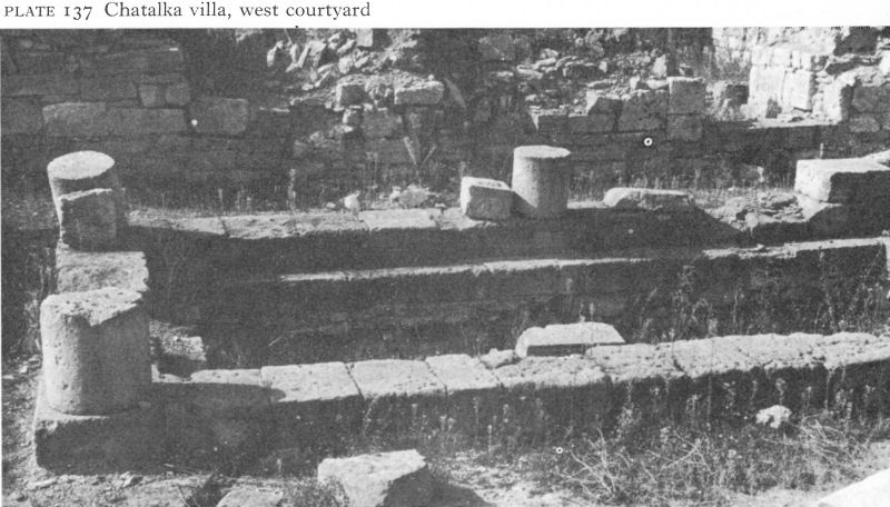
Plate 137 Chatalka villa, west courtyard
![]()
210
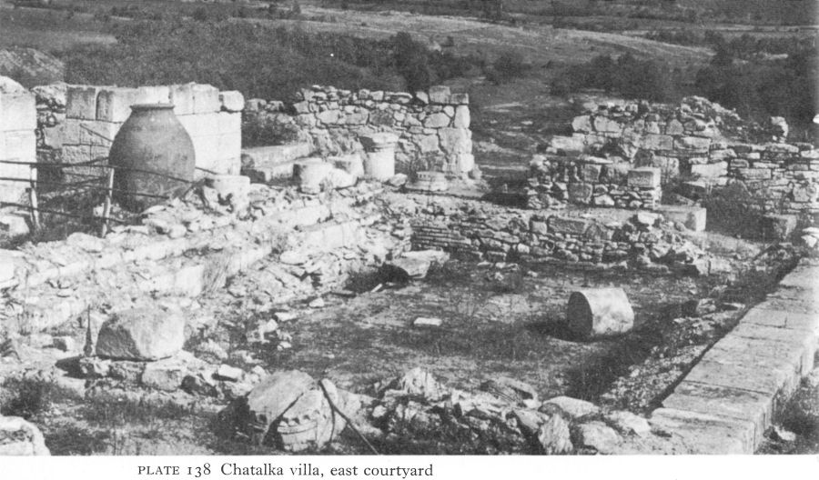
Plate 138 Chatalka villa, east courtyard
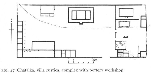
Fig. 47 Chatalka, villa rustica, complex with pottery workshop
Building techniques and materials suggest the villa was built as early as the first century when Hellenistic methods had not yet been superseded. By the south-west corner, beyond the ‘women’s quarters’, many apparently deliberately broken fragments of votive tablets, mostly dedicated to the Thracian Horseman, lay in a destroyed house shrine. There were no indications of a heating system; the owners must either have used simpler forms or passed the winter in the city.
The eastern sector of the pars urbana occupied a slightly lower terrace; here were a small baths, a well, and staff quarters, faced with a wooden colonnade on stone bases. The type of construction was similar, except in the baths, where fired brick was used for the usual apodyterium, or dressing room, frigidarium, tepidarium, and caldarium, or room containing the hot bath, the last with a hypocaust and next to the praefurnium, or furnace. The lower parts of several dolia for water storage were found.
![]()
211
The pars urbana yielded 230 coins ranging from the first to the fifth centuries, further evidence for a first-century building date. Two Roman phases have been identified, the first lasting until a total destruction, probably by the Goths, in the mid-third century. Rebuilding followed quickly on similar lines, but using more fired brick. This phase lasted until the Visigothic wars.
A few metres west, across a little gully, was a second walled complex, a regular rectangle enclosing an area of 7,500 square metres (Fig. 47). Here, on stone foundations, the superstructure was of wattle and plaster. The smaller, eastern section, occupying about a quarter of the whole, contained a pottery, an open pool, and living accommodation. The pottery had a large workshop with three ditches or pits for emulsifying and purifying clay, two small kilns, and two heated rooms for shaping and drying, next to the praefurnium. Three channels supplied the large amount of water needed. It is estimated that a pottery of this size would have functioned all the year round on a commercial basis, not merely to serve the needs of the estate. The rest of the complex was a large yard lined with stables, other farm buildings, and living quarters for the workmen.
On the right bank of the Mogilovska stream was a separate baths with seven rooms, three with hypocausts, and a vestibule with a geometric-patterned stone mosaic floor. The building technique relates this to the first phase, and the excavator suggests that when the pars urbana acquired its own baths, these were turned over to the staff, but the reverse seems equally likely, given their respective sizes and sites.
A kilometre away, on the left bank of the Chatalka stream, another complex combines flimsy farm buildings with a masonry baths which included three apsed rooms with hypocausts below (Fig. 48). As stones from the villa were used to restore the complex, it is considered part of the Chatalka estate, but the
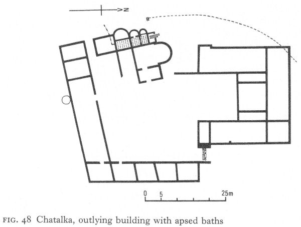
Fig. 48 Chatalka, outlying building with apsed baths
![]()
212
180 coins here date from the first to the third centuries and it may first have belonged to another landowner who did not survive the Goths.
Seven large tumuli near the pars urbana are proof of Thracian ownership. The closest - and largest - was over 20 metres high with a base diameter of 80 metres. At ground level in the centre of the mound was a large rectangular pit, once roofed with beams, in which a narrow trench contained cremated remains, together with ash, embers, and a large quantity of nuts and almonds. The plan of the tomb is thus very like that of the earlier Arabadjiska tumulus (p. 63), and the many and rich grave finds, not yet fully published, also indicate a female burial. The abundant gold jewellery included a necklace, earrings, finger rings, pendants, and a wreath of oak leaves. The necklace was composed alternately of red bezel-set gems, some of those surviving being engraved with female heads or the figure of Fortuna, and of stout sheet-gold plaques, pierced in the lace-like opus interrasile technique. The earrings had granulated ornament on their lower curves and a long hook for insertion into the ear. The jewellery in general is attributable to the first century a.d. Feminine accessories also included combs, a hand mirror, and even what the excavators suggest was pink toilet powder. Various larger objects, including a candelabrum and bronze and clay vessels, stood outside the trench, where was also the imprint of a big wooden chair.
Ten metres above this burial was found a marble chest with another cremation burial, presumably male because of the predominantly warlike nature of the grave goods. These were unfortunately damaged, but most of a Roman bronze helmet-mask has survived (Pl. 139), not unlike that from Durostorum (Pl. 88), but with flowing curls below the helmet. Other parts of the armour are comparable with Sarmatian finds and may have been trophies of warfare in Scythia. Another 10 metres higher, a little below the present surface of the mound, another cremation burial was found. With less rich grave goods than the other, it also belonged to a warrior.
On the basis of imported grave goods from Italy and the Greek East, the female burial has been dated to the mid-first century, the second to its end, and the last to the early second century.
The other tumuli averaged only 10 metres in height; almost all contained single cremation burials of both sexes, dated to the first and second centuries, one perhaps to the early third. By this time large tumuli had ceased to be the custom, probably a result of increasing foreign influence, although the reforms of Septimius Severus also made it less easy to empanel the labour force required.
A more distant cemetery with low tumuli was also partly excavated. This is thought to have been used by the villa servants or the inhabitants of some local dependent settlement.
V. THE EASTERN RHODOPES
Haskovo Mineralni Bani
A tangle of hills and valleys making up the eastern end of the Rhodope mountains slope down to the right bank of the Maritsa as it leaves the Thracian plain. Partly controlled from Beroe-Augusta Trajana and partly from Hadrianopolis, this region, relatively densely populated during the Roman and Early Byzantine periods, has been little studied.
![]()
213

Plate 139 Chatalka, helmet-mask, ht. 23 cm.
![]()
214
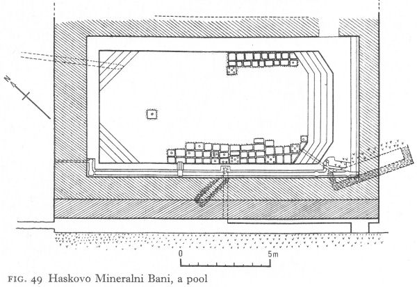
Fig. 49 Haskovo Mineralni Bani, a pool
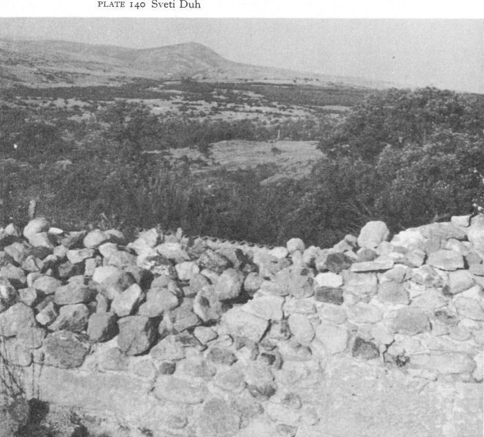
Plate 140 Sveti Duh
![]()
215
Baths and a hill fort which were part of a settlement have been identified 20 kilometres west of Haskovo on the left bank of the Banska, a tributary of the Maritsa. In a rescue dig in 1936 at the Mineralni Bani of Haskovo, four groups of mineral springs up to 150 metres apart showed signs of Roman use; there were also the remains of buildings, but much destruction had been caused by invaders, road construction, and the building of the modern spa.
One rectangular pool was comparatively well preserved, although the outer buildings were barely visible and excavation was impossible. Brick steps at the south-eastern end and across the north and west corners provided access (Fig. 49). The walls of the 1.40-metre-deep pool were of broken stone faced with ashlar, their very substantial nature suggesting a vaulted roof. Although the walls went down to bedrock, below the floor of the pool a metre-thick porous layer of rubble and mortar blanketed the powerful flow of the hot spring, the temperature of which was lowered by cold water from elsewhere, before being filtered upwards through holes in the floor slabs of the pool. An efficient if primitive form of water tap regulated the cold flow as required. Besides such small objects as bronze fibulae and glass bracelets, many bronze and copper coins dating from the second half of the third century to the early sixth were found in the outflow channel.
A second group of almost completely destroyed rooms probably included a similar pool, but a third was preserved up to 1 1/2 metres high; many fragments were also found of the piping which had brought cold water from the rock fissures. The two adjoining pools in this complex were smaller than the one described above, each about 7 metres long and 4 1/2 metres wide.
A coin of the Thracian vassal-king Rhoemetalkes (11 b.c. to a.d. 12) in the last group of springs is the earliest archaeological evidence of their use although, again mainly on numismatic grounds, the bath complexes are thought to have been built during the second century and the first half of the third. The spring with the Thracian coin may have been part of a nymphaeum for fragments of votive tablets to the Nymphs, Artemis, and Silenus were found in the surrounding ruins.
Sveti Duh
‘There is almost no peak or high hill in the Eastern Rhodopes where survey does not reveal the remains of fortifications.’ [6] Sited to be visible from one another, the purpose of the fortresses was to protect the ‘Diagonal’ and other important routes along the Maritsa tributaries. On the hill of Sveti Duh (the Holy Spirit), which rises steeply behind the Haskovo Mineralni Bani, is a fort probably representative of many others, and now in process of excavation. It was one of a chain running from the highest peak in the area, the Aida or Mechkovets, to Dimitrovgrad on the Maritsa. From Sveti Duh it would be easy to signal to the neighbouring forts at Aida and Tatarevo (Pl. 140).
The fortress wall, 2 metres thick, built of large rusticated stone blocks with a filling of broken stone, enclosed an almost circular area nearly 40 metres in diameter on top of the hill. Two stretches of wall, the rampart walk reached by wooden stairs, the holes for which are still visible, and two projecting square towers have been cleared.
![]()
216
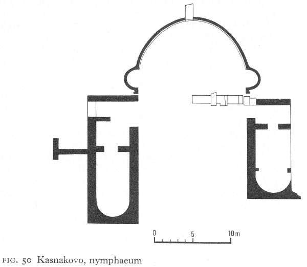
Fig. 50 Kasnakovo, nymphaeum
The curtain wall was prolonged to form one side of an internally projecting tower, which is about 7.70 metres square inside and contains a layer of debris covered by heaps of roof tiles. This first phase is provisionally dated to the second or early third century. Destroyed by the Goths about 250, the curtain wall was rebuilt soon afterwards, using opus mixtum and red mortar.
Kasnakovo
Not far from Klokotnitsa, above which stands another fort in the same chain as Sveti Duh, are ruins which include a cliff sanctuary near the village of Kasnakovo. They were discovered by peasants at the end of the last century, looking for the source of the excellent spring water which, since it had been named by the Turks ‘the well of the unbeliever’, they hoped would have some sacred value for themselves, as Bulgarian Christians. On finding the springs, they built a little chapel from stones lying around. Nearly fifty years later archaeological excavation uncovered the pagan sanctuary. It was centred on an apsidal support wall against the cliff from which gushed three springs, one at either end of the curve and the third emerging from a vaulted niche almost in its centre (Fig. 50). On the carefully dressed stone arch framing the vault, a now much deteriorated Greek inscription dedicated the spring to the Nymphs and to Aphrodite from the builders of the nymphaeum, a Romanised Thracian and his wife. [7]
A low stone wall and ceremonial entrance probably joined the ends of the curved wall enclosing the springs. Extending at right-angles on either side were two rectangular apsed buildings.
![]()
217
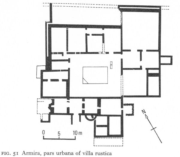
Fig. 51 Armira, pars urbana of villa rustica
The eastern, nearly 18 metres long and 7 metres wide, contained the remains of an ornamental brick cornice and some elaborately carved marble architectural fragments. The western, which was shorter, had the remains of a floor mosaic. Both must have been related to the cult.
The building inscription has been dated to the second century and the buildings, on the basis of the architectural fragments, to the end of the third, the difference being possibly due to successive building phases. The springs continued in use for a long time, the support wall being repaired when necessary with fragments of a marble architrave and other stones from nearby buildings as yet unexcavated.
Armira
Armira, 4 kilometres south-west of Ivailovgrad and named after a small tributary of the Arda, is the site of a large villa rustica. The important city of Hadrianopolis (Edirne, in Turkey) on the 'Diagonal’ at the confluence of the Maritsa and Tundja and just beyond that of the Maritsa and Arda, is an easy 40 kilometres away. The villa’s rich and essentially urban decoration creates a vivid impression, as unexpected, in its simpler manner, as that given by the imperial villa of Piazza Armerina in Sicily, lost likewise in a sunny sheltered valley.
Excavation here is still continuing. The latest published information gives the area of the pars urbana as 2,200 square metres; what were probably labourers’ quarters, ancillary farm buildings, and other work rooms have been traced nearby. The main building stood on land sloping down to the river; it had required levelling.
![]()
218
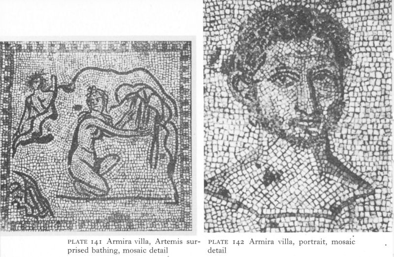
Plate 141 Armira villa, Artemis surprised bathing, mosaic detail
Plate 142 Armira villa, portrait, mosaic detail
The north walls - the best preserved - were found standing to a height of up to 1.80 metres; about half a metre thick, they were built of dressed stone and white mortar. Three building phases were noted, all apparently within the first 60 years of the second century. The first was relatively modest, the next two, although single-storeyed, were much larger and more grandiose. Figure 51 shows the plan of probably most, if not all, of the third phase which, according to the preliminary reports, added the rooms east of the courtyard to the structure of the second phase. Over 20 rooms were then arranged round a large peristyled courtyard, with a central impluvium. Vast quantities of nails and roof tiles were scattered over the floors and in three of the northern rooms pieces of window-glass were found. Two praefurnia heated many of the rooms by means of hypocausts using brick piers and clay pipes or, in some cases, intra-mural ducts. A double wall had been built along the north-west sides of the building and along the north side of the large triclinium, or dining room, in the east corner, perhaps partly to prevent subsidence and partly for ventilation.
The courtyard and seven rooms were laid with mosaic, originally covering an area of 450 square metres of which 260 square metres were found in situ. Heaps of broken marble sculptural decoration lay in most rooms. Walls not revetted with marble had coloured plaster. The excavator has described the probable appearance of the courtyard. Stylobates in situ showed that the colonnade ran near the edge of the pool and consisted of 14 spirally fluted columns, one at each corner, three on the longer sides and two on the shorter. Intercolumnar slabs were linked by herms, each wearing a different expression and one, at least, being Janus-headed. The architrave was carved with acanthus leaves, Gorgon heads, and Ionic mouldings, and was smoothly polished behind. The four walls enclosing the courtyard had a pilastered revetment imitating a colonnade.
![]()
219
Their socle was preserved along the whole north side and, in places, the carved base. The pilasters, to be correct pseudo-pilasters, also had profiled bases, vertical fluting, and decorated capitals; 16 capitals were found intact and fragments of another ten. No two are the same, and the motifs, imposed on various types of stylised acanthus, include a lifelike snail, eagles, a bee, a satyr’s head, a Gorgon head, and two little dolphins. Between the pilasters were large marble slabs, some incised with geometric or trompe l'oeil designs, others with borders of ivy leaves. A few retained traces of red colouring. The floor was laid in an interlacing geometric mosaic pattern, except in the southern part where wide white bands also contained vegetal motifs. One of the east rooms, with similar marble pseudo-pilasters, had the remains of an opus sectile pavement.
The floor mosaics mostly consisted of white and greyish-blue stone tesserae; occasionally more colours were used, but so rarely that the overall effect is hardly changed. The floors remained in use for a long time and many tesserae are very worn. Mosaicists could not have been available for repairs, since marble slabs were used to fill gaps.
One of the north-east rooms has the best-preserved and some of the most interesting mosaics. The floor is divided into three zones, a central square flanked by two rectangles. The larger areas in the central zone contain a series of framed mythological scenes, many concerned with Dionysos or Artemis. The figures are executed in graphic outline, neither portrait-like nor highly stylised, but more in the manner of bold pen and ink drawings (Pl. 141). The smaller areas contain theatrical masks, panthers, female heads, a little bird, an ivy leaf, and so on. At the base of the square is a fine male portrait, assumed to be the owner of the villa (Pl. 142). The smaller, carefully chosen, tesserae portray a noble, gentle face in masterly fashion. It is curiously placed in the upper part of an otherwise empty panel, perhaps designed for an inscription or for a pendant portrait of the wife, for some, perhaps domestic, reason omitted. Panels on either side contain full-length portraits of naked infants, surely his sons. Although the heads are disproportionately large, the figures are realistically and not very sympathetically rendered. One cannot mistake them for erotes.
The mosaic floor of the triclinium included a central zone depicting Medusa, surrounded by the four Seasons and the four Winds and by heads of maenads and satyrs. Belonging to the villa’s third phase, this mosaic differs in the use of white and red as basic colours and a large number of others for the details. The room had painted walls, of which only tiny multicoloured fragments remained above the marble socle.
The purpose of the other rooms is hard to define. Strangely, pottery, usually the commonest find in houses, was extremely scanty and consisted mainly of coarse third- and fourth-century local ware. Coins, also few, ranged from the second to the fourth centuries. The owners may have had time to remove the more valuable objects, but the scarcity of kitchenware is odd. Perhaps the villa was very thoroughly looted before it was set on fire, and possibly unexcavated servants’ quarters may provide a partial answer. Nevertheless, the limited evidence of the pottery and coins, when associated with the signs of wear and tear on the structure, points to continuous peaceful residence over about 250 years. Such conditions, so different from those obtaining farther north, are historically possible.
![]()
220
But the Visigothic invasion of 376-82 was accompanied by widespread devastation in the eastern Rhodopes and Ammianus Marcellinus specifically refers to the destruction of villas in the vicinity of Hadrianopolis, after Valens was defeated near the city in 378. [8] Archaeological evidence shows that this villa was gutted by fire and abandoned. For a time parts of the burnt-out skeleton remained standing, to collapse by degrees. Thus some fragments of the marble revetment were found immediately above the mosaic floors; others fell upon an intervening layer of soil.
Provisionally, the first modest structure has been dated to the end of Trajan’s reign or the very beginning of Hadrian’s. The second was built ten to twenty years later under Hadrian; on stylistic grounds much of the sculpture is assigned to this phase, including the revetment capitals and herms, as well as the mosaic portraits. The third, the north-east wing, followed quickly, as is shown by the identical style of the acanthus leaves of its pseudo-pilasters and those of the peristyle. This, then, would have belonged to the reign of Antoninus Pius.
Pending the completion and full publication of the excavations, this dating seems to accord with the historical background. The growth of Hadrianopolis out of Thracian Uskudama was rapid. The city minted coins until the reign of Gordian and was the chief city of the province of Haemimontus from the reign of Diocletian. There would have been many rich villae rusticae in the environs. The surroundings of the Armira villa have long been vineyards and the only tumulus excavated - with a base diameter of 40 metres but now only 2 1/4 metres high - yielded no relevant evidence, although it stood only 250 metres away at the top of the slope. Perhaps Armira was not, like Chatalka, a Thracian manor, but the private residence or hunting lodge of some high official from Hadrianopolis, a provincial dignitary’s version of imperial Piazza Armerina.
NOTES
1. IGB III/1, 878.
2. BASEE II, 1971, 45.
3. IGB III/2, 1588.
4. Nikolov, D., Arh X/1, 1968, 43 ff.
5. IGB III/2, 1690.
6. Aladjov, D., in Rodopski Sbornik II, Sofia, 1969, 252.
7. IGB III/2, 1714.
8. Amm. Marc. XXXI, 6, 2.
9 The Black Sea Coast
I. THE SOUTHERN CITIES
Writing in a.d. 9 of his voyage of exile to Tomi (Constanţa in Romania), Ovid prays for his ship:
. . . may she steer her way along the Thynnian bays; and thence impelled past the city of Apollo, may she pass on her course the walls of Anchialos. Thence may she pass the harbours of Mesembria and Odessus and the towers, Bacchus, that are called after thy name. [1]
If the Salmydessian coast with its Thyni inhabitants had not entirely lost its evil reputation, the Greek cities were accommodating themselves to Rome; but although both Apollonia and Mesambria were minting coins again by the time of Trajan, their economy and influence had suffered. In the first centuries of Roman rule, both seem largely to have been bypassed, although it has been suggested that the Hellenistic walls of Mesambria were repaired in the reign of Marcus Aurelius and again soon afterwards.
No doubt to counterbalance Greek influence, Vespasian founded a colony of veterans from Legio VIII Augusta (then at Novae) at Deultum (Debelt) on the eastern north-south road. Although the city prospered, there is little archaeological evidence yet to support its history. Mid-third-century coins of Deultum show a beehive, probably symbolising a main item in a largely agricultural economy, although the safeguarding of the highway from Hadrianopolis to Marcianopolis must have given it and other inland settlements a military and strategic importance, which was to grow when Hadrianopolis became a gateway to the new capital.
The Romans also encouraged the development of Anchialos (Pomorie), hitherto a minor trading station but which was issuing coins under Domitian. Trajan named it Ulpia Anchialos and enlarged the territory under its administrative control. Besides serving to offset the economic power of Mesambria and its founder-city, Apollonia, the considerable salt-beds south of the city must have been an important commercial factor. The baths of Anchialos, Aquae Calidae (Burgaski Mineralni Bani), were on the site of a Thracian village some 20 kilometres inland from the city. Here was a famous sanctuary of the Three Nymphs, in whose honour games were held under Septimius Severus, Caracalla* and Geta, although only a few chance finds, including votive tablets with the same iconography as represented at Burdapa, are known. When Anchialos was captured by the Goths in 270,
. . . they are said to have stayed for many days, enjoying the baths of hot springs situated about twelve miles from the city . . . There they gush from the depths of their fiery source and among the innumerable hot springs of the world they are particularly famous and efficacious to heal the sick. [2]
Excavation of Anchialos began in 1969. In 1970, the excavator reported the identification of the decumanus maximus, paved with large stone slabs, and on its south side the excavation of part of a pentagonal building with a peristyled inner courtyard.
221
![]()
![]()
222
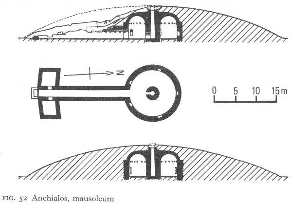
Fig. 52 Anchialos, mausoleum
An aqueduct had been traced to Bryastovets, some 20 kilometres away to the north-west. [3] As this is one of the few coastal sites not completely overbuilt, excavations may be fruitful. Coins and written sources suggest strong fortifications, and inscriptions are evidence for bronze statues of Caracalla and Alexander Severus. The many and varied types struck almost without interruption during the second century and first part of the third contrast with the few and spasmodic types emanating from Mesambria.
Five kilometres west of Anchialos is its only published archaeological monument, a large, late Thraco-Roman tumulus mausoleum just off the main road from Bourgas to Nesebur (Fig. 52). A 22-metre-long dromos with opus mixtum walls and brick vaulting was flanked at the entrance by two side-chambers, now outside the remains of the mound; but their slightly trapezoid shape was no doubt planned in accordance with its original periphery. The dromos led directly into the circular tomb chamber, a spacious brick-vaulted ring-corridor, its centre a hollow pillar from which spring the inner curves of the vault (Pl. 143). The general proportions and skilful vaulting, in fact, create the impression of a circular domed chamber. The central pillar had two openings - opposite the dromos and at the top. There had been a wooden spiral staircase inside; it is impossible now to determine the relationship between the top of the pillar and that of the mound, but its purpose seems likely to have been ventilation. Five arched niches were arranged symmetrically round the outer wall of the ringcorridor ; all varied in width and height.
The tomb is difficult to date. It has been assigned to between the second half of the second century and the end of the fourth, [4] and to the fourth century. [5] As has been seen, large Thracian tumuli persisted until the early third century.
![]()
223
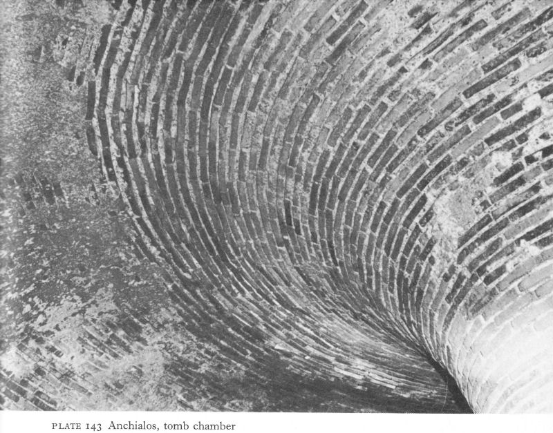
Plate 143 Anchialos, tomb chamber
Thrace had a tradition of ‘false’ or corbelled domed tombs with long dromoi, as at Mezek (p. 40) and Kazanluk (p. 98). The brick parallel with the latter springs at once to mind, although it is difficult to sustain. A ‘genuine’ dome, such as those appearing in Roman mausolea, could not have borne the immense weight of earth forming a rich Thracian’s tumulus. Hence the original solution of the central pillar supporting a wide ring-vault that produced the illusion of a domed chamber, probably under quite a low mound. This tomb may represent some imported tradition adopted and adapted by Thracians at Anchialos. Etruscan parallels have been suggested, but to be valid it is necessary to reconcile the wide discrepancy in dates.
Where the Stara Planina meets the sea was the town of Aristaeum (Emona) referred to by Pliny. The trading station of Naulochos (Obzor), 10 kilometres to the north, was renamed Templum Iovis by the Romans. Both these are archaeologically unexplored.
II. ODESSOS AND THE NORTH
For Odessos (Varna), the picture during the Roman period was very different from that of her southern counterparts. Although Trajan’s foundation of Marcianopolis was only 23 kilometres away and the junction of almost all the important highways, the two cities proved to be complementary.
![]()
224
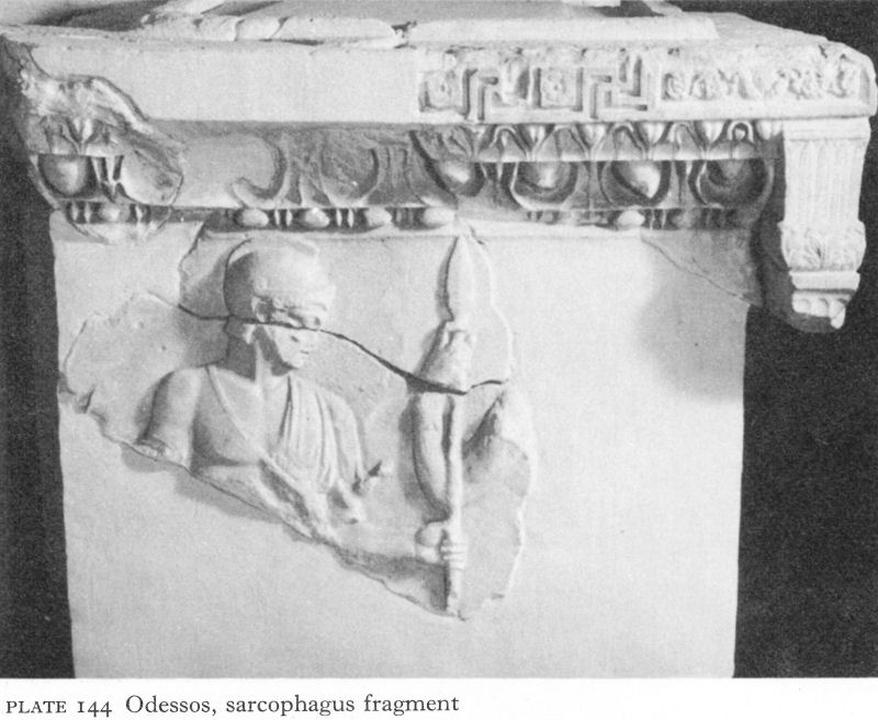
Plate 144 Odessos, sarcophagus fragment
With the growing importance of the lower Danube, the port of Odessos, especially during the second century and the first half of the third, enjoyed a boom, serving as a main channel for the Romanisation of the north, while the old links with other Black Sea cities, especially those to the north, with Asia Minor and the whole Aegean world, were maintained and intensified. Like all Moesia Inferior, the economy of Odessos declined sharply with the mid-third-century Gothic invasions, and the increased emphasis on Marcianopolis as a military centre may well have curtailed her neighbour’s prosperity. The fourth century was probably a period of relative poverty until the Visigothic invasions brought the value of a northern port into prominence - the imperial navy’s control over the sea-lanes rendering them safer than the inland road network. The harbour is likely to have been repaired by Valens, who used it during his military expedition to the lower Danube.
Sectors of the second-century Roman wall found here and there under modern Varna bear witness to the increase in the size of the city under Roman rule. It is estimated that the fortifications enclosed an area of about 43 hectares. Numerous inscriptions show that a number of the new inhabitants were Thracian, but many came from Asia Minor. These immigrants were culturally Hellenised, some were of Hellenic stock, so that Odessos remained essentially a Greek city, with Romans and Romanised inhabitants in a very small minority.
Part of a sarcophagus slab from the early period ranks among the city’s finest reliefs (Pl. 144). Broken in antiquity and re-used in pieces, its original location is unknown. The reassembled fragments show that at the top was an intricate carved decoration and that the side slab had an elegant pilaster with acanthus and other vegetal motifs.
![]()
225
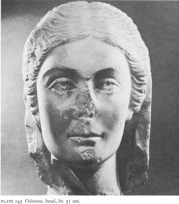
Plate 145 Odessos, head, ht. 31 cm.
Of the scene depicted the upper part only of a youth remains. Wearing a sleeveless chiton and helmet, he is accepting a tall spear with his left hand from a figure of whom only a hand and arm remain. The pose is frontal, but the head appears in profile. The scene is interpreted as a detail of the hiding of Achilles on Skyros. There is little doubt that the sarcophagus was imported, either from Asia Minor or, as has recently been suggested by analogy with one found in Athens, from Attica. [6] Stylistically dated to the first half of the second century, it is an eloquent reminder of the continuing Hellenism of the city.
But Roman art and architecture also made their contribution to the city’s cultural history. An example is the beautiful second-century head (Pl. 145) of a young woman. Proud yet gentle, the modelling of the face is still impressive, despite damage to nose and chin.
![]()
226
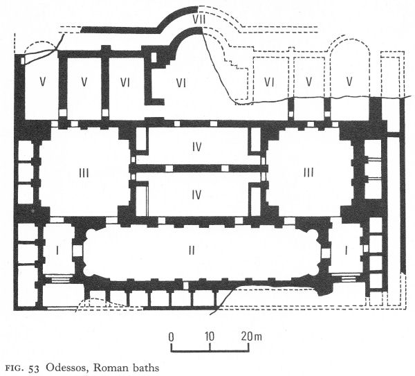
Fig. 53 Odessos, Roman baths
And the major excavated archaeological site of any period is a large, luxurious Roman baths, the best preserved yet found in Bulgaria.
The complex occupied about 7,000 square metres. In the centre of the modern city, part of the site is still built on, but the work accomplished and the typical Roman arrangement have enabled the excavator to reconstruct the plan of the whole (Fig. 53). A general division into two symmetrical parts perhaps provided for the separation of men and women, but intercommunicating doors made the complex a single unit.
The walls survive to a height of from 2 1/2 to 18 metres and are from 1.6o to 2.40 metres thick (Pl. 146). Well-cut stone usually alternates with bands of brick, but some walls are built entirely of brick, as well as all apses, niches, and pilasters. Parts at least of all the brick doorways survive, many still retaining their monolithic ashlar jambs and lintels supported by a brick framework (Pl. 147). Large quantities of white marble fragments show that the walls of rooms and pools were revetted with marble slabs; floors were marble and the apodyteria floors probably had large central areas of opus Alexandrinum. Capitals, architraves, and statue-pilasters were also part of the rich interior decoration.
Two monumental entrances on the north led in each case to a vestibulum (I) with access to a spacious palaestra (II) between them, used for athletic exercises, sports, recitations, lectures, or as a general meeting-place.
![]()
227
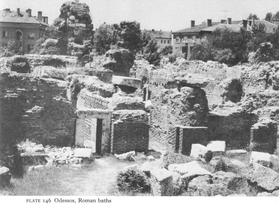
Plate 146 Odessos, Roman baths
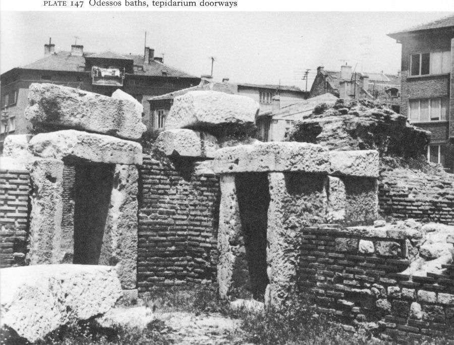
Plate 147 Odessos baths, tepidarium doorways
![]()
228
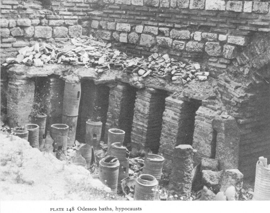
Plate 148 Odessos baths, hypocausts
Each vestibulum also led to a large square apodyterium (III). In the north-west corner of the western apodyterium one of the massive square piers which supported the roof still stands to a height of 18 metres. The roof, vaulted and perhaps in places domed, was of light tufa blocks.
Each apodyterium had a wide entrance to the palaestra and two much narrower ones to the two frigidaria (IV), parallel rooms with piscinae at either end. The warm rooms were in a row on the south side. First, entered from an apodyterium were - at either end of the building - what were probably two tepidaria (V), not completely excavated, then a central tripartite caldarium (VI). Along its sides were additional thick brick walls, no doubt to retain the heat, their wings and the apse forming perhaps a sudatorium, or sweating room. From the north of the caldarium were two entrances to the south frigidaria. A vaulted gallery ran along the whole south wall, enclosing the praefurnium - usually underground, but here, owing to the uneven terrain, almost at ground level.
The praefurnium linked all the hypocaust systems below the floors of the warm rooms, which were also heated by hot air rising up ducts in the walls behind the marble revetment. Below the suspensura the hypocaust installation consisted of vertical clay pipes half a metre apart, with little columns of square bricks round the walls (Pl. 148).
![]()
229
Wide vaulted passages circulated warm air from room to room, under the thresholds or the partition walls.
The drainage system is well preserved, a symmetrical arrangement of vaulted channels with a total length of some 300 metres. The channels were either contrived within or close by the foundations, but, where necessary, free-standing constructions intersected the substructure of the halls to drain away the large quantities of dirty water produced by such an installation.
The baths were built on the ruins of earlier buildings - the depth of the foundations has not yet been established. Coins from the drains date from the reign of Antoninus Pius up to and including that of Claudius II. It is thus likely that the baths were built soon after the middle of the second century, a period which coincides with the construction in 157 by the then legate for Moesia Inferior of a new aqueduct to meet the needs of the expanding population. An altar dedicated by the same legate was found with other material relating to the worship of Asklepios and Hygieia, in the north-western corner of the baths, suggesting a nearby and probably associated Asklepieion. Asklepios and Hygieia are only known on coins of Odessos in the reign of Gordian III when, according to the evidence of the drains, the baths were still in use. Other finds briefly reported include many coins from the period after the reign of Constantine, together with pottery, lamps, and other everyday objects of the fourth century and later, so it is not possible to say when the baths were abandoned. Probably disuse and decay came gradually after the Gothic invasions. Later, little houses were built inside or round the walls, profiting from their solid construction. These may have collapsed gradually or as the result of a calamity, such as the violent earthquake of 544 when, according to Theophanes, the sea rushed in over 4 miles of land. In the course of centuries the mass of debris grew and was covered, except for the two ‘Roman towers’, by the later city.
Even though the baths continued to be in use during and possibly after the fourth century, they probably came to be superseded by a recently identified much smaller and simpler complex. Below it were the ruins of the Hellenistic and Roman sanctuary of the Thracian Horseman.
No other buildings have been excavated or even securely located. Temples must have been numerous and rich. Pre-Roman cults continued. The Thracian Horseman and the funerary feast are frequently represented on stelai (Pl. 149). By 1964 the number of the latter in the Varna Museum had reached 115 and many more have since been found. Their chronological development between the second and fourth centuries is, as a rule, easily traced in the hair and features of the persons depicted, which follow imperial styles. [7] Inscriptions and coins show that games were held in honour of the Great God, now usually known as ‘Darzalas’. Between the reigns of Trajan and Gordian III he or the cult statue in his temple are represented on almost all coins of Odessos, although Roman cults, such as that of Concordia, whose temple also appears on a coin of Gordian, were introduced too. After the reign of Septimius Severus, the growing influence of the settlers from Asia Minor was reflected in the appearance of Cybele, as well as by the syncretisation of Darzalas with Serapis, iconographically apparent on the coins.
At first the city continued to use the old Hellenistic necropolis along the road to Dionysopolis.
![]()
230
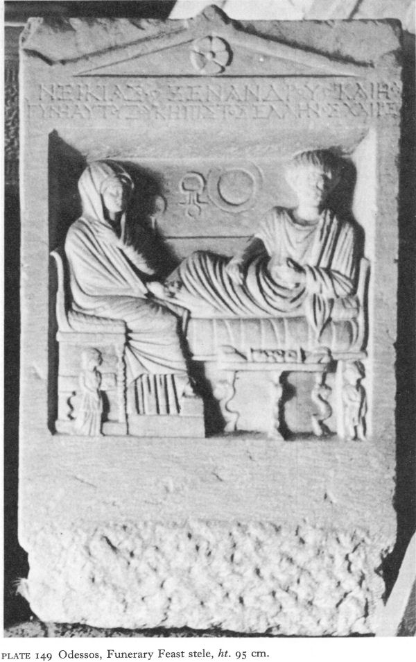
Plate 149 Odessos, Funerary Feast stele, ht. 95 cm.
![]()
231
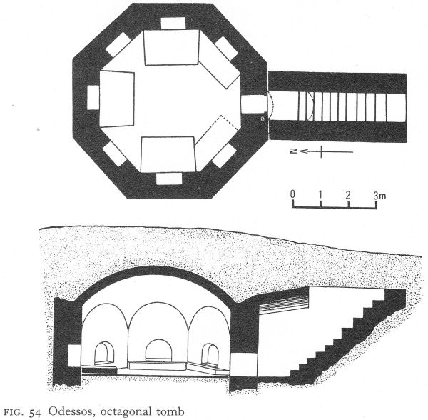
Fig. 54 Odessos, octagonal tomb
With the building of the new fortress wall to the south and west about the middle of the second century, another cemetery grew up along the road to Marcianopolis, and burials were made here until the late fourth century. An interesting monumental tomb near the fortress wall in the older necropolis is dated by situation and skilful construction techniques to the end of the second or beginning of the third century. Cleared by early looters, it is a large underground octagon, approached by a stone staircase and a small barrelvaulted passage with a tiny opening (Fig. 54). The tomb chamber is oriented north-south and has a domed roof. The walls, of well-cut limestone blocks, bound by red mortar, rise to semicircular curves which, with intervening brick pendentives, support a fiat brick dome. In each wall - except the one with the entrance - is a brick-arched niche. There were three podia-beds by the north, east, and west walls and two smaller ones, obviously later, on either side of the entrance.
Another kind of vaulted underground tomb was found about 3 kilometres north-west of the city. Again oriented north-south, it was almost cubical, the dimensions just under 3 metres. Ten steps approached it. The arched walls, of carefully smoothed limestone blocks bound with red mortar, supported the brick-vaulted ceiling, basically cross-groined, except that the centre was occupied by a regular domed apex measuring only 70 by 80 centimetres, in which vertically placed tiles were arranged diagonally across the angles (Fig. 55), an interesting attempt to create the illusion of a dome on a square base without either pendentives or squinches.
![]()
232
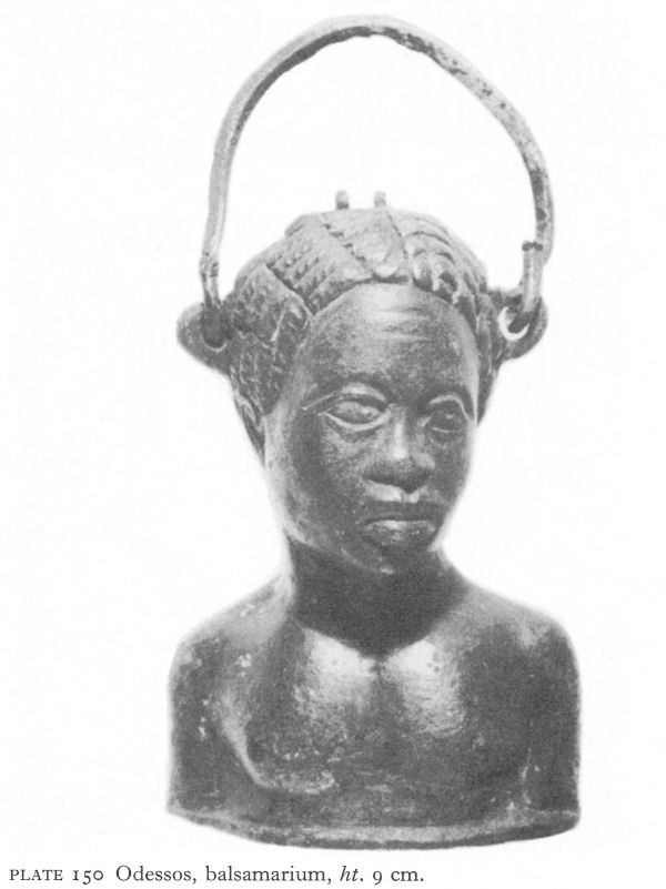
Plate 150 Odessos, balsamarium, ht. 9 cm.
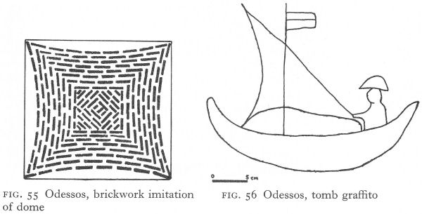
Fig. 55 Odessos, brickwork imitation of dome
Fig. 56 Odessos, tomb graffito
![]()
233
The careful construction and nearby finds - though the tomb was empty - date it to the end of the third century. On either side of the entrance rough graffiti incised in still damp mortar depict an anchor and a sailor sailing his boat, pennant flying from the mast (Fig. 56).
Some scattered graves near the city reflect the culture of partly or almost wholly Hellenised Thracians. On a natural ridge near the ‘Vladislas Varnenchik’ tumulus three graves were found, one containing a coin of Hadrian. In this small family plot, although all were coffin burials, one was by cremation and the others by inhumation, showing the co-existence of both rites towards the middle of the second century. One burial, with Charon’s obol in the shape of a coin of Antoninus Pius, contained, among strigils and clay, glass and other bronze objects, a fine example of a balsamarium. This last was probably an import from Alexandria or Asia Minor. Balsamaria were in common use during the first to third centuries, but, as they were used for aromatic substances, they often represented the native inhabitants of the southern or eastern lands from which the spices came or were believed to come, as in the case of a moving portrayal of a young negress which was a chance find in Odessos (Pl. 150).
Finds along the coast, both north and south of Odessos, confirm the continuance of the amicable relationship between Greek and Thracian communities. At Galata, the Hellenistic sanctuary of the Thracian Horseman continued to flourish and a nearby tumulus, 2 1/2 metres high today with a diameter of about 25 metres, contained a single central burial with grave goods including coins of Hadrian and Lucilla. North of Odessos, its fellow Greek colony Dionysopolis, although still remaining of secondary importance, probably shared in the prosperity of its neighbour. Remains of a recently found two-wheeled chariot with the skeletons of three horses (one a saddle horse) from a nearby tumulus are on view in the local museum, but not yet published.
Although the Black Sea colonies survived under Roman rule and Anchialos and Odessos are known to have prospered, their renaissance belongs to the Early Byzantine period.
NOTES
1. Ovid, Tristia Bk. I,x, trans. Riley, H. T., The Fasti, Tristia, Pontic Epistles, Ibis, and Halieuticon of Ovid, London, 1878, 271.
2. Jordanes, Getica, 109, trans. Mierow, C. C., The Gothic History of Jordanes, Princeton, 1915, 82.
3. NAC 1970, Arh XII/3, 1970, 78.
4. Petrov, T. et al., Antichnata Grobnitsa krai Pomorie, Bourgas, 1960, 21.
5. Dimitrov, D. P. et al., Kratka Istoriya na Bulgarskata Arhitektura, Sofia, 1965, 46.
6. Gerasimov, T., IVAD V (XX), 1969, 54 ff.
7. Toncheva, G., Arh VI/4, 1964, 37 ff.